 |
Grasmoor via Dove Crag Arête |
 |
 |
14th June 2012 |
 |
|
I have to go back for this one, so far back to January 2011, the time I first spotted this gem of a route. That day I only had one thing on my mind & that was bagging two brand new Wainwrights in Whiteside & Whiteless Pike, wait Paul, that’s two things… D’Oh!
The particular day in question could of been mistaken for a mid-summers day, I had a lucky break with the weather as below me laid a thick frost whilst high above, deep blue winter skies with the Moon still visibly clear as if it was still three in the morning, I’d only been walking a mere five minutes as I came to cross Liza Beck via a narrow wooden Bridge, when I spied this narrow path that disappeared into Gasgale Gill alongside Grasmoor’s flanks. One day Paul, your going to find yourself on that path. I have since gained Grasmoor’s summit on numerous occasions & each & every time I see the path that mystically disappears into Gasgale Gill, I say to myself one day Paul.
I’ve recently come up with the idea to spend whole day’s on just the one particular fell, my idea is relatively new to me so the fells on which my plans are based upon are coming in slowly but surely Grasmoor, Great Gable & Great End are three fells that instantly come to mind, I thought of; instead of gaining their summits by the orthodox route, why not try something a little different? I feel incredibly lucky in the fact that I can do this now that my Wainwrights are behind me & it is most certainly not a fixture for the future as you may know by my blog, at times I like to take in as many summits within my route as I possibly can.
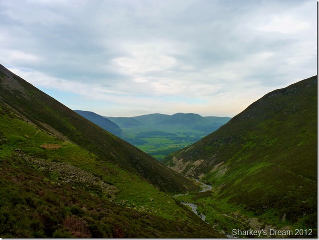
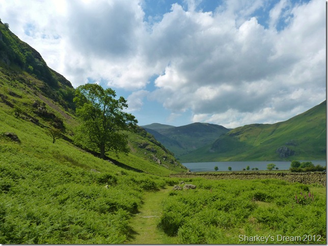
I’d be lying if I told you I’d always known about the Dove Crag ridge, or Dove Crag Arête, the ridge is gained from within Gasgale Gill just under half way along Grasmoor’s southern flanks. Gasgale Gill is an incredible place to find yourself within, flanked by Whiteside’s steep rocky buttresses that form Gasgale Crags, echoed by Liza Beck gently cutting through the V shaped valley I only wish I hadn’t waited over twelve months to find myself at the foot of Dove Crag Arête deep with in Gasgale Gill. |
|
| Wainwright Guidebook |
 |
| The North Western Fells |
Dedicated to those lovely twins; MY RIGHT LEG AND MY LEFT LEG
Nature never uses straight lines in her designs, but has come remarkably close to doing so in fashioning this arête and the approach to it from the gill along the edge of the scree. A plumb line dropped from the summit to the valley would lie over the route almost exactly. This is very noticeable from the top of Whiteside.
There is no difficulties in the ascent. The rock slab is set at an easy gradient but is greasy and needs care. The views down the crags from the arête are tremendous. |
 |
|
|
| |
|
Overview |
|
|
| Ascent: |
2,550 Feet, 777.4 Metres |
| Wainwrights: |
1, Grasmoor |
| Weather: |
Overcast & Breezy AM, Turning Warm Bright & Sunny PM, Highs Of 17°C Lows of 10°C |
| Parking: |
Car Park, Lanthwaite Green (F O C) |
| Area: |
North Western |
| Miles: |
6.3 |
| Walking With: |
On my own |
| Ordnance Survey: |
OL4 |
| Time Taken: |
5 Hours |
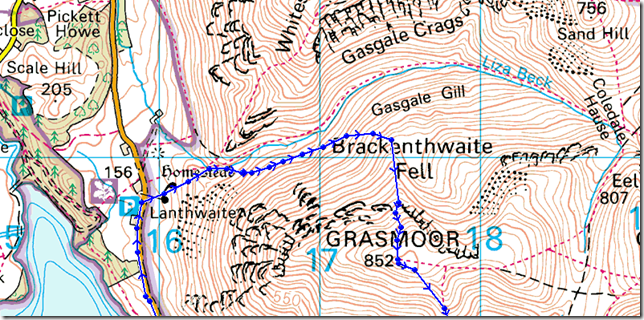
| Route: |
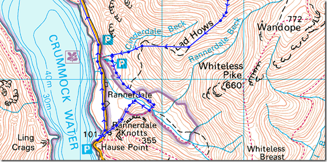
Lanthwaite Green – Gasgale Gill – Dove Crags Arête – Grasmoor – Lad Hows – Cinderdale Common – Hause Point – Lake Road – Lanthwaite Green |
|
| |
|
Map and Photo Gallery |
|
|
  |
| |
| |
 |
| |
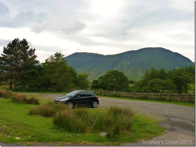
Lanthwaith Green car park, 10°C 8:19am.
I was expecting a little more sunshine If I’m brutally honest as I arrived in Lanthwaite, as I open the car door to a silence cut open by a sudden howl of what felt like artic wind, this causes me to look down at the shorts that I am wearing & think? Paul, I’m so glad you decided to pack your walking trousers too.
Engine off. I gaze upon a murky Grasmoor as I ponder, am I ever going to leave this car at all? but its so peaceful in here & more importantly, warm.
No point meandering, get the hell out the car you boy-scout & kit up.
At the boot of the car I listen for traffic approaching, Ok, I’m good to go, because right now the shorts have to come off & the walking trousers have to go on, not wanting to startle the locals in just my boxers I wait & make sure there’s no traffic, down come the shorts as I struggle them over my North Face mids
BT van, motorbike, car, car, x4 wheel drive all pass in succession. Great
There’s nothing more awkward than seeing a bloke mid struggle standing on one leg and the whitest legs you are ever likely to clap your eyes on, half-naked at twenty past eight in the morning… I know for a fact that BT mon laughed at me.
Sod it. |
 |
| |
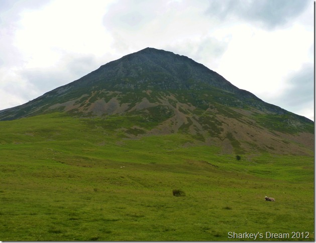
Grasmore End from Lanthwaite Green.
Feeling the cold wind at the lower slopes I opt for my Rab Latock jacket & blow warm air to my cupped hands as I say to myself, I cannot believe we are half way through June.
The walk to Liza Beck will take just five minutes over a lovely gentle grassy incline, within the next five minutes I do warm up a little. |
 |
| |
Whin Ben & Whiteside from the gentle slopes of Lanthwaite Green. |
 |
| |
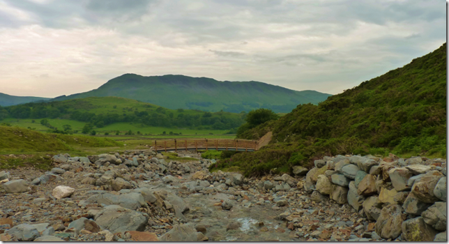
Gasgale Gill from Liza Beck.
I instinctively head for Liza Beck taking time out for a few photos, noting the force of the water with the damage to both banks. The old wooden bridge was situated where the beck narrows & was quaint enough for the one walker to cross at a time, it was just a case of not if, but when this little bridge was going to get washed away.
Indecently you can just make out Dove Crag Arête; with an easier point to put it, just above ‘The’ it’s a little while of yet… |
 |
| |
Looking in the opposite direction towards Low Fell & Fellbarrow.
The new bridge looks sturdy enough to last decades & is built with the debris in mind, funnily enough the last time I saw an exact replica of this bridge was just a couple of months ago as I crossed Woundell Beck in Ennerdale, new bridge contractors with the same idea’s eh?
Time to double back a little now & head Gasgale Gill. |
 |
| |
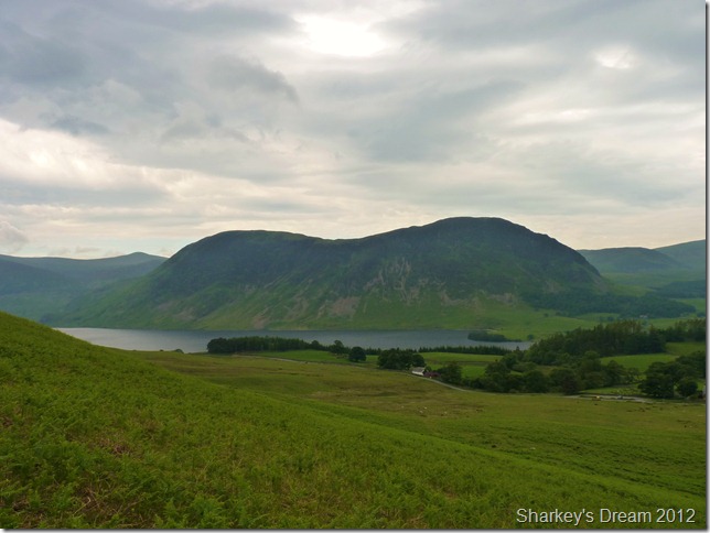
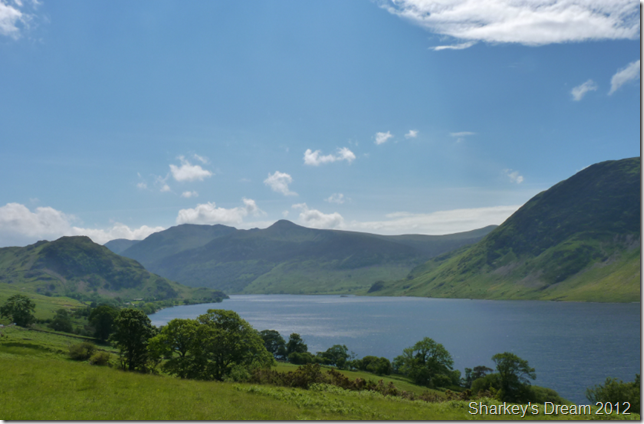
Not before a quick shot of Mellbreak & Crummock water.
The car park is situated just past the white building you see, Lanthwaite Green Farm. |
 |
| |
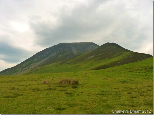
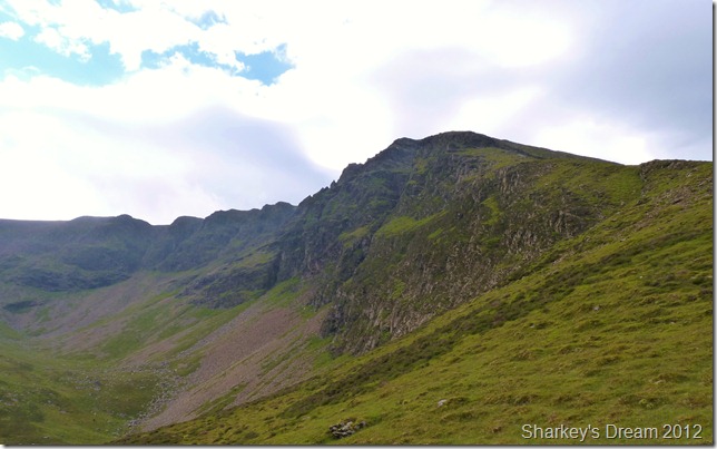
Gasgale Gill, with Whin Ben & Whiteside (L) & Grasmoor (R) forming the distinctive narrow V
The path is a little higher to my right as I take in the jaw dropping Gasgale Gill before me. Really photos here just do not have the same affect as actually being here. |
 |
| |
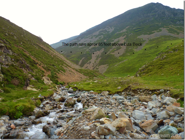
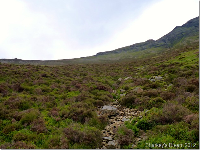
Picking up the path & ending that year long dream.
The path is easily located but attention must be drawn underfoot despite the fantastic views, the path here is at its best. The deeper you follow the path the less obscure it becomes as it weaves its way through thick heather patches & cumbersome heather roots to constantly negotiate.
Wainwright described this route as the old walkers path; Rough & now serves sheep, yet still fairly clear, I’ll go with that Mr Wainwright. |
 |
| |
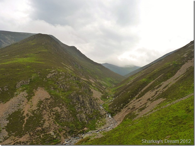
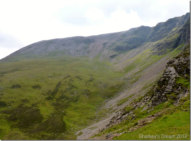
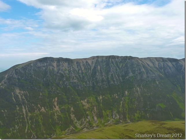
Hopegill Head & Gasgale Crags (R) dominate the route.
It is here I make my mind up on how to gain the bottom of Dove Crags & indeed Dove Crag Cove, the Arête can be seen in the foreground, so for now where I am to leave the path for the ridge is fixed firmly on my mind. The greenery patch of grass (top right) is my target but for now I’m going to savour this little path some more. |
 |
| |
Looking out towards the Loweswater Fells from within the steep sides of Gasgale Gill. |
 |
| |
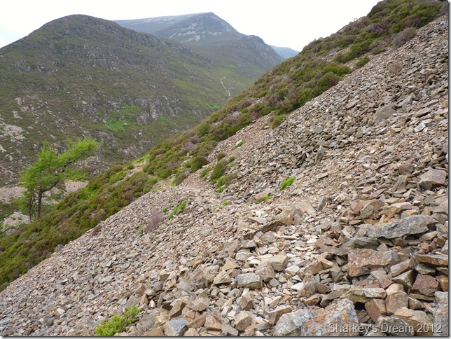
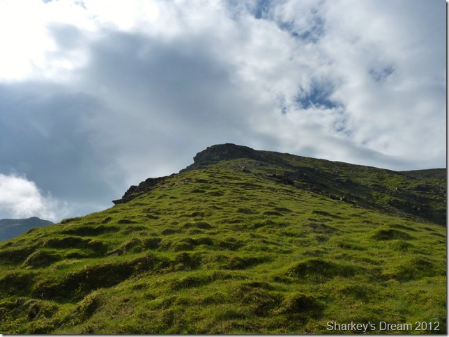
Dove Crag Arête as I prepare to leave the main path.
I was at the point where I needed to start thinking about heading up the fell side when I came across this narrow stone path, this was great news that there was a path & I needn’t have to scarper up through the wet heather, but to my disappointment this stone path is only visible for less than half the way I intended to use it, my aim is to get to around halfway you see in the photo or, at the top where the heather becomes less visible, then skirt across left to try & take in as much of the ridge as humanly possible.
This path is located just past a stone shelter along the route, which sadly I didn’t get a snap of. |
 |
| |
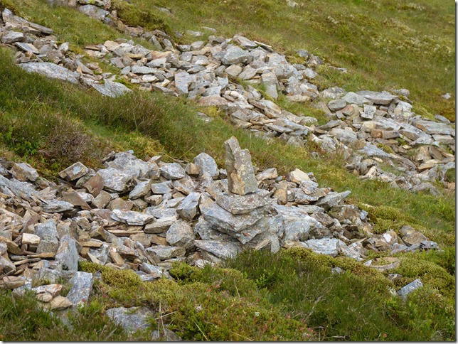
Even a few hastily built cairns line the last few yards towards the ridge which was a welcome sight. |
 |
| |
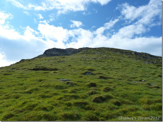
Dove Crag Arête.
It doesn’t take long to locate the bottom of the ridge after a thoroughly enjoyable steep ascent through the heather patches. |
 |
| |
Dove Crags & Dove Cove. |
 |
| |
Dove Cove.
A place that always kept Wainwright guessing as this was an ideal spot for a tarn yet the cove has no stream nor tarn, a huge sponge comes to mind.
It’s time to leave the cove & ascend a little where upon I can gaze at the Arête & my ridge route. from here it looks a steep one… |
 |
| |
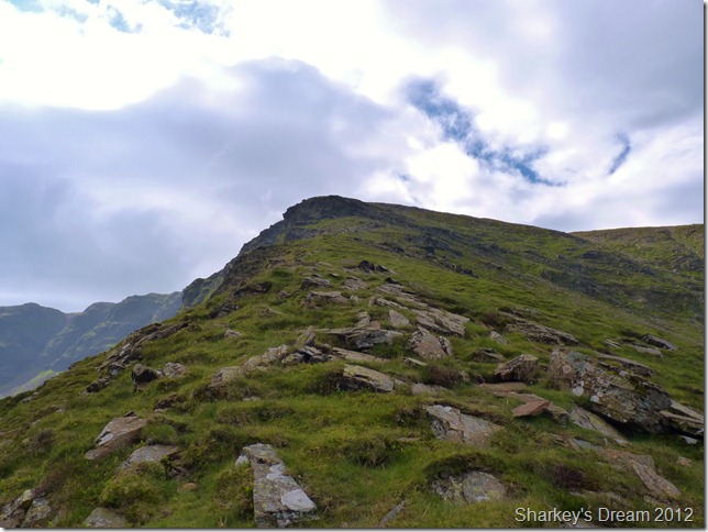
Dove Crag Arête. |
 |
| |
Dove Crag Arête. |
 |
| |
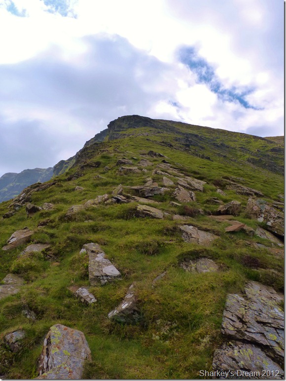
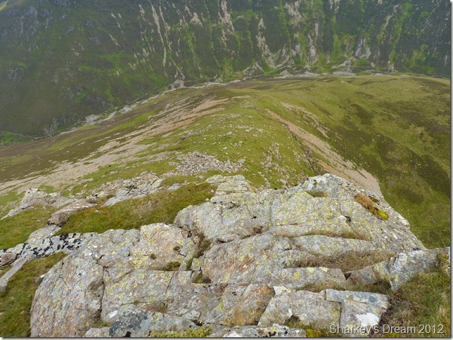
Dove Crag Arête.
Ahead lies the aptly named Rock Step, before that entails some of the finest walking I have ever partaken in. Words or pictures do not do this place any justice whatsoever, you simply have to life it, I soak in this climb with the magnitude & respect it deserves.
#Footnote#
Its not very often I am seen with a walking pole in my hand, yet after leaving the main path below I used my walking pole as an aid to help me over the steep ascent, now just when I need it, I find the lower half is not screwing back in after adjustment, I guess you may well know what I mean when I say the damn thing just kept spinning & spinning & just wouldn’t tighten up, Ok I thought, its still usable it just means although it wasn’t secure & I could still walk with it? No – I try, yet as I walk, especially up the steep grassy incline – the tip of the pole very annoyingly sticks in the grass, thus me trying to pull it out then detaches itself away from the rest of the pole.
OK, I paid quite a lot for this pole, its a LEKI with built in shocker & has a tungsten tip, its helped me through many a scrapes & right now when I need it, it gives up on me.
I’ve always carried half a role of Gaffer Tape in my pack, this can be used to strap up boots, temporarily repair rucksacks, even strap up an open fracture, today, for the first time since I started walking, I gaffer up my walking pole.
Job Done |
 |
| |
Gasgale Crags & promising blue skies from my ascent. |
 |
| |
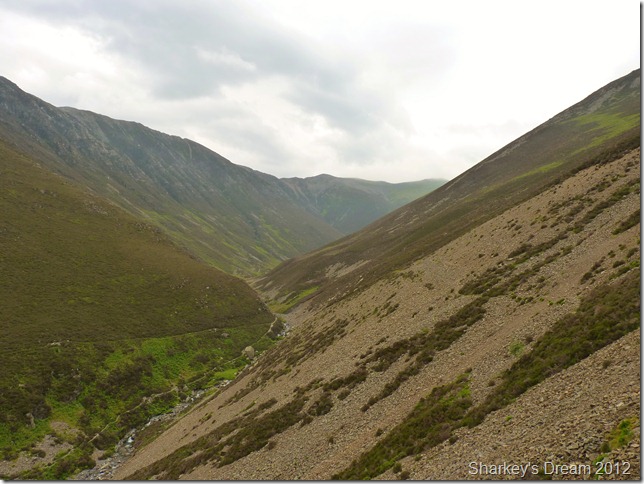
Nearing half way as I ponder on how about I negotiate the Rock Step ahead. |
 |
| |
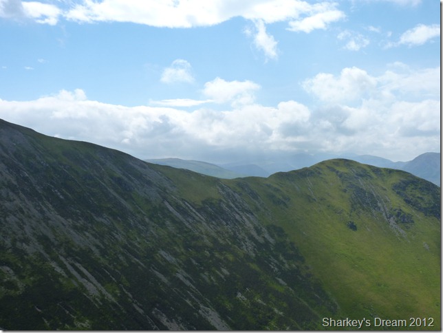
Hopegill Head (L) continuing on to Sand Hill with the Coledale Hause disappearing off towards the right of the picture. The prominent peak in the background is that of Grisedale Pike. |
 |
| |
Looking down the Arête from above the Rock Step.
On earlier research (of which there isn’t much) I had found out that even on the best of days the Rock Step is incredibly greasy, the closer I got to the rock the easier it was to find an alternative around it, this can be done by heading right around the lower flanks of the rock, here there is still a few little enjoyable scrambles but nothing that the average walker isn’t used to.
After leaving the Rock Step & a little more steady climb are then met by a much gentler hike across the summit shoulder, it is here the weather turns from grey to blue all in the space of around fifteen minutes, Fantastic. |
 |
| |
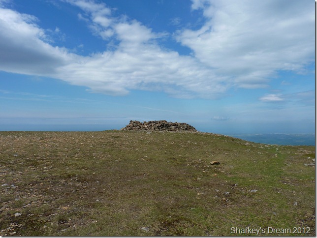
Grasmoor summit shelter.
I approach the summit with a strong cool breeze on my back, as I look around, I seem to have the whole mountain to myself which is rare & spectacular.
Time for brunch. |
 |
| |
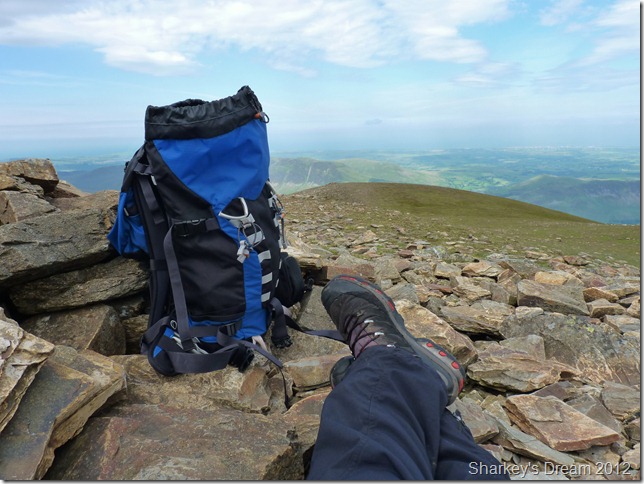
Fantastic views of the north west coast as I sit in the shelter with the wind whizzing above my head, eating an exceptionally early lunch. It doesn’t get much better than this… |
 |
| |
With views opening up all over north & north western Lakeland.
It’s around 11:00am & I can see a weather front approaching from the south as predicted far left in the picture, I had nothing to worry about as this was just mostly low cloud & haze, it lay dormant as it crept its way north at a snails pace, which I found very unusual for Lakeland.
In the very foreground of the picture lays my exit route of Grasmoor’s summit (the green & patchy brown ridge) of Lad Hows, which added more new territory to an already exceptional day on the fells. |
 |
| |
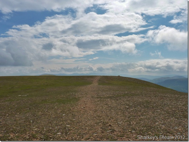
Grasmoor’s fine summit plateau.
I lose the jacket & pack it under the hood in my pack, the sun is warm as it approaches midday, here I am heading for Lad Hows, a fine ridge that will lead me back to Cinderdale Common & Crummock Water.
Locating Lad Hows is pretty easy in weather such as this – if you’ve never used Lad Hows as a descent before, however I have had the experience of being on Grasmoor in zero visibility & wouldn’t recommend this route personally, best stick to the main paths & somewhere you are more familiar with. Thankfully today I don’t have that problem, the path is on the right just beyond the cairn in the distance. |
 |
| |
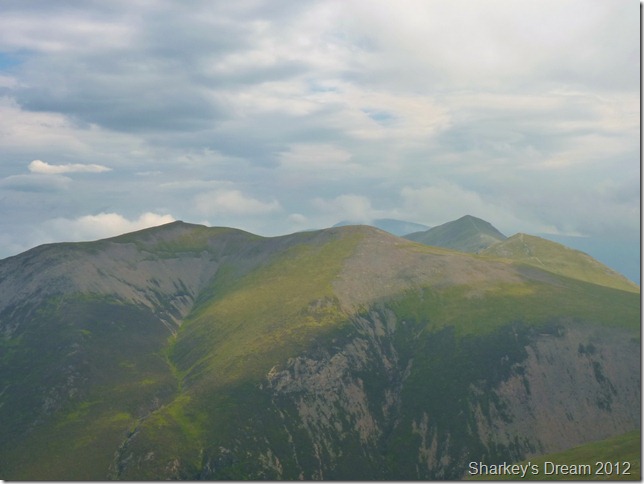
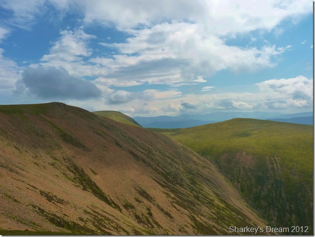
Looking across the scree towards Crag Hill (Eel Crag) (L) & Wandope (R) as I start my descent. |
 |
| |
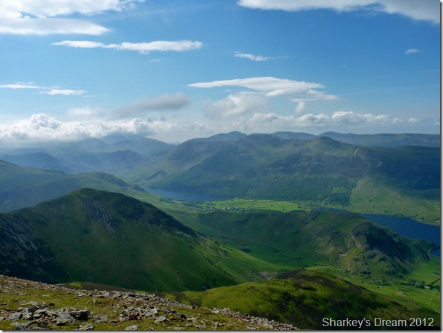
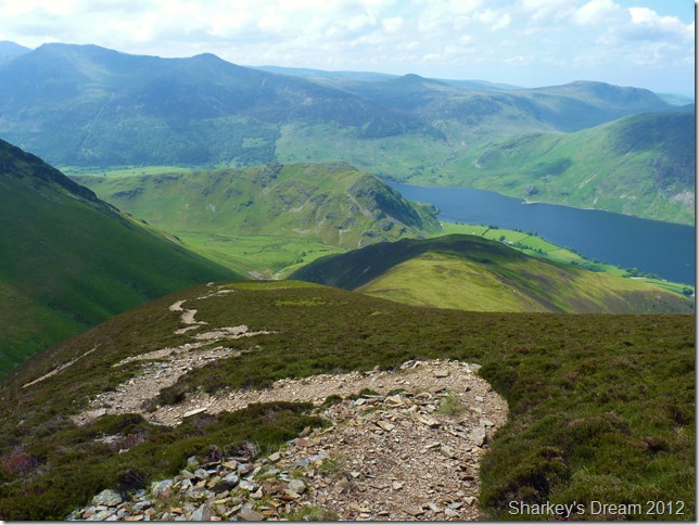
Descending the Lad Hows ridge with views of Rannerdale Knotts & the western fells.
I soon learn that this is a fantastic way of the mountain either ascended or descended as I am today. Although the path is pretty steep it fashions the way down by steep zig-zags & before you know it you are on the fine grassy ridge you see in the foreground.
It was while here, I hear the roar of jet engines, I quickly grab my camera & await there arrival, as the roar gets louder & louder & as quick as a flash, a BA-HAWK T1 training jet roars within less than 200 feet over Crummock Water. Vapour trail emits from both wing tips as it banks right over Buttermere before disappearing over in the direction of the Scarth Gap pass, anyone on Haystacks or Pillar would have been treated to an awesome sight overhead.
Sadly although I captured the jet with my camera, the picture wasn’t good enough to make it on the blog! |
 |
| |
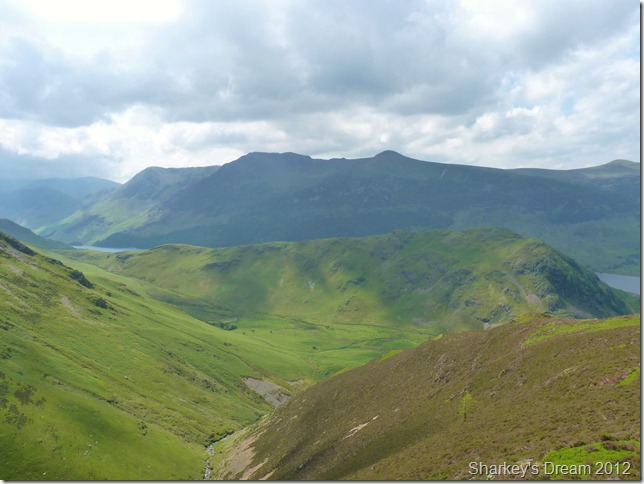
Rannerdale Knotts & High Rannerdale.
With the suspect weather creeping in from the left the High Stile ridge can be seen in shadow ahead. The distinctive hump of Red Pike (Buttermere) summit can be seen centre, with Starling Dodd on the far right & High Stile, High Crag & a hazy Haystacks continuing the ridge far left. |
 |
| |
Whiteless Edge & Whiteless Pike.
Although you can’t see it the Whiteless Edge & indeed Whiteless Pike has quite a few people on it today, more than I thought usually for a mid week. |
 |
| |
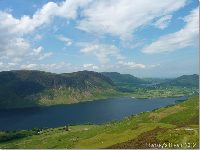
Mellbreak attracts the attention during the descent, here looking all the way towards Loweswater & the Loweswater Fells.
It was shortly after I took this photo, did I meet my first walker of the day, By Eck, you must of been up early if your coming down now.. Morning, I greet my fellow walker with a smile, It sure is a pull up from the car park down below he says, judging by the gradient of the descent, I have to agree with him, I’ve been keeping an eye on that weather heading this way he says, yeah its pretty slow moving I say – I don’t think you’ll have any problems reaching the summit before it reaches here, it looks like it hasn’t moved since I left the summit I say.
Good luck mate have a great day.
A non-the less peculiar conversation between two fell walkers, but I’ll have to admit that was a first for me to see a walker with pierced eyebrows, nose & tongue stud, & illuminous green & orange studs in his ears, other than that, the guy looked like he talked the talk & walked the walk.
Good on ya pal. |
 |
| |
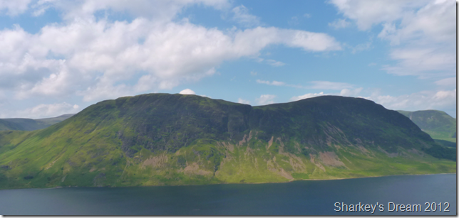
Stunning Mellbreak. |
 |
| |
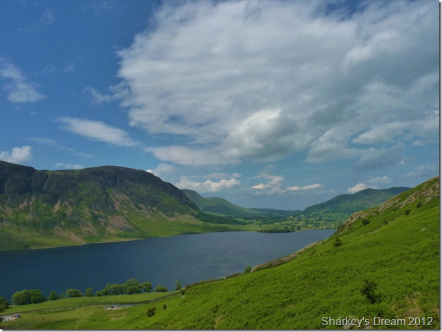
Looking towards the hamlet of Loweswater & Low Fell over on the right. |
 |
| |
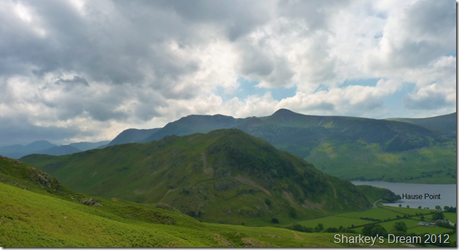
Rannerdale Knotts & Hause Point.
Slowly but surely the cloud cover increases as I make my mind up to pay one of my favourite hide away beaches in Lakeland a quick visit, Hause Point seen in the photo is a stretch of beach shingle & is a beautiful & sometimes remote spot. If I’m lucky, I may be able to spend a few moments there & maybe take a few shots & finish of my sandwiches. |
 |
| |
Passing through Dale How & the lower flanks of Rannerdale Knotts. |
 |
| |
Hause Point.
I take take the small pathway that will lead me down to the beach where I am met with sights of this tree washed up upon the beach, ahead in shot – I spot a family & think, I can deal with that, however behind me not two feet from where I took this photo is a couple enjoying a lovely afternoon, reading their books shielding their heads with straw sunhats, I feel like I have just walked into their front room, I even ask do they mind I take a few photos…
With this I’m outta there. |
 |
| |
Crummock Water, Rannerdale Knotts & the High Stile ridge from Lanthaite.
The mile long walk back to Lanthwaite was met by a leisurely pace to say the least, it is said that I have never walked so slowly after a day on a fell (plural!) I bid you, even if you are within the mist of Wainwright bagging, try this just once, pick a fell, spend as I did, five fantastic hours climbing, exploring & taking in the views, with no haste to be anywhere soon, this sure works wonders for the soul.
I arrive back at the car park which is now full, I watch two walkers cross towards Whin Ben & Whiteside in brilliant afternoon sun, shorts & t shirts seemed a million miles away from the exact spot from whence I was billowing warm air into a cupped fist.
The car park is hustling with coffee mugs, tea cakes as the elderly couples sit side by side clicking at their cameras most probably thinking I used to climb that, I people watch momentarily & think, that is going to be me one day. |
|
| |
| Back to top |
 |
|
