|
High on Langstrath |
 |
 |
20th May 2012 |
 |
|
For this walk I’ve left the adrenalin junkie in me at home, there are moments & times when only you will know you’re ready for an assault on one of the UK’s most famous arêtes & today, is not one of them. The Langstrath valley really isn’t that well known if you compare it to the likes of Grisedale or Newlands. To find yourself in Langstrath you are there for mainly one reason & this maybe the ridge that connects both Eagle Crag with Sergeant’s Crag, its a lonely valley best described by Wainwright as often admired yet seldom ascended & I guess Wainwright’s words still echo on nearly sixty years later.
I comprised this walk just three days previous while on the prowl for something less obvious & a little obscure & as far as I’m aware only a handful of people have connected the ridges as I did today, in saying this, the little research that I did do only went as far back as Google so if you have walked this route before let me be the first to congratulate you & apologise for my ignorance.
The weather unusually kept to its promises with a bright sun & distant fells seen, the container ship I spotted from the M6 in Morecambe bay on the early morning drive-in confirmed this, I was in for a good day on the fells, a hot humid & sweltering day, I may even catch a spot of sun-stroke, which indeed I did, but I’ll get to that later.
I centred this whole route around the exit out of the Langstrath valley, its just under five miles of walking bliss, funny how now as I write this blog, that the exit was for the finest part of a walk, but first you have to have an entrance, & this came in the way of four Wainwright’s Eagle Crag, Sergeant’s Crag, High Raise & finally Rossett Pike.
This route was a first for me, a route where upon you can forget time & time forgets you. The Langstrath valley certainly is one of Lakelands hidden gems, but shush – keep it to yourself… |
|
|
|
| |
|
Overview |
|
|
| Ascent: |
3,850 Feet, 1,173 Metres |
| Wainwrights: |
4, Eagle Crag, Sergeant’s Crag, High Raise, Rossett Pike |
| Weather: |
Warm & Sunny Turning Overcast PM, Highs Of 16°C Lows Of 8°C |
| Parking: |
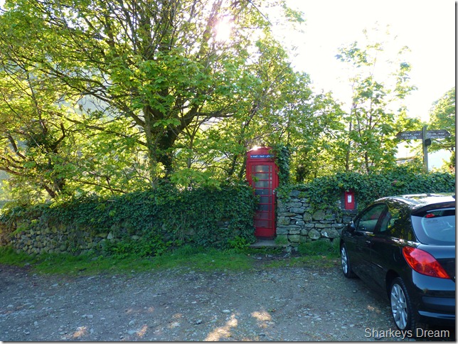
Stonethwaite (Next to the Red Phone Box, Room For Six Cars – FOC) |
| Area: |
Southern and Central |
| Miles: |
12.5 |
| Walking With: |
On my own |
| Ordnance Survey: |
OL4 & OL6 |
| Time Taken: |
|
| Route: |
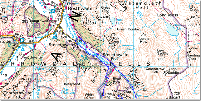
Stonethwaite – Greenup Gill – Eagle Crag – Sergeant’s Crag – Low White Stones – High Raise – Stake Pass – Buck Pike – Rossett Pike – Angle Tarn – Langstrath Valley – Tray Dub – Blackmoss Pot – Stonethwaite |
|
| |
|
Map and Photo Gallery |
|
|
 |
| |
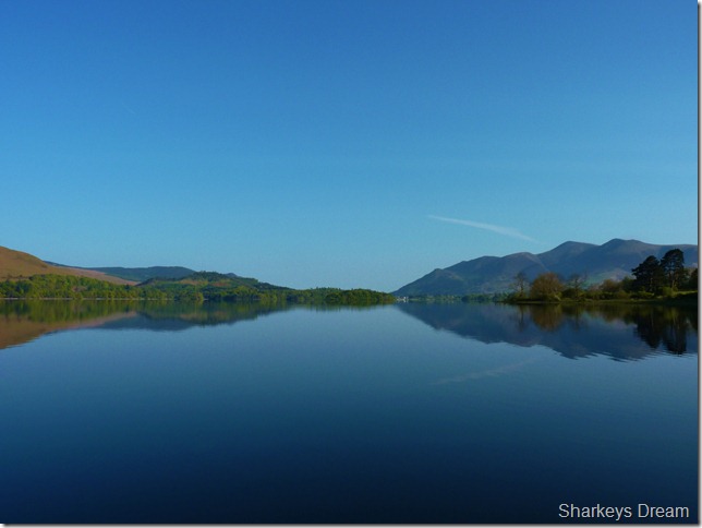
Peaceful Derwent Water.
I couldn’t resist stopping by at Kettlewell car park as I drove along the lake road, Derwent Water looked so peaceful before the Launches & the crowds arrived. |
 |
| |
Stonthwaite village, 8:03am 8°C
I arrived in Stonethwaite relatively early & with this came confidence that I would park with ease, which is just what I did, right next to the landmark that is ‘the old red phone box’ next to my car are the last two/three spaces available given the fact that to the right of my car the car park stands full, mostly with what looks like over-nighters going off the dew on the windscreens.
I’m almost ready when a local woman & her collie walk by & wish me a cheery ‘good morning’ as she disappears off in the direction of the wall seen in the photo.
I note that I am only carrying three litres of hydration today, two for the walk & as usual I leave one litre in the boot of my car, it really is getting to that time of year again when I should be carrying more fluid with me I say to myself, I do this every spring & summer & never seem to learn at getting the formula right, oh well, I shall be rationing the sips again! |
 |
| |
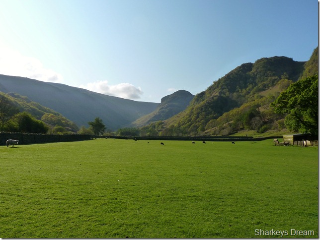
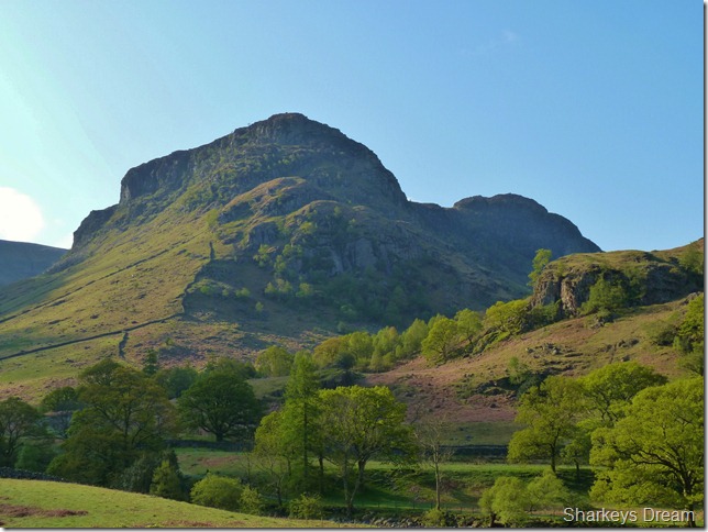
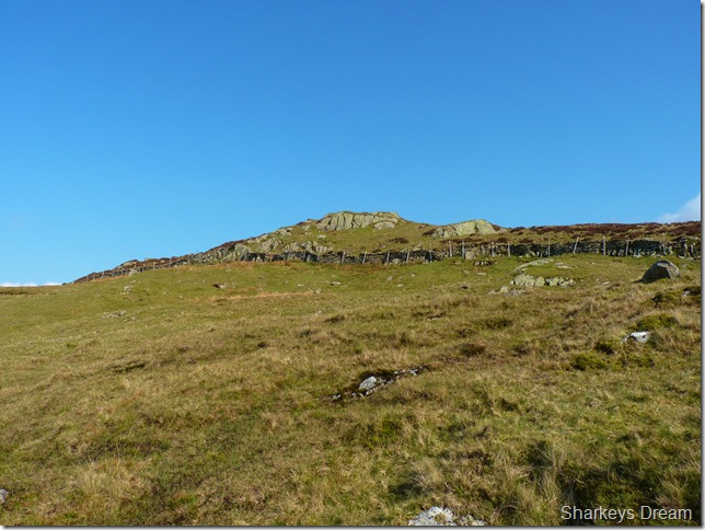
Eagle Crag & Greenup Edge.
I leave the car behind & head in the direction as the woman & quickly catch up to her where she is feeding the young lambs something through an aluminium gate, again, as I walk by & smile she wishes me a good day & sends me off with a ‘see ya’
Very friendly I thought. |
 |
| |
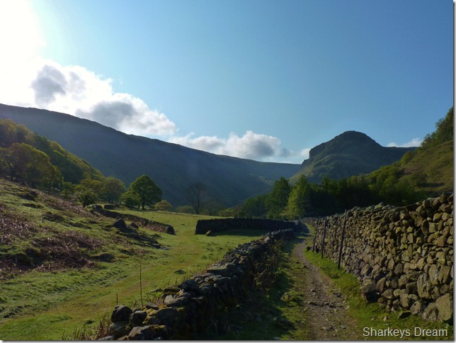
Eagle Crag & Greenup Edge seen after crossing the bridge over Greenup Beck.
It truly is a wonderful morning & right now I couldn’t ask for more with the fresh scent of morning dew & a constant reminder of Greenup Gill over on my right. Ahead lies my route & its pretty simple in the fact that all I have to do is follow this path along the flanks of Eagle Crag, where upon I should find a suitable place to cross Greenup Gill – but that is a good hour away so I will remember this being just one of the favourite parts of todays walk. |
 |
| |
Eagle Crag & Sergeant’s Crag from the path. |
 |
| |
My crossing point just ahead.
I decide to cross Greenup Gill at the dip ahead, note the steepness of the fell side to the right, it has only been a short while since I was last on Eagle Crag & even back then I climbed it from this side only a little further back along the gill. Described as easy & without thrills ‘the backdoor’ of the summit even, I think Wainwright back then forgot to mention how short this last section was, it is incredibly steep after leaving the comfort of this fine sheep laden path! |
 |
| |
Crossing Greenup Gill.
The crossing was easy & without incident. Considering however popular Eagle Crag is, I don’t seem able to spot a path along the grassy lower slopes, a few animal tracks maybe & sparse kick holes that disappear into nothing – leaving me thinking that this route ‘or the back door to Eagle Crag’ wasn’t as popular as I first thought.
Well, its not going to climb itself Paul! |
 |
| |
Taking in the steep grassy fell side.
I have to be perfectly honest at this point I struggled up the fell side, I cannot blame heat stroke at this point although it does have a factor later on in the walk, I blame myself for lack of motivation (every ten strides to be precise)
It seems at this point that Paul is having an ‘off day’ I just need to self motivate but with the morning heat bearing down I find this a tadge difficult.
But it will come (sooner or later) |
 |
| |
Eagle Crag’s summit looms.
With the steep ascent now behind me & motivation slowly kicking in I head for the summit, the ground underfoot despite the warm sunshine is pretty wet & at times I had to do quite a lot of negotiating across this small section.
A tip here would be follow the fence all the way over to the left where there is a wooden sty you can use to gain the last few metres. What I had noticed is that quite a few people had clambered over the stone wall & at places left it in ruin, the land owner getting sick of repairing the stone wall then decides to protect the wall by lining a high wire fence a foot apart from the wall thus creating a no-mans land effect, should anyone be brave enough to try & scale both wall & wire fence.
A bit of rational thinking is all it takes, this is Lakeland summit, a Wainwright & a Birkett, access to the summit will be there it just takes a little patience, so no need to to get caught in no-mans land leaving you to be captured by zee Germans! |
 |
| |
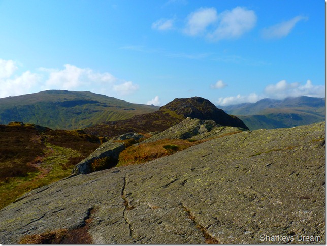
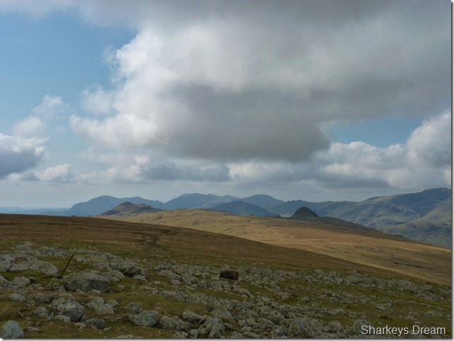
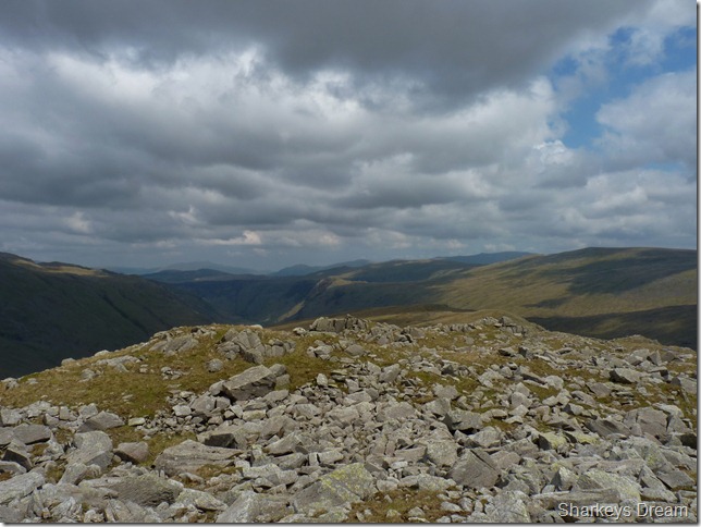
High Raise & Sergeant’s Crag from Eagle Crag summit.
This photo more or less describes my route with all three summits, in the foreground we have Sergeant’s Crag which is gained by a small traverse along the ridge, over on the left of the picture is High Raise & lower right is the Rossett Pike ridge just nestling beneath Bowfell, if you notice the small hump in-between High Raise & Sergeant’s Man, this is Pike O’ Stickle, part of the Langdale Fells & a few miles away I might add. |
 |
| |
Sergeant’s Crag & the Langstrath valley.
The Esk fells sit at the top of the valley & clearer views are appreciated a little further on in the walk, right now, I just need to negotiate some more bog before I reach my next summit of Sergeant’s Crag. |
 |
| |
High Raise seen from Sergeant’s Crag summit cairn. |
 |
| |
South Lakeland from Sergeant’s Crag summit. |
 |
| |
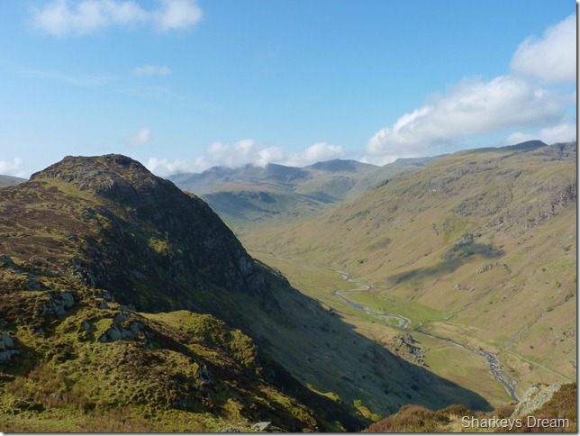
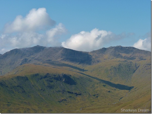
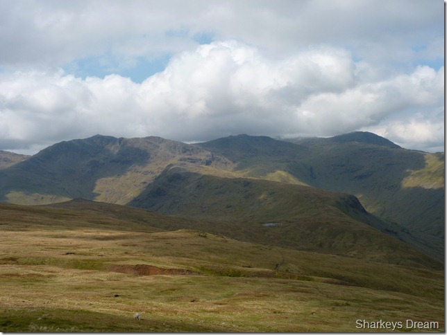
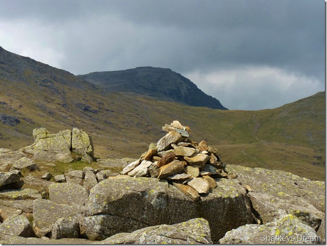
Bowfell, Rossett Pike, Ore Gap & Esk Pike from Sergeant’s Crag.
This picture depicts my exit route: Rossett Pike can be seen at the end of the ridge towards the left of the picture with Bowfell domineering the whole ridge route, after leaving Rossett Pike I will head right (under the cloud) & follow the langstrath Beck out of the valley.
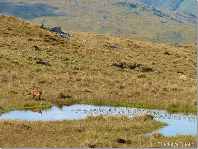
What I saw next caught me fully un-aware & by total surprise.
A first for me… |
 |
| |
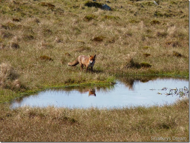
Bowfell, Rossett Pike, Ore Gap & Esk Pike from Sergeant’s Crag.
This picture depicts my exit route: Rossett Pike can be seen at the end of the ridge towards the left of the picture with Bowfell domineering the whole ridge route, after leaving Rossett Pike I will head right (under the cloud) & follow the langstrath Beck out of the valley.
What I saw next caught me fully un-aware & by total surprise.
A first for me… |
 |
| |
Then as calmly as they come, he takes a drink from the pool of water. |
 |
| |
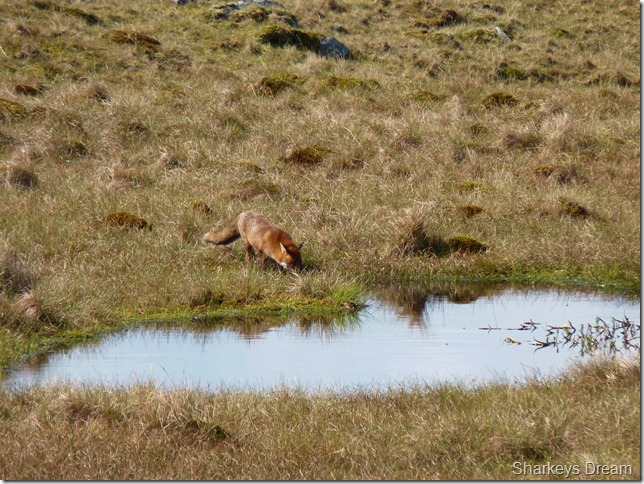
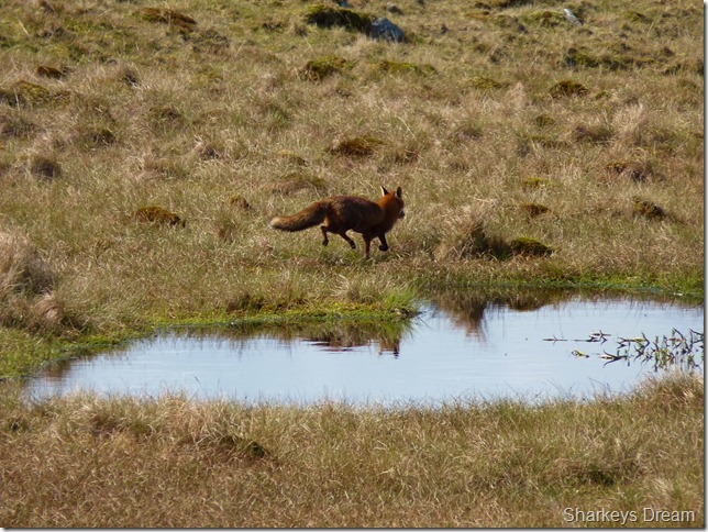
Stares at me one more time… |
 |
| |
And makes his exit.
By now I am in total awe at what has just taken place before me, I know that a Fox sighting in daylight is rare, to pose for the camera & check me out?
This made my whole day as he gingerly trots of in-between a herd of around four/five sheep, non of which blink an eyelid as I’m guessing they too may know, that a Fox in daylight is a tired & full Fox. |
 |
| |
Looking back on Sergeant’s Crag & Eagle Crag.
Bassenthwaite can be seen in the background of the picture along with north, & north western Lakeland, in the foreground of the picture is the patch of water from where I spotted the Fox, but for now its a arduous climb along the flanks a High Raise. |
 |
| |
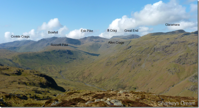
The views keeping morale up, here with Esk Pike on the left, III Crag centre & the magnificent Great End on the right. |
 |
| |
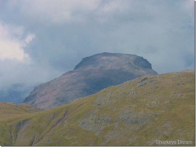
A somewhat hazy close up of Great Gable, the pathways clearly visable. |
 |
| |
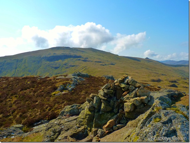
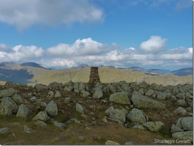
High Raise summit trig point.
I promised myself a short stay in the nearby shelter whilst on the ascent not ten minute’s previous, but as it comes, by now I’m feeling pretty good again. |
 |
| |
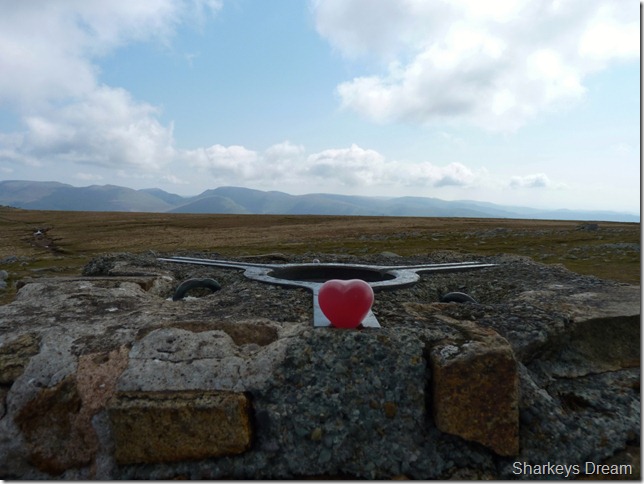
The last heart in my bag of Haribos goes to High Raise. |
 |
| |
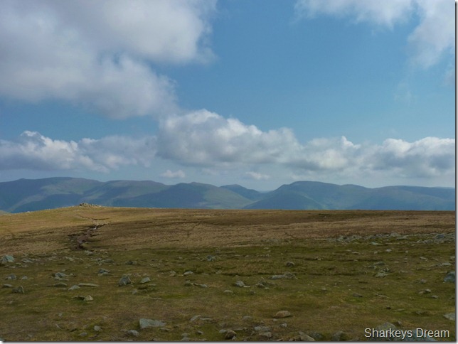
The eastern fells from High Raise smooth summit plateau.
Forming the Helvellyn ridge from the right we have Catstye Cam, Helvellyn, Nethermost Pike, Dollywagon Pike, Saint Sunday Crag, Seat Sandal, Fairfield, Hart Crag & finally Stone Arthur. |
 |
| |
Looking south towards the Coniston fells with Harrison Stickle & Pike O’ Stickle getting a little closer. |
 |
| |
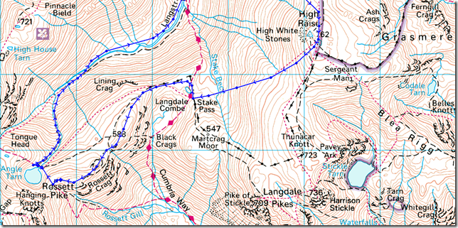
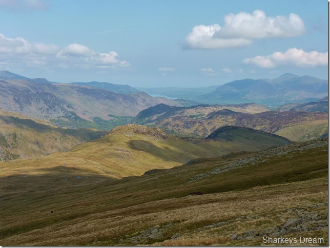
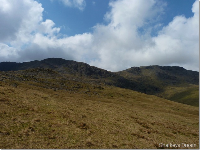
Rossett Pike & my route ahead.
My aim as I leave High Raise is to head for the small un-named Tarn you see in the middle of the photo, it looks pretty straight forward, & it is really, but not as the ‘Crow would fly’ or more importantly as ‘Paul would walk’
With spectacular views as I leave the summit for the grassy moraines of Stake Pass which runs parallel with the Tarn on its left flanks I fumble down the fell side with prospects of Rossett Pike & lunch at Angle Tarn, but that is a wee while off yet so best crack on… |
 |
| |
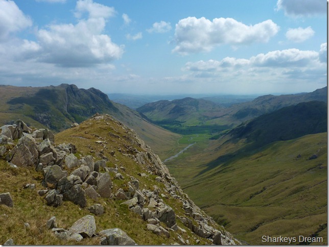
Looking back along the far end of the ridge towards Sergeant’s Crag & Eagle Crag. Glaramara lies to my left with the Langstrath valley dividing both ridges. |
 |
| |
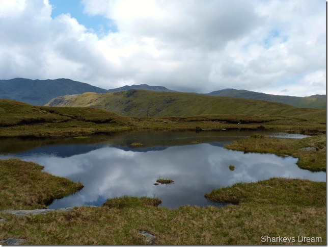
Rossett Pike from the un-named tarn at Stake Pass.
By now as predicted, the weather has changed slightly, leaving the sun obscured by high & dark cloud, this fairs well at this point giving me time to walk in the shade for a while & maybe try to cool down, remember, small sips Paul. |
 |
| |
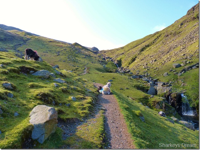
Mickleden & the Langdales seen from the start of the ridge.
Gaining the ridge towards Rossett Pike has always been a boggy affair, ok I admit, I don’t hold a great deal of percentage at the amount of times I have been here, but on every occasion that I have been here the bog has been pretty rife, taking time to negotiate, adds to journey time a little |
 |
| |
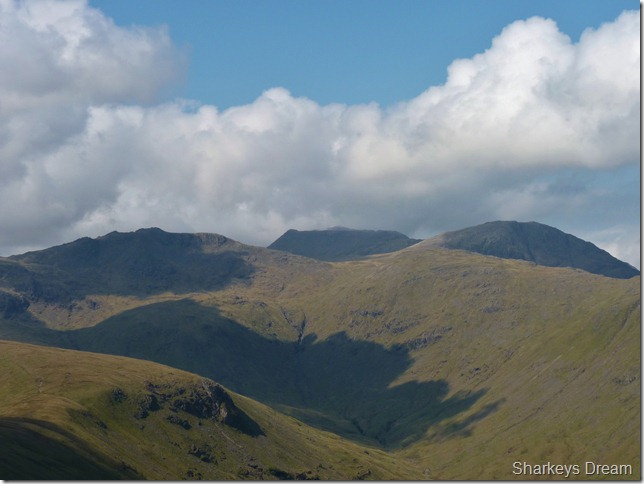
Bowfell, Hanging Knotts, Ore Gap & Esk Pike sure take your mind of the boggy sections though.
Rossett Pike summit is just ahead. |
 |
| |
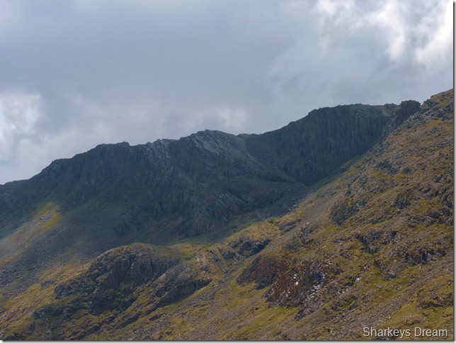
A close up of Bowfell’s Great Slab & a glimpse of Bowfell Buttress to the right, Bowfell’s Climbers traverse picks its way through the crags to the left of the picture. |
 |
| |
Mickleden, The Langdales & Lingmoor Fell from Rossett Pike summit. |
 |
| |
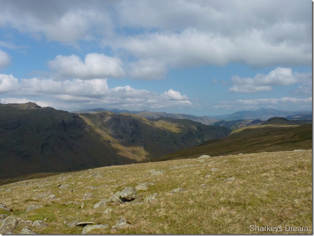
Looking back along my route which by now looks a very long way, towards the right of the picture is High Raise & centre in the distance is Sergeant’s Crag & Eagle Crag. |
 |
| |
Great End from Rossett Pike summit cairn.
Believe it or not there are two women sitting down behind the summit cairn, they asked me are they in my way for me to get a summit shot, I reply with ‘would you mind’ they weren’t elves, but they look it from here!
Time for some lunch… |
 |
| |
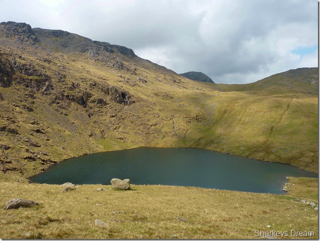
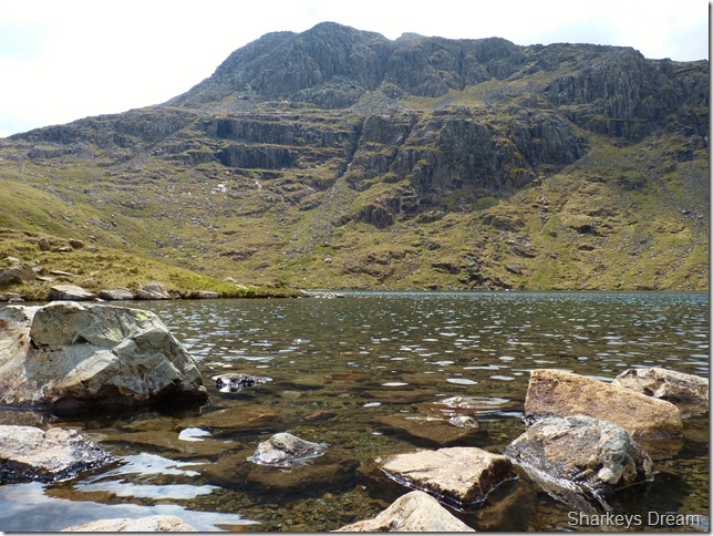
At Angle Tarn (Langstrath) |
 |
| |
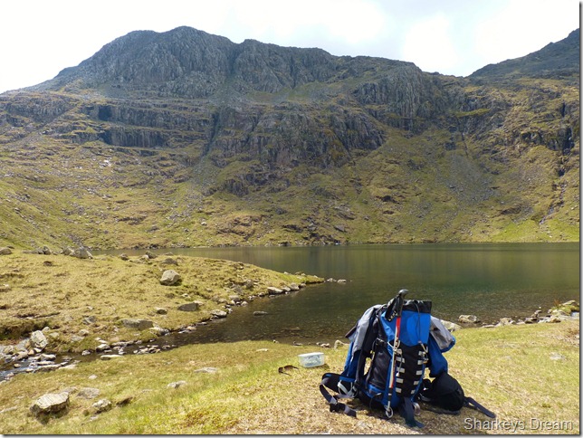
Lunch with a view with Bowfell’s Hanging Knotts distracting my attention from my Tuna Mayo. |
 |
| |
Angle Tarn with Hanging Knotts (an extension of Bowfell’s Summit) |
 |
| |
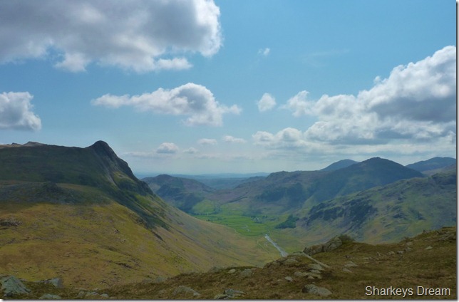
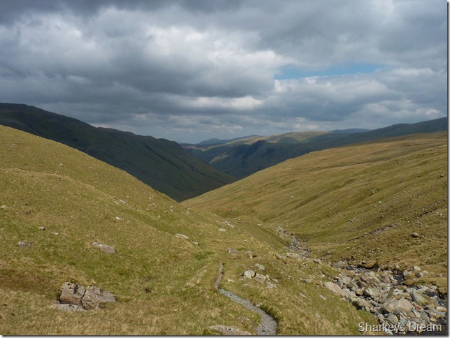
Just what I had been waiting for, The Langstrath Valley & my exit route, just under five miles of walking heaven.
It is here I start to meet walkers on their way up to Angle Tarn, firstly a lone woman walker then a couple of whom the bloke asked, have you left me a cup of tea at the Tarn mate? even better I reply, a cold drink of beer, he laughed & says don’t tempt me mate! |
 |
| |
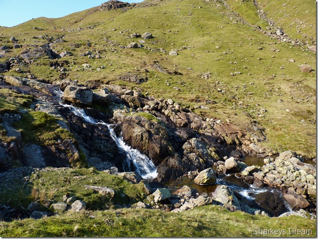
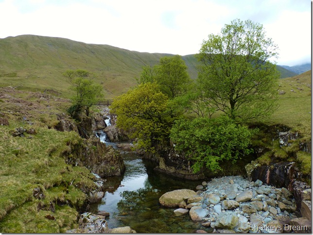
Tray Dub.
Another key feature that I didn’t want to miss while in the Langstrath valley was this gorge, cut by millennia creating a rather interesting & beautiful feature to the walk.
It’s a two hour walk from the summit of Rossett Pike back to Stonethwaite, in this time the cloud above has thickened & the temperature has dropped slightly yet still leaving the air muggy.
I sight three women walkers ahead of me & before I know it I catch them up, as I approach I smile & say Hi, while one of the walkers holds a map in her hand, excuse me? is that the Cumbrian Way up there? I take a quick look at her map & yes I reply – that is the Cumbrian Way, are you ok I ask? well, we came down the wrong valley we think & we need to get back to Dungeon Ghyl.
I quickly map out in my head the quickest way back for the the women, one word enters my head & I keep it there, Oh Dear. Ok if I was you I say, I’d go back the way you came & pick up the Stake Pass / Cumbrian Way which will then in turn lead you back through Mickleden & Dungeon Ghyl, NO WAY one of the women quips – the woman holding the map says that’s what another guy said who I asked earlier. Picking up the Cumbrian Way while in Langstrath is hard work physically, your easier route would be the way you came, that’s what I’d do anyway.
I ask them do they have enough Hydration & food, one sandwich & some bottled stream water they reply – I silent sigh & suggest they follow me to Tray Dub, here they can cross the Langstrath Beck & pick up the Cumbrian Way there (their route will hopefully lead them at the un-named tarn I was at earlier after leaving High Raise)
I couldn’t help but feel I could of done more to help these three women, ok they have the light on their side yet as you could see in the picture the cloud was slowly coming down, Great End was barely visible as I left Angle Tarn & while the cloud might of remained high enough by the time they had reached the top the Cumbrian Way fells they had seen earlier may not have been so visible.
I only hope they listened to my advice & kept Pike O’ Stickle to their left as they descended down to the Mickleden valley. |
 |
| |
| Langstrath |
 |
| |
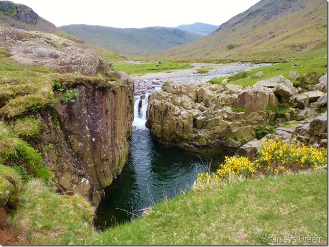
Blackmoss Pot.
Nearing the end of the valley are you blessed with yet another fantastic feature to Langstrath of Blackmoss Pot, in all the times I have been in Langstrath I have always failed to leave the path & do a little exploring as I did today.
Three young lads are diving in the deep pool of water from the rock seen centre as they disappear within the deep pool. I can definitely see the attraction on a hot summers day, but seeing as its now overcast & the three lads are sat shivering out of shot, I think to myself maybe another time Paul. |
 |
| |
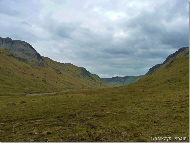
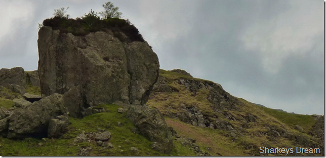
Blea Rock, Langstrath.
I think this goes to show that the Langstrath valley has more features than you can shake a stick at!
By now I’m touching the eleven & a half mile mark & if I’m honest limbs are starting to feel slightly sore & rock underfoot gets the odd kick rather than a step over, I feel a little odd, sickly even & more lethargic than I’m ever used to.
I think I’ve picked up a little sun stroke along the way. |
 |
| |
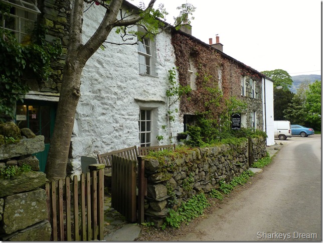
Stonthwaite Cottages.
I walk the stone lanes & pass an almost deserted Stonethwaite Campsite, unusual for the time of year & no doubt the unseasonal weather hasn’t helped matters.
By the time I arrive back at the car, the car park is full, so at least If we are not staying over night we are still enjoying Lakeland by foot. I still have one sandwich left so I de-pack at sit on the rear panel finishing off the remains of lunch languishing at the thought of another fantastic day on the fells.
My sunburn, my chapped lips & scorched dried sweaty forehead tells a thousand stories of another great day on the fells. |
|
| |
| Back to top |
 |
|