|
The Kirkstone Pass Fells |
 |
 |
28th April 2012 |
 |
|
Its been over three weeks since I was last in Lakeland & time was beginning to take its toll – & the heart strings began a begging for fell time, Paul time.
With this the boots have been staring up at me in their clean state that I left them in after my Yorkshire excursion, the kit has been waiting for yours truly patiently in my study with soppy eyes & eagerness to boot…
Its funny what three weeks can do to a man & his kit.
Today I am walking with Tim & by going off the texts he’s been throwing at me, he too could do with a bloody good day on the fells, for it seems just like mine, Tim’s first aid box in work contains no “bottled up Lakeland” Its fair to say there’s only so much a loved one can do in this situation, to save sanity one must travel North & lug heavy packs up some steep Mountains.
As I am with Tim, todays walk is based upon Tim’s ever decreasing Wainwright list, every walk with Tim gets him closer to that magic 214. But savour these days. I am still struggling in coping with the emptiness of nothing & no goal to aim for, at times I would swap my walking catalogue with any of you who haven’t finished his or her Wainwrights, its now that matters I say to Tim, after the 214 it will hit you like a steam train – & if you felt anything like me, that train derailed & at times I walked aimlessly around that wreckage.
I’m going way of track, get it? track? trains? – okay I’ll move swiftly on!
Besides the texts of which I can not repeat from Tim stressful workplace I got one that included the Kirkstone Pass fells, you know the ones; Middle Dodd, Red Screes etc., etc. Well it was just so funny you should text me these fells Tim because just like before, I have had these particular fells on the back burner,especially Middle Dodd of which I have some personal issues, but I’ll get to that later.
This walk is another result of Tim’s ever increasing planning procedures, I had no say nor did it need tweaking all I asked of Tim was – can we include St Ravens Edge?
As I did, come along for the ride… |
|
| Wainwright Guidebook |
 |
| The Eastern Fells |
- the Eastern Fells:
To the traveller starting the long climb up to Kirkstone Pass from Brothers Water the most striking object in the fine array of mountain scenery is the steep pyramid ahead: it towers high above the road like a gigantic upturned boat, its keel touching the sides barnacled and hoary. This pyramid is Middle Dodd, the middle one of three Dodds which rise from the pastures of Hartsop, exhibiting the same characteristics. When seen from higher ground in the vicinity, however, Middle Dodd looses its regal appearance (as do the other two): its summit then is obviously nothing than a holt in the long northern spur of Red Screes. |
 |
|
|
| |
|
Overview |
|
|
| Ascent: |
3,215 Feet, 980 Metres |
| Wainwrights: |
4, Middle Dodd, Red Screes, Caudale Moor (Stony Cove Pike) & Hartsop Dodd |
| Weather: |
Overcast With Some Showers – Some Failing As Hail, Turning Brighter With Strong Gust PM, Highs Of 15° Lows Of 6° |
| Parking: |
Cow Bridge Car Park |
| Area: |
Eastern |
| Miles: |
8.8 |
| Walking With: |
Tim Oxburgh |
| Ordnance Survey: |
OL5 |
| Time Taken: |
|
| Route: |
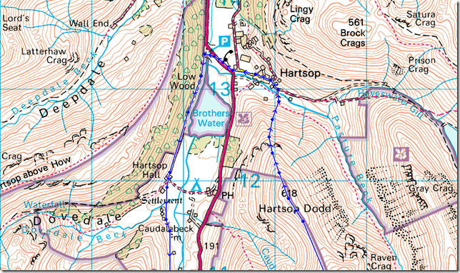
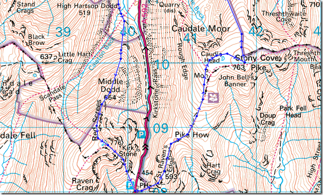
Cow Bridge – Brothers Water – Hartsop Hall – Middle Dodd – Smallthwaite Band – Red Screes – Kirkstone Pass – St Ravens Edge – John Bell’s Banner – Caudale Moor (Stony Cove Pike) – Hartsop Dodd – Hartsop – Cow Bridge |
|
| |
|
Map and Photo Gallery |
|
|
 |
| |
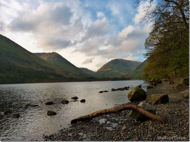
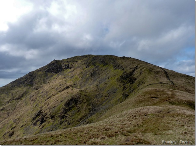
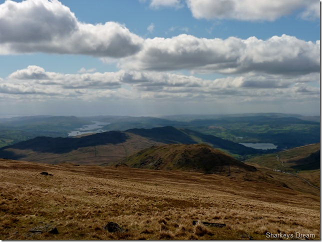
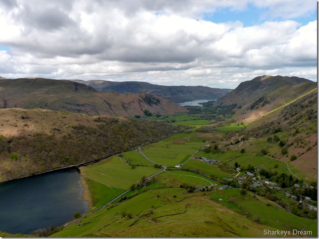
Middle Dodd & Caudale Moor from Brothers Water.
07:55 – 6°
It feels colder than it actually is, we kit up at Cow Bridge with eagerness to get the jackets on, my body shivers as I lace up my boots in doing this I slip an eyelet on the last knot & now; I have the courtesy of undoing my double knot with shivering fingers..
Bloody Hell.
At the side of my car is another walker kitting up, he had the CP to himself until we arrived so he turns the volume down on his car stereo & asks? Going far? I explain my route pointing at the fells in question, I’m heading for Hart Crag then Fairfield he explains, I think about it split secondly & think yeah - that’s so doable from Cow Bridge, in doing this as the walker heads off I also think?
Why didn’t I ever think of that! Fairfield from here? great. Hope he has a good un, as he leaves the CP oddly enough, with an espresso in hand. |
 |
| |
High Hartsop Dodd (R) & Middle Dodd as we pass through Dovedale.
After leaving the shores of Brothers Water behind do we then pass through what was Hartsop Hall, now residing as a farm I fail to feel inspired to get the camera out which was such a shame. |
 |
| |
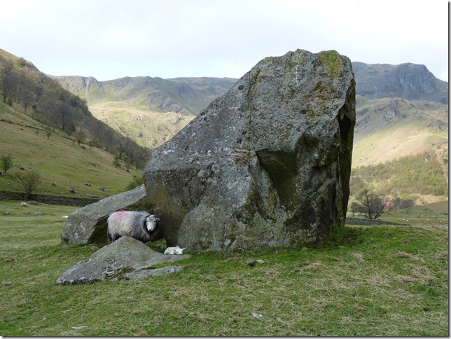
Dovedale.
A mother protects its new born & glares as we pass, the spring lamb however is relaxing at the foot of a huge boulder left here by the previous ice field thousands of years ago |
 |
| |
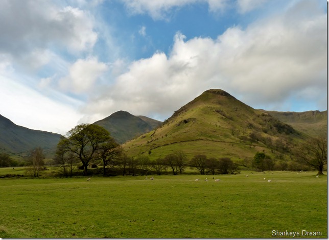
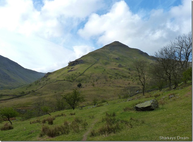
Middle Dodd.
With High Hartsop Dodd on our right flank Tim gets his first close up view of Middle Dodd, I however have been here before & know what to expect of the steep climb that lies ahead, This I call “the mini Lingmell” except Lingmell has better footings!
We eye up our route not shown on the map & basically follow the stone wall just past half way until we reach a gap at the point where you see the outcrop of rock to the left hand nose of the fell, here the path gets a little less steeper with views of the Kirkstone Pass far below. |
 |
| |
Looking back toward Brothers Water, Angle Tarn Pikes, Place Fell & Hartsop Above How over on the left. The chill is still present yet it is much less felt as our legs & bodies absorb the steepness out of the climb. |
 |
| |
Tim checks out the views from an outcrop of rock.
Below us runs the Kirkstone Pass & the vastness of Caudale Moor, for me Caudale Moor & Red Screes are to the Kirkstone Pass; as what Fleetwith Pike & Dale Head are to the Honister Pass. |
 |
| |
Looking back from just beneath Middle Dodd’s summit. |
 |
| |
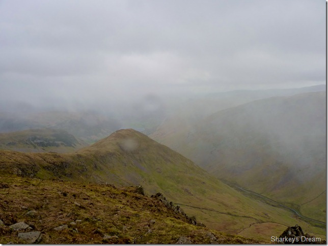
The top of the Scandale Pass & Little Hartsop Dodd from the climb.
Everybody gets lost at some point during their walking careers & Scandale was the setting back in 2009 when I lost myself epically after summiting Middle Dodd & Red Screes. Back then I was still cutting my teeth with maps (ahh the good old days!) when a weather front engulfed me as I reached the summit of Red Screes. Instead of making a bearing for Scandale, my would be descent route, I headed of for Snarker Pike, just under a mile in the total opposite direction, still engulfed in cloud & un-able to get a fix on any object until I finally dropped out the cloud long enough to realise I had passed the Kirkstone Inn below on my left & had barley visible signs of the head of Windermere.
I wouldn’t say this scared me although it was the first time I had found myself in low cloud & un-able to get a fix on anything, if anything I learned a valuable lesson which was not to panic in low cloud when on ones own, this I owe & use to this day. Back tracking if un-sure when out on the fells cuts deep, especially if its back up from where you came, but sometimes its the only answer. A telephone call & reassurance from a friend also got me out of this scrape! |
 |
| |
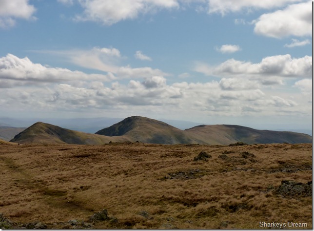
Looking towards the Eastern fells, in the very foreground we have Little Hartsop Dodd forming the top of the Scandale Pass, then we have Dove Crag & behind that is Hart Crag, Saint Sunday Crag is over on the right of the picture with its summit just under cloud. |
 |
| |
Red Screes & Smallthwaite Band from the summit of Middle Dodd.
I clinch my fist for the last part towards the summit, if not to stop the now biting wind from freezing my fingers, I know were nearly in May but I easily succumb to Hat & Gloves, for now at least. |
 |
| |
Red Screes & Smallthwaite Band.
Smallthwaite Band is a lovely short ridge across to Red Scree’s summit, a section of the walk which was pleasant now that most of the hard work was behind us, also behind us was… |
 |
| |
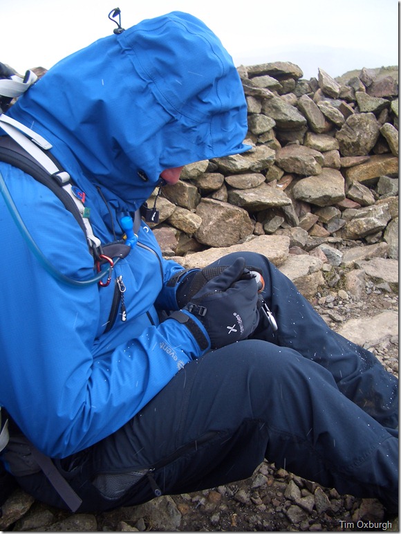
A hail storm, not ten minute’s previous was we basking on the ridge under glorious blue skies!
We hastily head for the comfort of the summit shelter & sit out the hail storm which was brief yet powerful. |
 |
| |
Sitting it out.
Tim peels open a boiled egg as I add a waypoint into the GPS, I’m definitely not a shelter person I can walk past one without ever setting foot, but today, actually being sheltered from the passing hail storm was quite comforting.
Tim shares out the Haribo & we are soon on our way. |
 |
| |
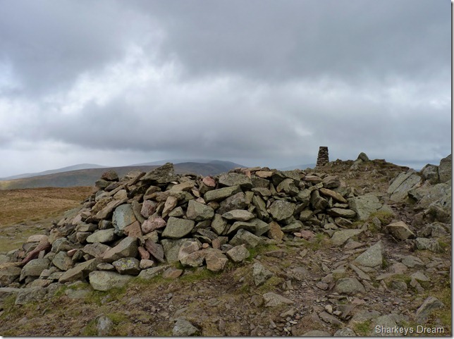
Leaving our humble abode not before taking a quick photo of Red Scree’s summit shelter & trig point. |
 |
| |
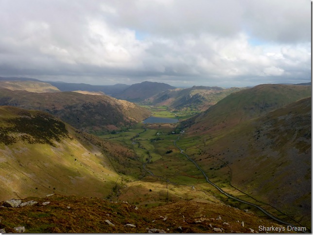
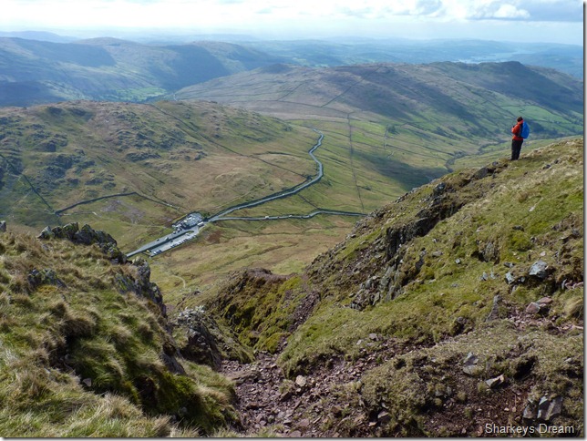
1,056 Feet above the Kirkstone Inn. |
 |
| |
Wansfell, Baystones & The Hundreds dominates the descent.
It is here while on the descent do we start to cross the first walkers of the day, we pass a guy with a Geordie ascent wearing jeans & a red Jacket & no pack, in tow, a brown Spaniel darts across the path like a super fit hero that it was…
The Geordies red jacket bore the emblem; Patterdale Mountain Rescue…
Never judge a book by its cover! |
 |
| |
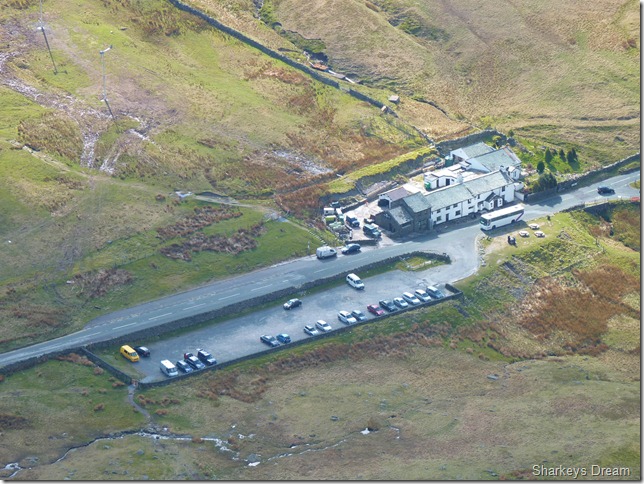
A close up of the Kirkstone Pass Inn from our descent.
To the left of the Inn marks our path that will lead us onto to St Ravens Edge, the badly parked coach on the Pass as we were later informed had broken down & came to rest at the top of the pass, a common site no doubt! |
 |
| |
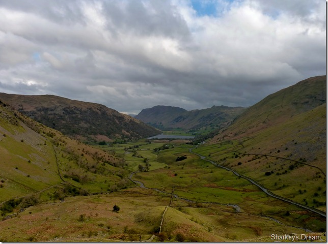
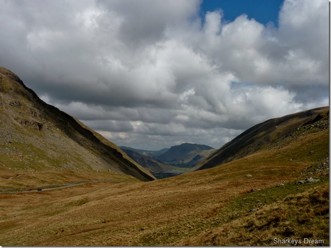
A distant Place Fell from the top of Kirkstone Pass.
We pick our way down the narrow stone path passing more walkers along the way, we pass through the car park seen in the previous photo & mentally prepare for more ascent onto St Ravens Edge, not before enjoying views such as this. |
 |
| |
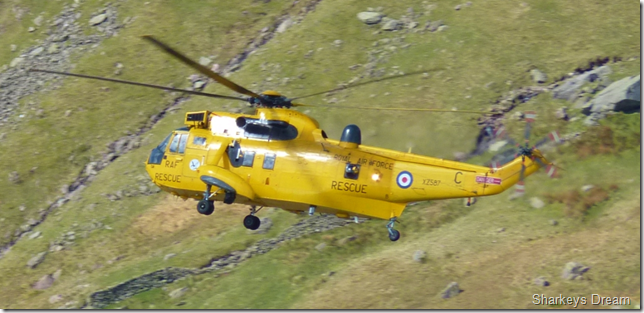
A RAF Sea King passes directly over the top of the Kirkstone Pass as we make our ascent onto St Ravens Edge, it idles slowly & I’m able to get a few descent shots this being one of them, note the blurriness around the tail & rotor, this being the hot exhaust fumes emitting from the engines. |
 |
| |
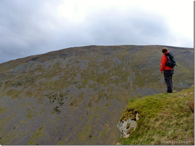
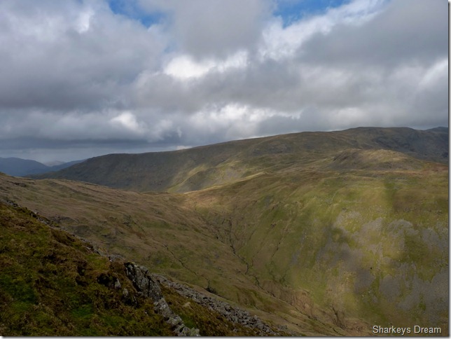
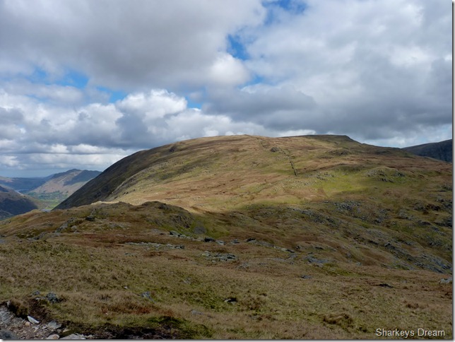
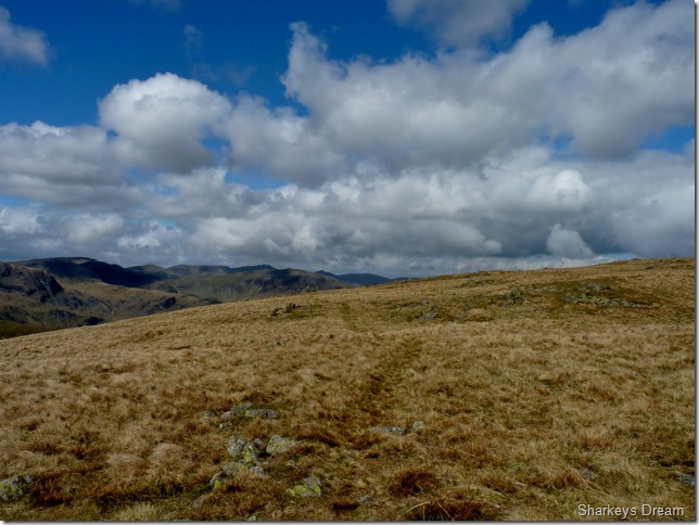
Pike How, John Bells Banner & Caudale Moor (Stony Cove Pike) from the top of St Ravens Edge.
This was a particular point I was looking forward to in the walk as it was completely un-walked & new territory to me, here you don’t really get the feel you are walking along an edge until you look back on it from a little higher up. |
 |
| |
That’s better!
St Ravens Edge from just beneath Pike How. |
 |
| |
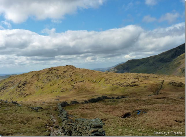
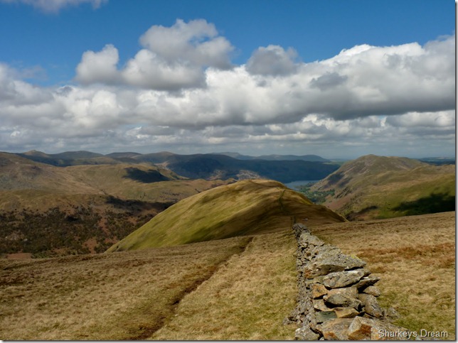
Looking back on ground covered, Red Screes & Middle Dodd from Pike How. |
 |
| |
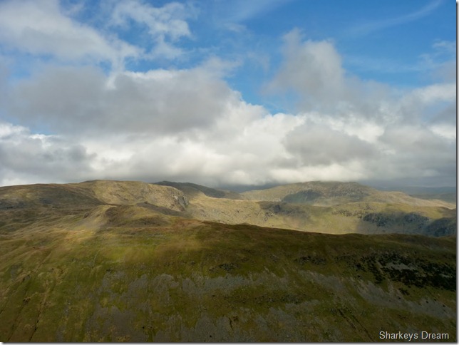
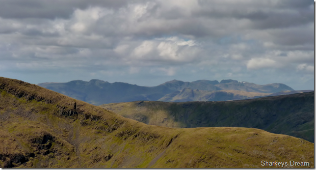
A close up of the Esk fells & the Scafells.
Clarity is near perfect as we approach midday, talking about midday, what was the rumbling? thunder maybe? Tim letting one go? no its the belly…
Time for lunch. |
 |
| |
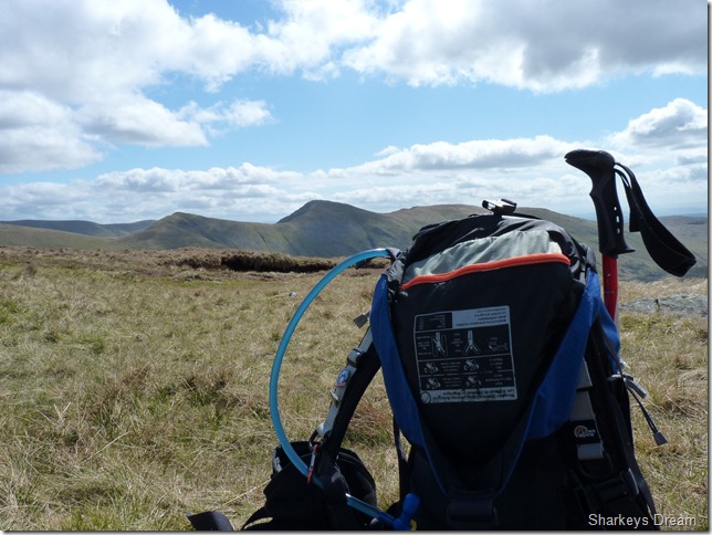
Lunch with views of the Illbell Ridge.
We pick a perfect spot to lunch, a dry grass bed with stone back cushions pitched perfectly for a power stop.
I sit with my legs stretched out & eat my Tuna Mayo sandwiches, out of the wind & basking in the sun I would pay good money in a restaurant to get views as good as this… Yet I hear something over a slight wind, its a beeping? its electrical for certain, the sort of beeping watch or even a GPS would make, I take out my GPS & hold it to my ear, nope its not mine, I then do the same with my camera & its not that either, I’m thinking someone has dropped something around here but it can stay where it is, the views & sandwiches are just going down to well…
A couple pass us as we finish up, It looks like Gaynors of Ambleside have just hit their monthly target looking at these two! with brand new this & that – even helmets with LED lights attached to there brand new packs, we watch on as the couple take more than there fair share of breaks towards the summit, but they do this hand in hand which kinda gives of that ahhh factor. |
 |
| |
We leave the main path & the stone wall we had been following for a slight detour over John Bells Banner & the Atkinson Monument. |
 |
| |
The Atkinson Monument.
A monument dedicated to both father & son of the Kirkstone Inn.
The monument sits directly in view of the Inn way back down the fell side, here Tim takes time to read both plaques situated within the stone cairn. |
 |
| |
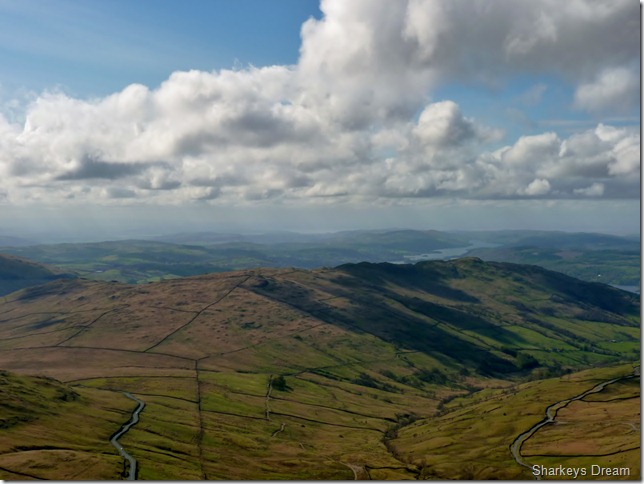
Looking back on the full length of Windermere together with St Ravens Edge, the Kirkstone Inn & Wansfell. |
 |
| |
Froswick, Ill Bell & Yoke forming the Ill Bell Ridge from Caudale Moor. |
 |
| |
Any given scene from the TV Series Last of the summer wine as two blokes sit on a stone wall & watch the world go by.
We do not need to rest as we leave Caudale Moor behind us as Tim takes a seat at this stone wall, ahead lies Hartsop Dodd but that can wait for a few minute’s while we sit in silence almost & take in the views. |
 |
| |
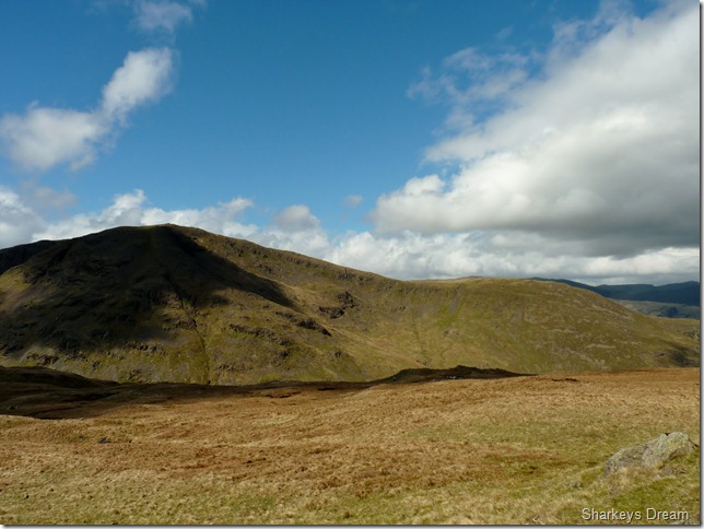
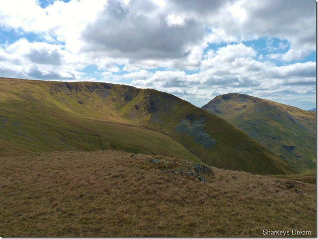
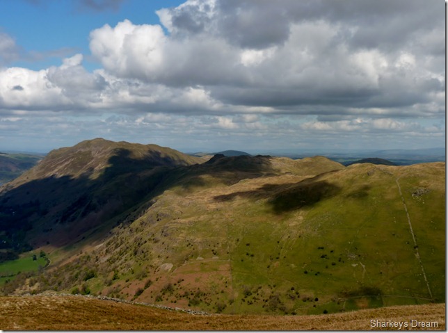
Caudale Moor, Red Screes & Middle Dodd as we approach Hartsop Dodd.
Evidence of old mine workings can be seen on the north slope on Caudale Moor. |
 |
| |
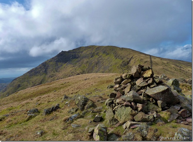
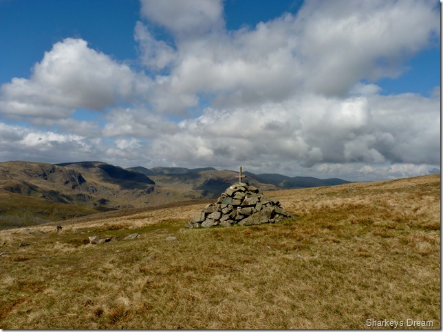
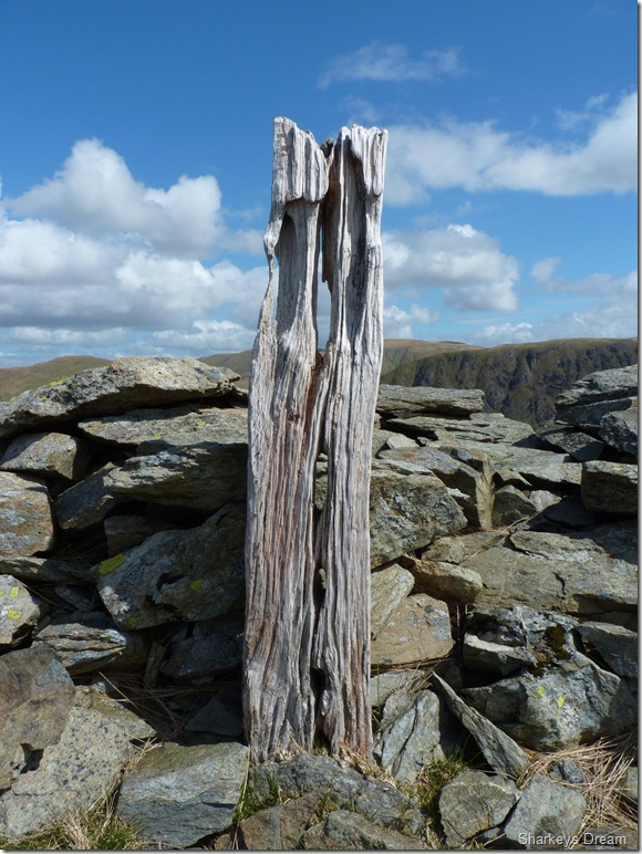
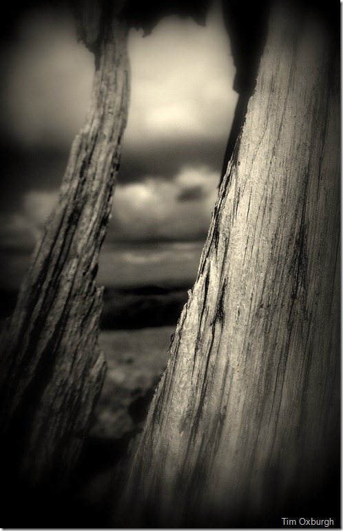
A cairn sits near by but this old wooded post marks the true summit of Hartsop Dodd.
Tim takes time to photograph this post & I’ll be eagerly awaiting the results as I know Tim has an eye for detail & his shots can really turn out surprising.
As I wait for Tim or look on in effect, I notice just how cold the wind is getting, not just cold but strong too, I blow in my hands to keep the finger tip’s from freezing, by now my back is against the wind that suddenly seemed to appear from no-where, despite the blue above our heads it is now bone chillingly cold, as a result of this we need to get off this exposed summit & try to take cover in the steep descent.
This does not work!! |
 |
| |
Surprised? |
 |
| |
Fighting the strong wind as I took this picture of Brock Crag, Angle Tarn Pikes & Place Fell. |
 |
| |
Ullswater, dividing the eastern, from the far eastern fells. |
 |
| |
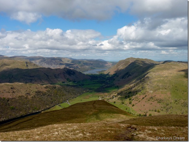
And from a little further down with Brothers Water now in the shot.
The descent down Hartsop Dodd can be tricky at times, its path is narrow & steep & I’ve always said that this path was made with only ascent in mind, (my own musings!) as all the foot holes tip into the fell side, thus giving anyone making a descent only the outer edge of the placed stone or in some cases mud hole, somewhat tricky to negotiate, couple this with a howling wind which by now had increased to nearly knocking the pair of us over.
I’ve never experienced wind gaining such strength in such a short period of time. |
 |
| |
Gray Crag from the cattle enclosures just outside of the tiny hamlet of Hartsop. |
 |
| |
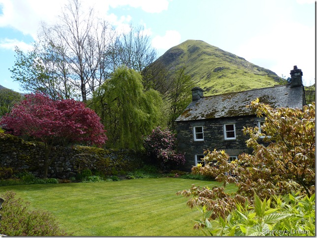
Hartsop Dodd from this beautifully presented Hartsop stone cottage. |
 |
| |
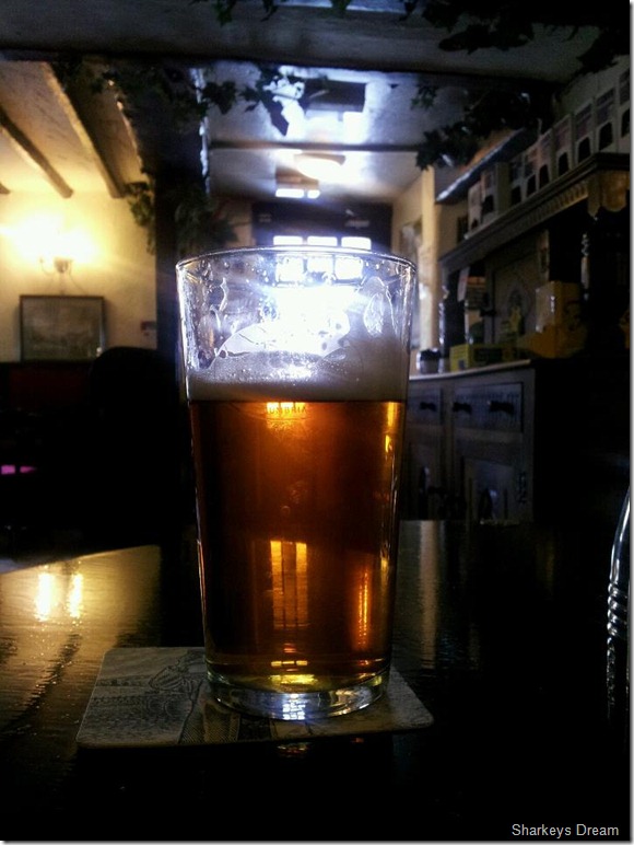
A pint of Old Faithfull at the Kirkstone Inn to celebrate a walk well undertaken.
Its getting a bit common Tim & I doing this celebrating lark! I can see future walks being planned around the nearest pub, as we both agree that we should sample the local brew from now on, well I’m not to sure if this will take place but the next time I’m on memory map I suppose it wouldn’t do me no harm to see where the local pub is. |
|
| |
| Back to top |
 |
|