|
The Borrowdale Fell’s |
 |
 |
5th August 2011 |
 |
|
This week has been mostly spent in Lakeland due to the fact me & the family has had a week off, a few plans had been pencilled in but due to the British summer some of these were shelved, so we opted for a drive to Buttermere in the lashing down rain & do a circuit of the lake & grab some lunch in Buttermere at the Fish Inn, it turned out the weather had cleared just enough to circle the lake with our jackets knotted around the waste.
Well, that was Tuesday & in-between 29th July & 5th August I’ve managed to notch a staggering 722 miles in the car driving to & fro from Lakeland, looking at those figures I’m almost lead to believe that I have had a driving holiday & nothing more… but it isn’t true, three trips I have had up to Lakeland can easily carry this kind of mileage.
My whole week as you can guess had been dominated by Lakeland, if I wasn’t there I was back here at the laptop planning my Scafell trip, this, a trip that has been yearning for the starters whistle for quite some time, If you can Imagine a sportsman/woman at there best, say Beckham on the penalty spot, three steps away from the ball & an eye for the top right corner, he’s just waiting for the ref to blow the whistle, that moment is where I am right now with this trip except I am not waiting for a whistle, I am waiting for the weather, it is extremely frustrating for me, for such a trip which for me will hopefully include Lord’s Rake, I need & want big blue skies & if I have to wait looking at that top corner then so be it.
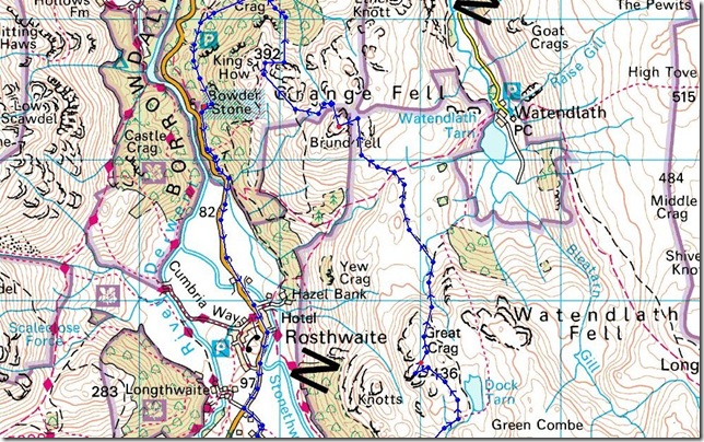
So with my plan for the Scafell trip put on hold, I take a look at the 27 fells I have left, and one thing that prompted me to be in Borrowdale today was the drive through it not four days previous, so as we drove through I said to the wife as we approached Rosthwaite ‘I haven’t done hardly any around here’ they were there for the taking, so in-between scanning the weather for my Scafell trip all week, this walk was my plan B, or at least part of it was, some of it I made up as I went along. |
|
| Wainwright Guidebook |
 |
| The Central Fells |
- The Central Fells:
Grange Fell is nothing on the map, everything when beneath one’s feet. In small compass, here is concentrated the beauty, romance, interest and excitement of the typical Lakeland scene. Here nature has given her very best and produced a loveliness that is exquisite. Not strictly the territory of fell walkers, perhaps, yet those who consistently hurry past Grange Fell to get there grips with the Scafells and Gable would do well to turn aside once in a while, alone, and quietly walk its sylvan glade & heathery top. The exercise will not tire the limbs, but it will do the heart and spirit and faith of the walker a power of good. |
 |
|
|
| |
|
Overview |
|
|
| Ascent: |
3,900 Feet, 1,188 Meters |
| Wainwrights: |
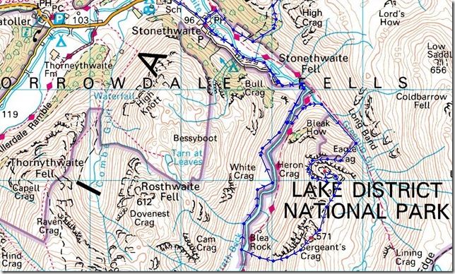
4, Great Crag, Grange Fell, Eagle Crag & Sergeant’s Crag |
| Weather: |
Over cast With Isolated Showers To Start. Turning Warm & Sunny For The Latter Of The Day, Muggy Throughout. Highs Of 22° Lows Of 16° |
| Parking: |
Roadside Parking, Stonethwaite, Next To Phone Box |
| Area: |
Central |
| Miles: |
12.12 |
| Walking With: |
On my own |
| Ordnance Survey: |
OL4 |
| Time Taken: |
|
| Route: |
|
|
| |
|
Map and Photo Gallery |
|
|
 |
| |
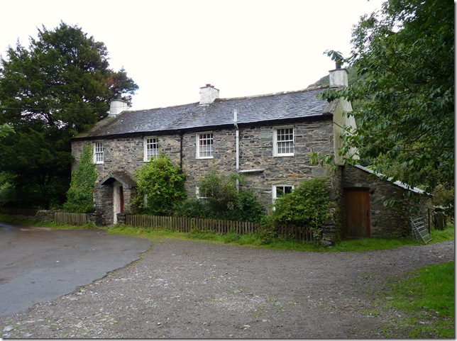
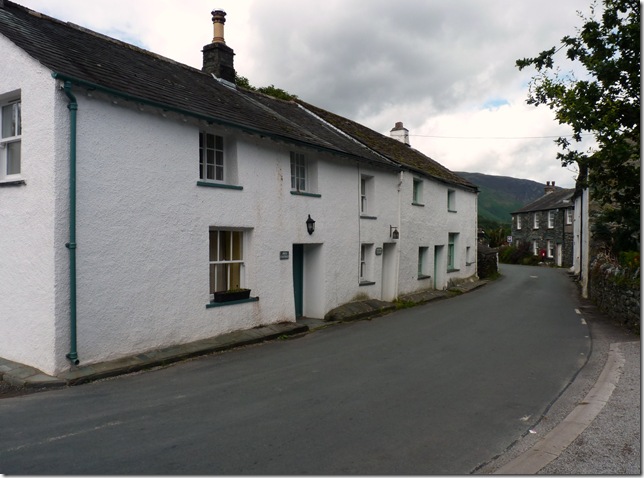
The cottages, Stonethwaite.
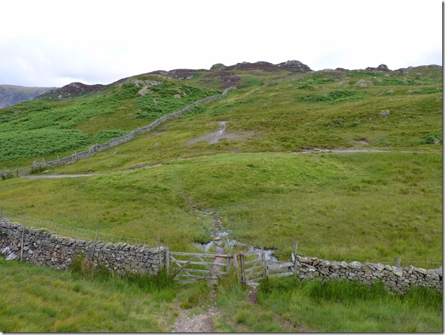
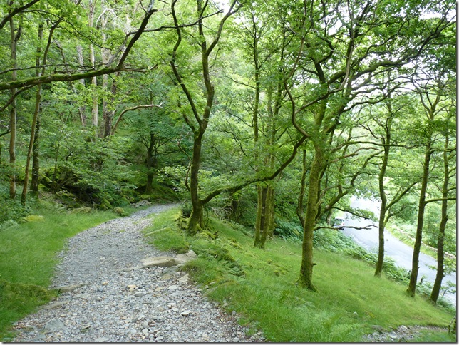
I reached Stonethwaite at around 08:30 after driving through some light rainfall on the way in. I kitted up to the croaks of a farmyard cockerel & made my way along the path seen here on the right. |
 |
| |
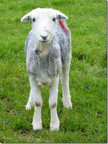
Look, ‘just because you’ve had an hair cut there’s no need to show off!’ |
 |
| |
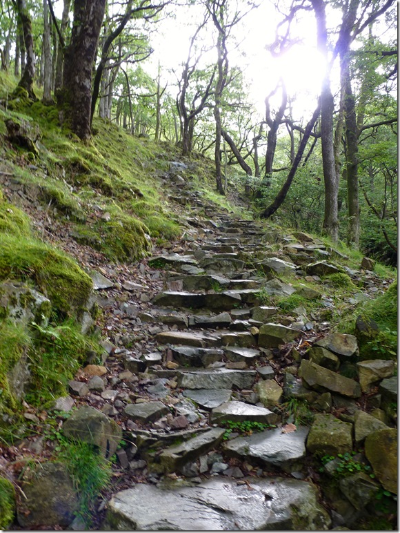
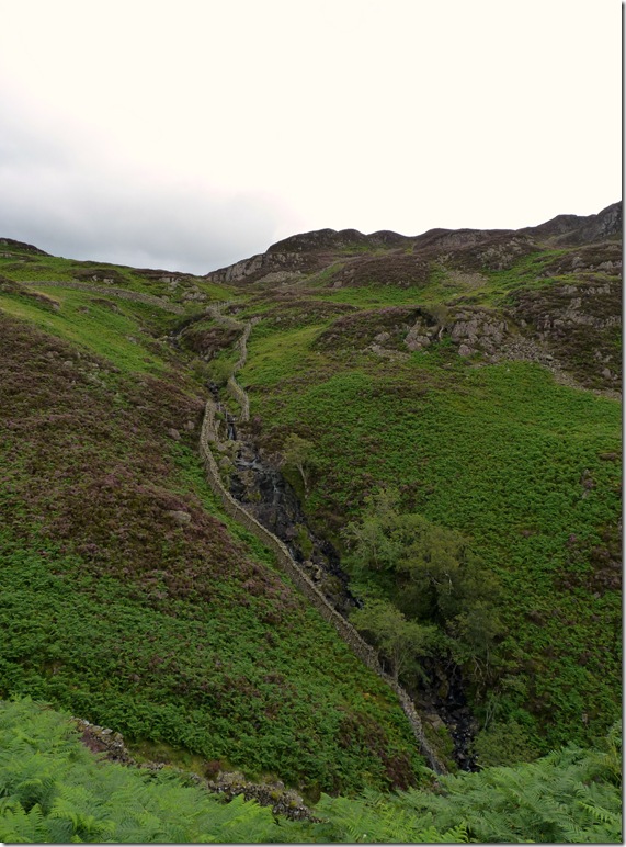
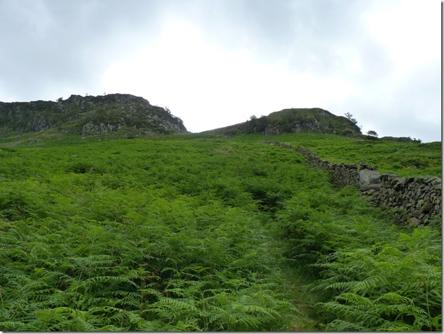
Picking up this stone path towards Lingy End, the path was of excellent pitch but does go on for a while, a sure way to get the leg muscles burning. |
 |
| |
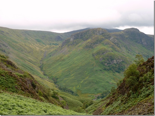
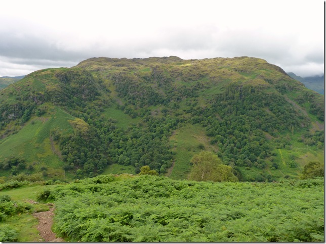
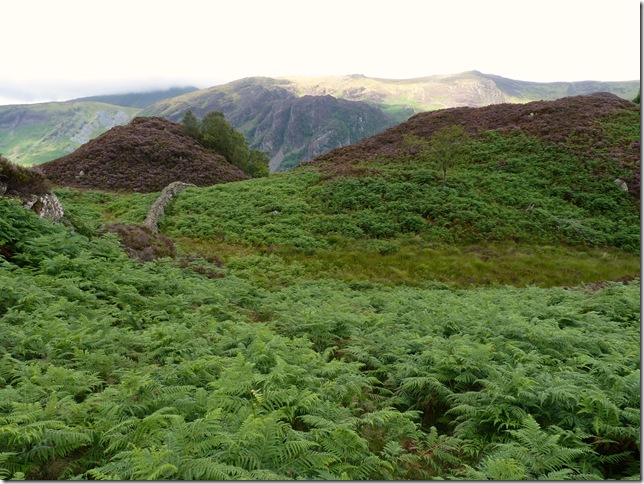
Looking back on Eagle Crag & Sergeant’s Crag from the top of Lingy End, notice the Drumlins at the top of the valley towards the left, these Drumlins were left behind as the ice from the last ice age retreated down the valley.
Being here & looking back at Eagle Crag got the brain matter pondering… |
 |
| |
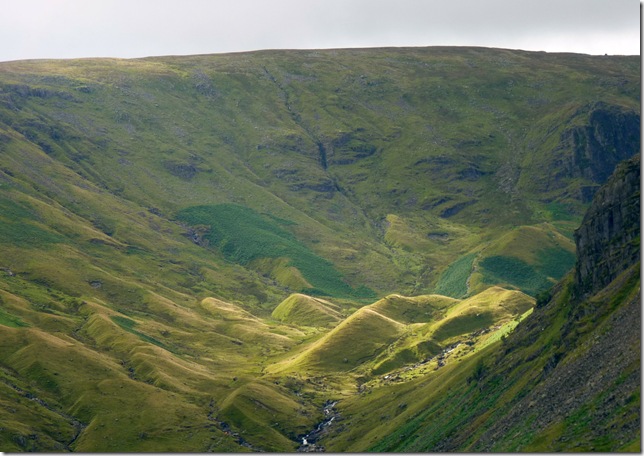
A close up of the drumlins & Lining Crag. |
 |
| |
Bessyboot (Rosthwaite Fell) from Lingy End. |
 |
| |
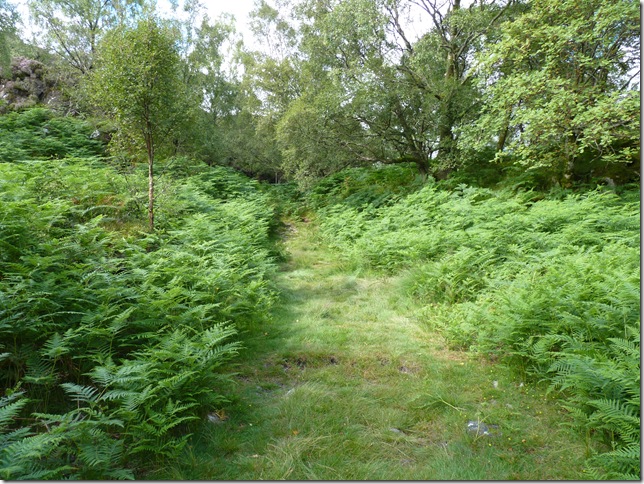
Willygrass Gill as I make my way for Dock Tarn. |
 |
| |
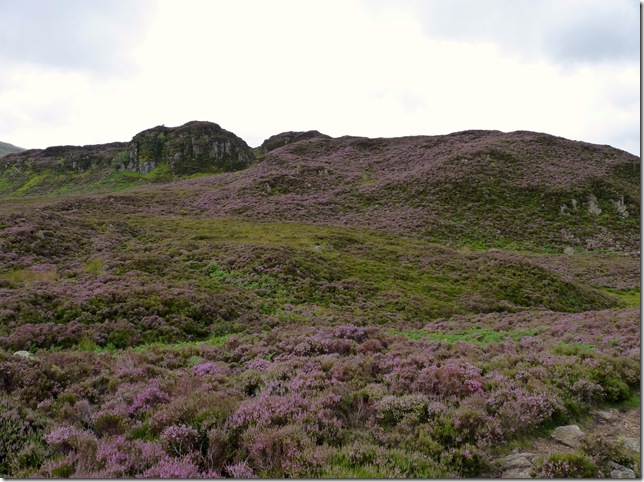
I am reminded of a quote from the Great Man himself as I gazed upon the heather. |
 |
| |
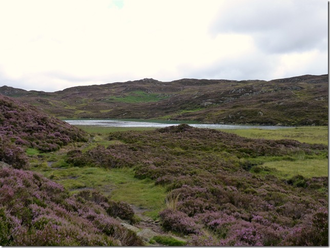
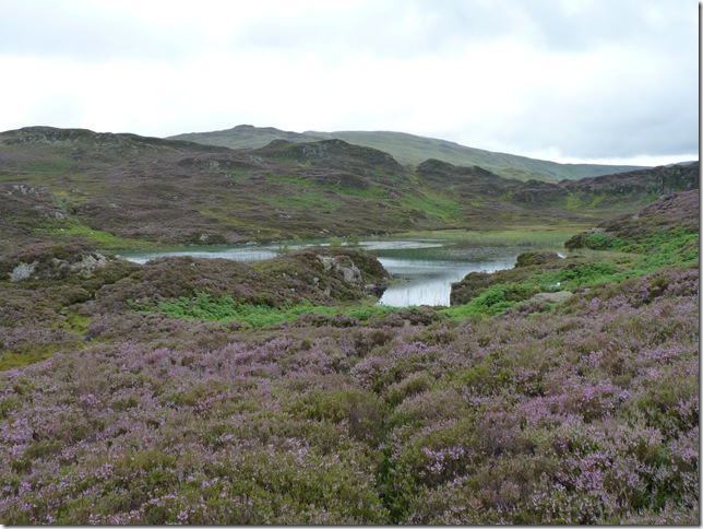
Dock Tarn.
This is a most beautiful short climb, best done on a sunny day in August, for the upper slopes are ablaze with heather. Dock Tarn is a place to lie dreaming, and life seems a sweet sweet thing. AW. |
 |
| |
Now leaving Dock Tarn for a short ascent on Great Crag. I do have another reason for being here today & putting something straight. Great Crag’s summit is a summit I had yet to grace, for back in February of this year I thought I had claimed this summit already, with the cloud down Dock Tarn was barely visible from my ascent on Great Crag, deep snow was underfoot & making this small ascent even more difficult, I summated what I thought was the summit of Great Crag with a shot of a small cairn in the mist, it was only later & whilst comparing summit cairns that I realised that I must of been on a set of crags due east of the main summit itself, so today I am here to rectify my mistake & claim the real summit of Great Crag. |
 |
| |
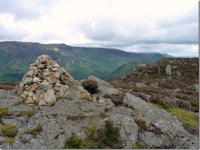
Great Crag summit cairn.
This makes Paul a happy boy. |
 |
| |
Leaving the summit of Great Crag you are treated to great views of Watendlath Tarn & the High Tove Ridge above. |
 |
| |
I’m making incredibly good time, with my next fell in mind (Grange Fell) seen to the upper left of the picture I now make my way over, content with myself that now; that one fell niggling the back of mind for all these months has finally been laid at rest. |
 |
| |
Not too far away from an ascent on Grange Fell, not before passing over this diagonal path linking Rosthwaite with Watendlath, from here it was just a case of following the wall.. |
 |
| |
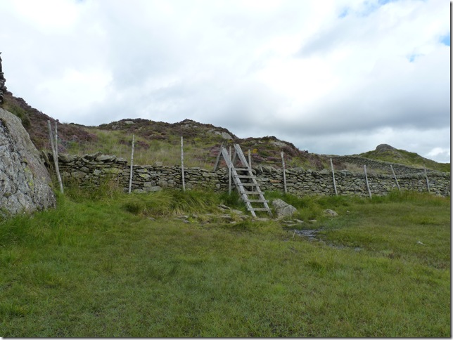
And this Sty to the summit. |
 |
| |
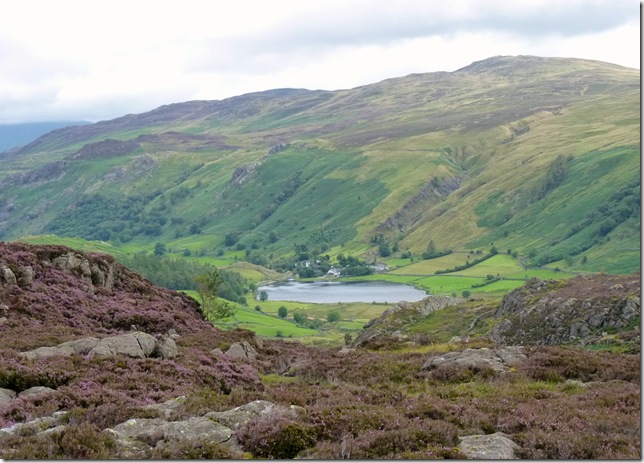
Grange Fell summit with Rosthwaite Fell (Bessyboot)& Thornythwaite Fell to the left, to the right of the summit is the Seathwaite Fells. |
 |
| |
And looking north towards Derwent Water & Skiddaw. |
 |
| |
After leaving the summit with a Lakeland spectacle at mind I blaze my own route down to a wall shown on the map, here I could pick my path up, not before making my way through Cummacatta Woods. |
 |
| |
Still following the wall at which I had to jump over just before I took this photo, there’s two ways I could of gone from here, I needed to be heading north or a fix on Derwent Water would of worked just as well, what I did here was head straight ahead & flank the small hill seen right, then pick up my northward bound path on the other side, the lay of the land here meant this was the easiest route. The fell to the left is Kings How, named as a memorial to King Edward VII due to its magnificent view points along the Borrowdale Valley, sadly I don’t do the fell any justice in my photo. |
 |
| |
Cummacatta Woods.
Are situated at the most northern point of Great End Crags Grange Fell, here the path (not on any map) makes its way down to the River Derwent & Borrowdale bound, the path empties its way through the woods becoming ever more narrow & overcome with wild chest high bracken, If & when I do return to these woods this path is one I certainly wouldn’t use again & doesn’t come recommended at all, yes it got me to my target for which you will see but the crags, boulders, dead wood & loose scree I had to negotiate made this short cut really test ones patience, I did get there in the end though… |
 |
| |
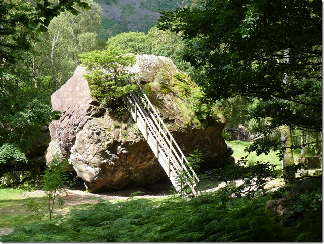
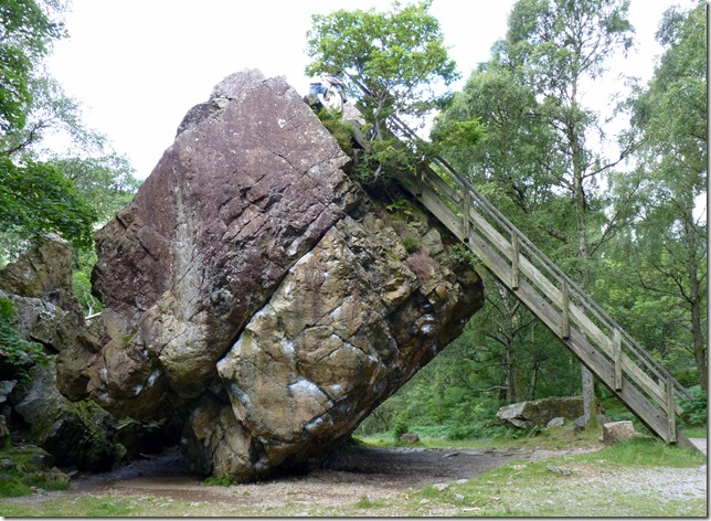
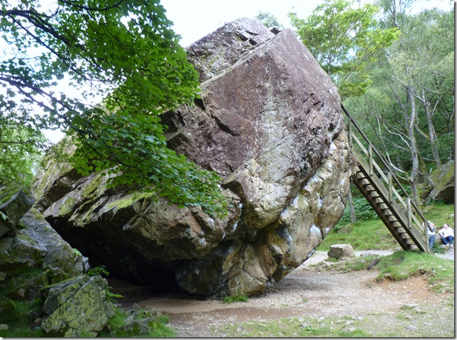
The Bowder Stone, Borrowdale.
Weighing an incredible 2,000 tons & standing 30 feet in height & 90 feet in width this is Lakelands biggest boulder.
Contrary to believe the Bowder Stone was not left from the Ice Age nor carried here form Scotland along an Ice sheet, it is in actual fact the result of rock fall which is all fair & well but how the hell did a 2,000 ton Boulder come to a stop like this? |
 |
| |
The rocks you see to the back of the Bowder Stone are separate & in no way holding its huge bulk up..its doing that all by itself. |
 |
| |
Absolutely fascinating, there are some times in history when I would love to witness an historical moment in time & this is one of them.. seeing this colossal boulder come to a stop. |
 |
| |
Contemplating my next move as I head along the path to Rosthwaite. |
 |
| |
Rosthwaite.
While making my way to Rosthwaite I had time to ponder on the idea that the day was still young & despite me looking like I’ve just scaled Everest (sweat & dust gel nicely together) for the third time this morning that it was not time to head home, I was in Borrowdale, I was a little tired but I was not beaten. |
 |
| |
After some lunch at the car back in Stonethwaite I now find myself at the bottom of the Langstrath Valley & the lower slopes of Eagle Crag, In all essence it was a tough call, I mean its now just past mid-day & the heat & humidity is at its highest & I have about two & a half litres of hydration left, this, & did I have the stamina for another steep climb after the 2.6 mile walk from the Bowder Stone was playing heavily on my mind, my legs felt good & strong but would they half way up Eagle Crag? Its a steep one & right now looking up I cant for the life of me see a way up through the bracken, from here I can pick up a stone wall that runs up the entire nose of the fell & through the crags around the top but this would mean a slog up in chest high bracken, now I know the summit has been obtained by this stone wall as I have seen this route on maps but today I want to avoid the bracken as best I can which means flanking the fell & finding an alternative route up. |
 |
| |
It didn’t take long to find a path along the eastern flanks of the fell, obtained here by you’ve guessed it? A bracken path – I guess there’s no getting away from it & here its not as bad as first thought, the path is a steady climb in humidity to mach the Gobi Desert & opens upto great views along Green Up Edge & the Borrowdale Valley below. |
 |
| |
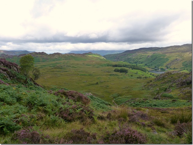
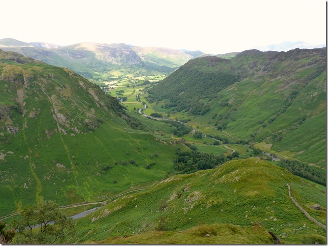
Borrowdale with Rosthwaite Fell on the left views towards where I was this morning with Great Crag to the right, the ridge in the distance is that of the Cat Bells, Maiden Moor & High Spy ridge. |
 |
| |
The mass of Rosthwaite Fell (Bessyboot) (R) forming the Glaramara ridge, at the head of the Langstrath Valley is Bow Fell & Esk Pike. |
 |
| |
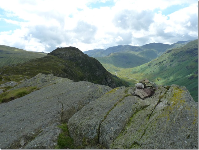
Sergeant’s Crag from the summit of Eagle Crag. |
 |
| |
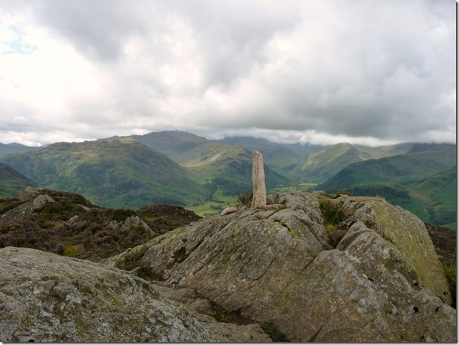
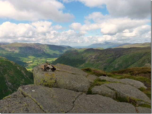
Eagle Crag summit cairn with views over Borrowdale & Great Crag. |
 |
| |
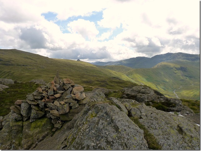
Sergeant’s Crag summit with High Raise & Pike’O Stickle to the left, over to the right we have Crinkle Crags & Bow Fell, the continuing ridge in the lower part of the picture is Rossett Pike. |
 |
| |
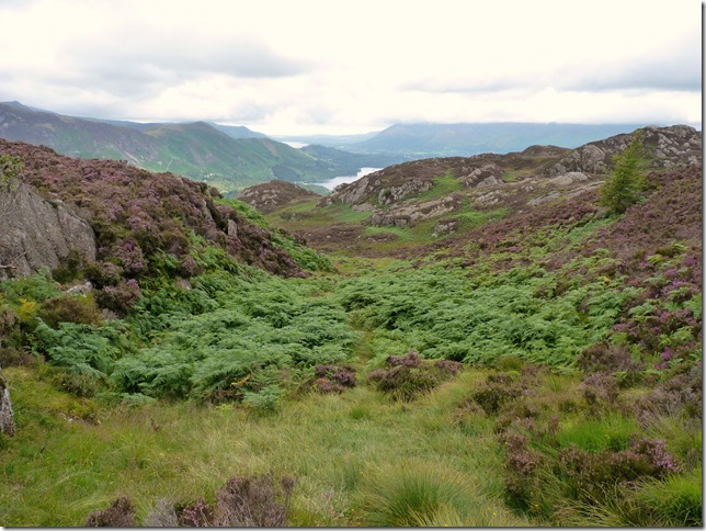
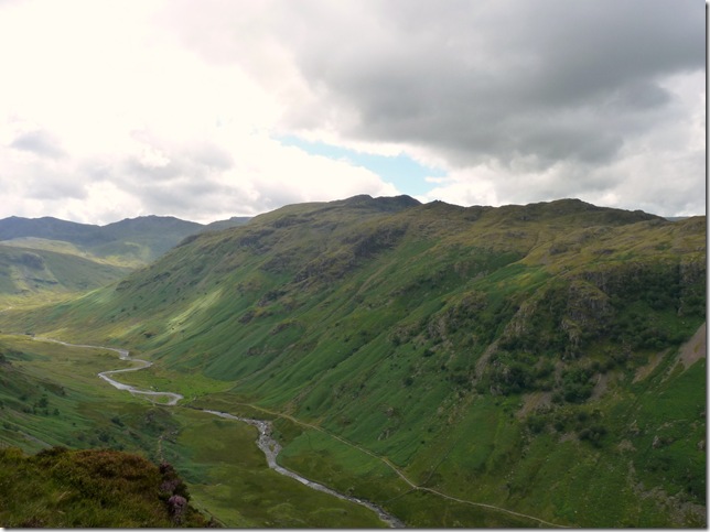
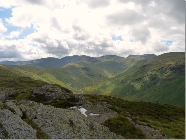
The head of the Langstrath Valley with a Langdale & Eskdale skyline. |
 |
| |
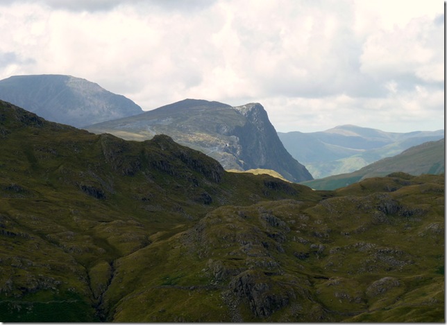
A close up of Fleetwith Pike from the summit of Sergeant’s Crag. |
 |
| |
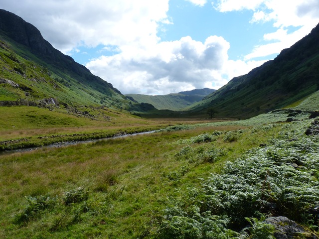
Looking up the Langstrath Valley from Langstrath Beck.
It was good to be back on the valley floor again, the latter of the afternoon would of been fit for any fell within the district & that includes my Scafell plans, this didn’t mean I hadn’t had a ball in Borrowdale & the beautiful first time visit of the Langstrath Valley. My descent from Sergeants Crag was a steep affair & the now aching limbs were ready for a good soak in the bath, I contemplated this in Langstrath Beck a little further up the valley but I opted for a good rinse instead of the face & hair & a few handfuls of freezing cold Langstrath beck water to keep me going after my hydration had turned more than luke warm, the power of the beck held me in good stead for the mile & a half walk back into Stonethwaite.
Lake District Mountain Landforms by Peter Wilson. |
 |
| |
Lake District Mountain Landforms is a book that is packed cover to cover with not just geographical fact but also why such a place looks the way it does, to tremors & land slip or even ‘where does all the water go?’ why & what this book has all the answers you will ever need about Lakeland & dealt with in such a manner that the everyday reader understands. The author Peter Wilson is of local origin (Nelson Lancashire) This book covers the whole of the Lake District all the way back to the Ice Age & picks up where the Ice left & leaves a fascinating encounters of this countries oldest Mountain Landscape.
A must buy for any Lakeland Lover. |
|
| |
| Back to top |
 |
|