|
The Loweswater Fells |
 |
 |
13th March 2011 |
 |
|
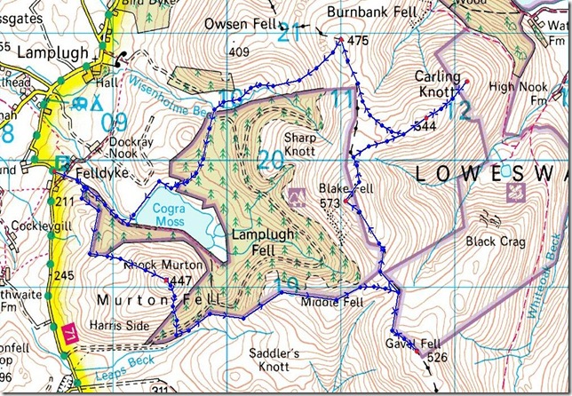
I though it was about time I spent some time walking in an area of Lakeland I don’t often traverse & that is the Western Fells, out of Wainwrights Pictorial Guides ‘The Western Fells’ I have yet to complete 9 out of 33 & that 9 are unavoidably in this far Western corner of Lakeland. The extra travel times are unavoidable, 2/3 hour slogs up the M6 beckons until I can claim this particular area as complete.
I didn’t get the best nights sleep for one reason or another & when I finally nodded off it was time to get up at around 05:45, drizzle & low cloud is what I was met with all the way up the M6 & partially the A66 until I reached Bassenthwaite Lake, here I could see chinks of blue developing all over Lakeland, this lifted my spirits, the 3 hour slog yawning every lamp post was forgotten about & by the time I got to Lamplugh a Hamlet I have only driven through twice on route to Ennerdale, I was bouncing & more than ready to go.
For those of you that follow my blog you may be aware that I have had the deadliest strain of man flu alive, & have so for the past 8 days, I actually thought I could shake this deadly strain off like you would a broken leg! & see fit I reached those fells but unfortunately for me I seem to have adopted this deadly virus & it is with me for the foreseeable!
The virus, the wheezing, the coughing, the drip on the end of my nose constantly, the watery eyes- could not spoil this little route around the Loweswater Fells. |
|
Wainwright Guidebook |
 |
| The Western Fells |
Blake Fell (locally known simply as Blake) is the highest of the Loweswater uplands, overtopping the others considerably and asserting this superiority by a distinctive final upthrust that makes it prominent in views of the group. A long high shoulder Carling Knott extends towards Loweswater, hiding the main summit from the valley, but on the opposite western flank, facing industrial cumberland, a scree-covered decisively drops immediately from the summit-cairn to the hollow of Cogra Moss and encircling arms comprise many subsidiary tops of which the chief is the shapely peak of Knock Murton. |
 |
|
| |
|
Overview |
|
|
| Ascent: |
2,626 Feet, 804 Meters |
| Wainwrights: |
3, Gavel Fell, Blake Fell, & Burnbank Fell |
| Weather: |
Dry & Overcast For Much Of The Day, Some Sunny Intervals, Gust On Topps, Highs Of 7° Lows Of 3° |
| Parking: |
Felldyke Car Park, Lamplugh |
| Area: |
Western |
| Miles: |
7.4 |
| Walking With: |
On my own |
| Ordnance Survey: |
OL4 |
| Time Taken: |
|
| Route: |
|
|
| |
|
Map and Photo Gallery |
|
|
 |
| |
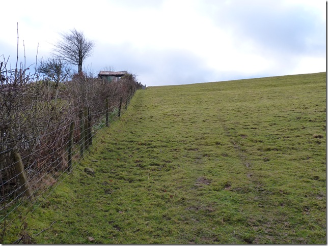
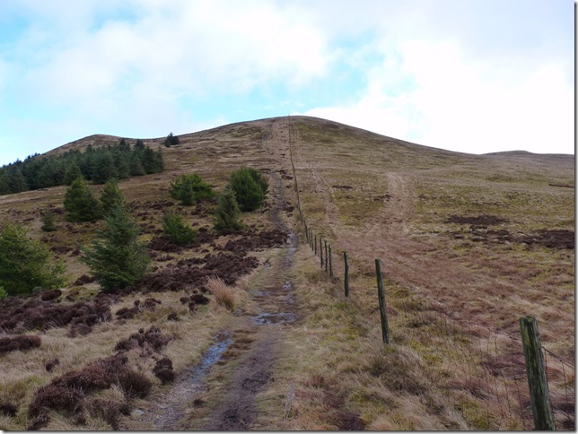
From the Felldyke car park you are given a choice, head left & take the nice gravel path towards Cogra Reservoir, or turn right as I did & up this steep grassy incline & towards an old tree felled plantation. |
 |
| |
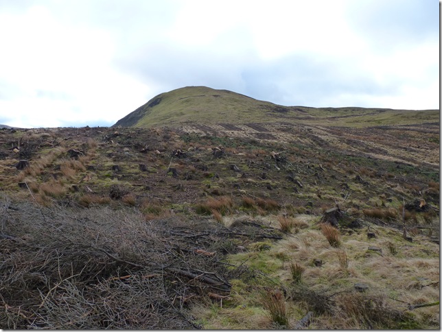
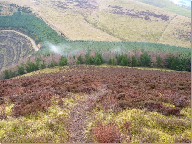
Knock Murton ahead, my path takes me around to the right avoiding this sad sight of fenced off felled pines. |
 |
| |
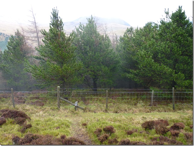
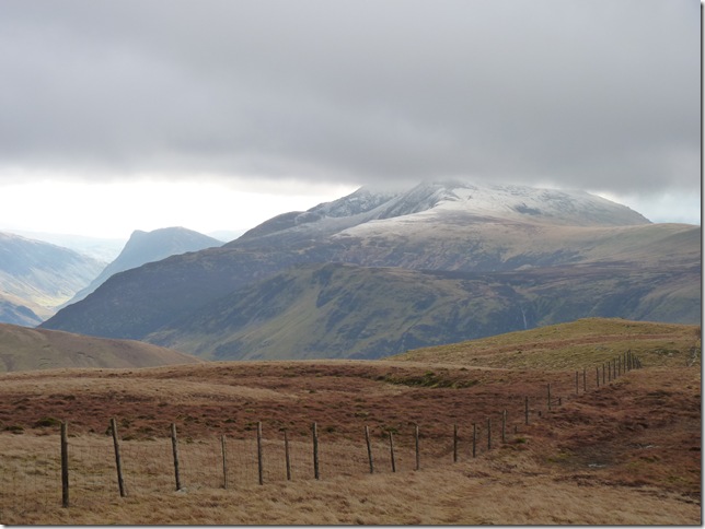
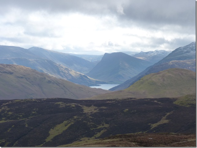
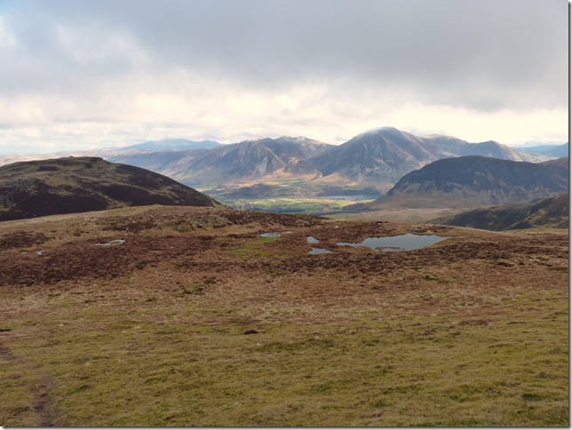
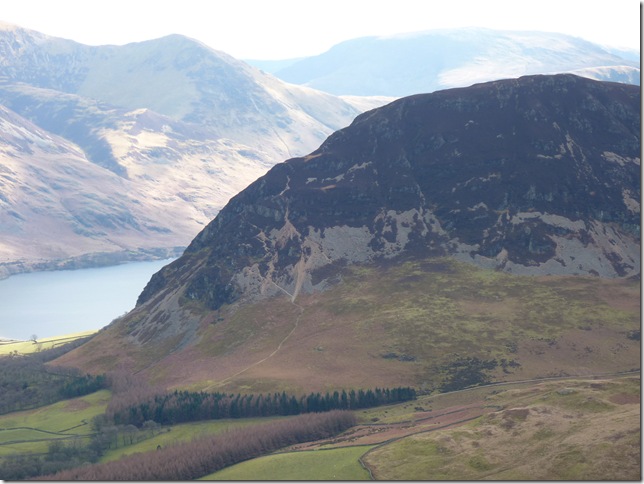
It really isn’t too long until the views open up over towards Ennerdale Water from my ascent, this side of Ennerdale Water we have Bowness Knott & Great Borne forming the High Stile Ridge, on the opposite side of the shoreline is Crag Fell & Grike just under cloud. |
 |
| |
After a steep ascent I gain the summit of Knock Murton which in actual fact is a Birkett & not a Wainwright, seen here with Blake Fell in the background, next stop Gavel Fell. |
 |
| |
Gavel Fell seen far centre, but first I have to descend an extremely steep path south of Knock Murton’s summit. |
 |
| |
It really is as steep as it looks, I follow the path all the way down to the Pines & hopefully pick up a path through the plantation. |
 |
| |
Beautiful views opening up over the Ennerdale Valley. |
 |
| |
Over the sty Paul. |
 |
| |
The steep ascent didn’t stop as I walked or as I would put it slipped & skidded all my way down the path, the wet pine needles were just horrible to try & control any grip underfoot.
Nearing the exit out of the woods the formidable happened & I slipped helplessly skidding over on to my right on a wet tree root, I must of looked like a Yeti coming out of that forest, clean down one side & caked in mud top to toe the other, nothing went amiss even the camera bag took a mud bath! |
 |
| |
It was just a case of following the fence all the way to Gavel Fell seen here as a small outcrop on the right. |
 |
| |
Looking back at the steep wooded area I had just passed through, Knock Murton & Cogra Moss. |
 |
| |
The path veered right still following the fence line but here I jump over the fence & detour right again, I can just pick up the faint path that will lead me Gavel Fell bound. |
 |
| |
Gavel Fell summit cairn with Knock Murton in the background. |
 |
| |
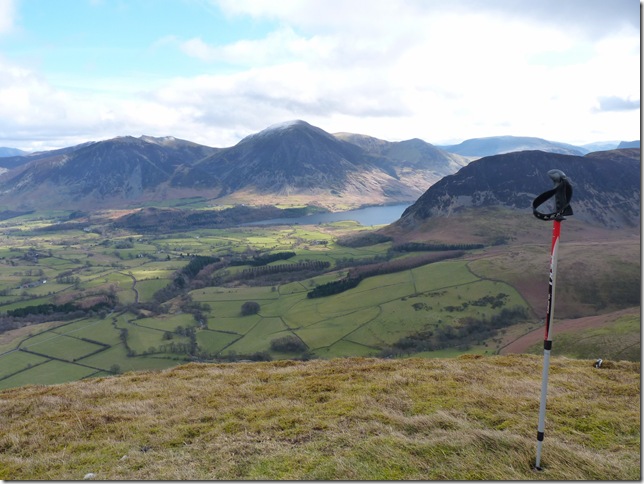
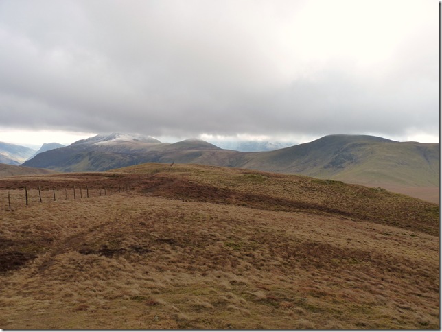
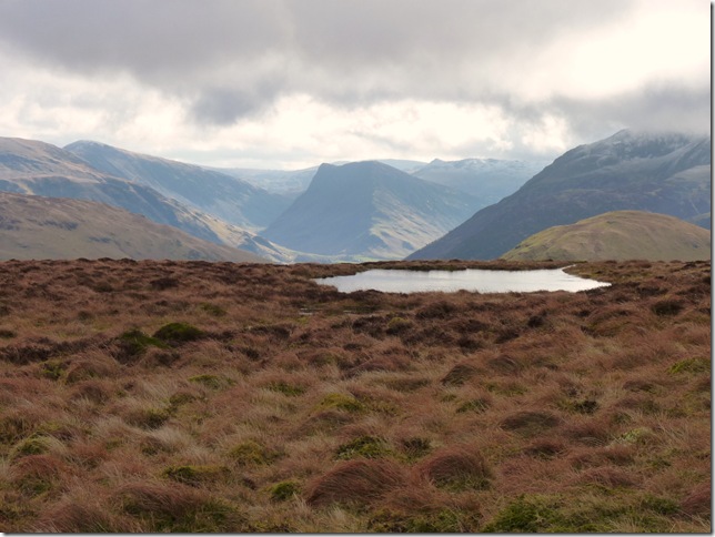
Red Pike & Dodd under cloud, to the left is a distant Fleetwith Pike from Gavel Fell summit. |
 |
| |
From the same spot & not so close up we have part of the High Still Ridge incorporating, Red Pike, Starling Dodd & Great Borne, to the very far left is Fleetwith Pike. |
 |
| |
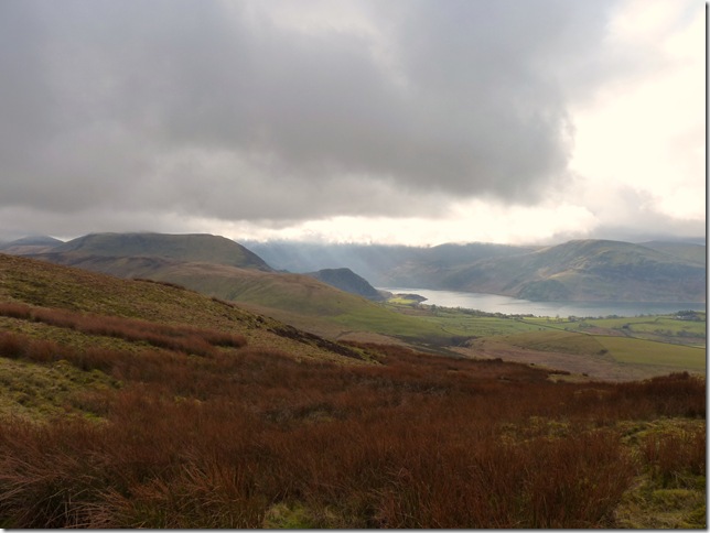
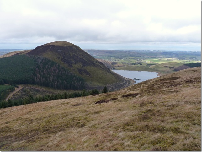
Looking over Mellbreak towards Grasmore & Whiteless Pike from my descent off Gravel Fell. |
 |
| |
The skies are starting to clear just nicely, views towards my next fell to the left Blake Fell & maybe a trip to Carling Knott, right. |
 |
| |
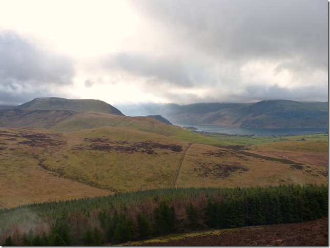
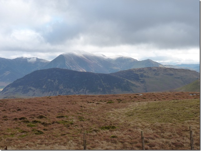
A whole host of western fells, L to R, Mellbreak, Robinson, Hindscarth & Dale Head, Centre is Fleetwith Pike with Grey Knotts behind, Red Pike to the right & closer in the picture is Buttermere & Hen Combe. |
 |
| |
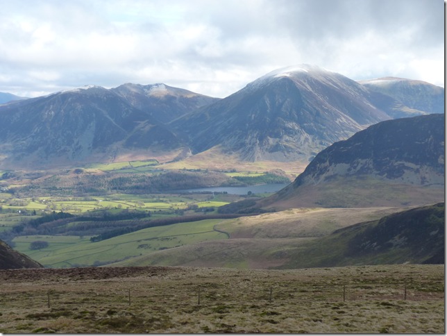
L to R is Whiteside, Hopegill Head, Grasmore, Wandope & Mellbreak, notice how steep Mellbreak looks from the Loweswater end. |
 |
| |
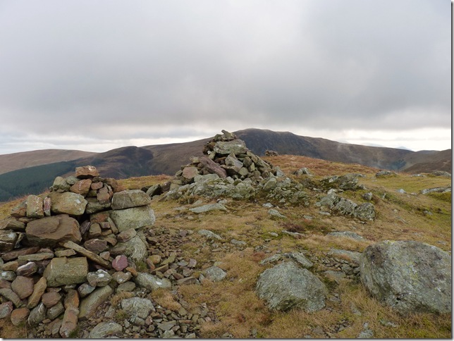
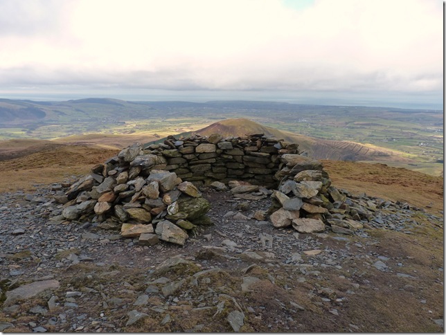
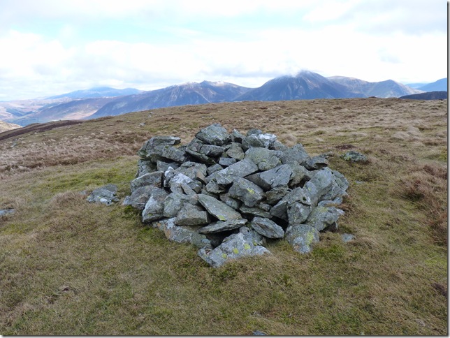
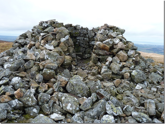
Blake Fell summit shelter with Knock Murton looking considerably smaller by now, I yearned for a cup of coffee & maybe a respite from the wind but I decided to press on until I got to my next fell top, Carling Knott. |
 |
| |
Knock Murton & Cogra Moss from Blake Fell summit. |
 |
| |
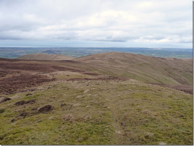
Making my way to Carling Knott seen left, the views from not as such a popular fell with the tourist as I are simply amazing. |
 |
| |
Fleetwith Pike domineering the skyline as I leave Blake Fell summit. |
 |
| |
Carling Knott summit cairn, again this fell is indeed a Birkett, it has two summit cairns, one the Blake Fell end & another the Loweswater end, I think I’ll have a walk over. |
 |
| |
The second summit cairn found ‘Loweswater End’ it was only a fifteen minute detour & the views are more than worth it. |
 |
| |
A close up of Mellbreak’s steep approach paths from the Loweswater end. |
 |
| |
Back at the main summit shelter now, this shelter has my name written all over it, Paul needs coffee |
 |
| |
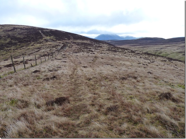
After a short break out of the wind in the shelter & a much needed coffee I am now Burnbank Fell bound, seen here centre, considering the amount of rain & snow the fells have seen It really was a pleasant walk to Burnbank. |
 |
| |
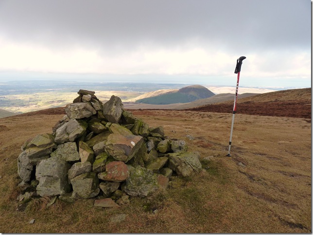
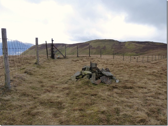
Burnbank summit cairn with Carling Knott in the back ground. |
 |
| |
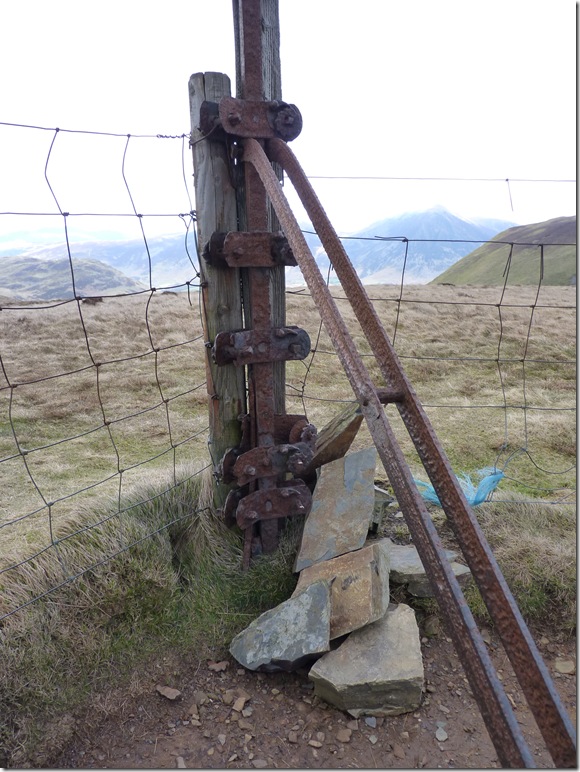
I’m no expert in fencing of old, yet these fence post wrenches are dotted all over Lakeland, I would imagine the fence wire would be fed through each individual pulley (a good one not yet rusted away top right) a taught tight with some kind of lever? that’s my guess anyway. |
 |
| |
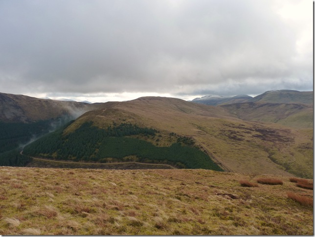
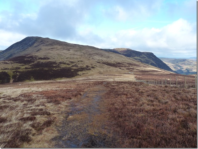
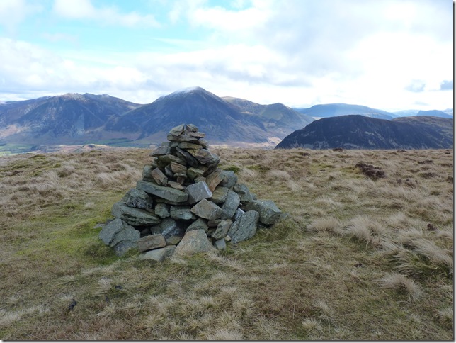
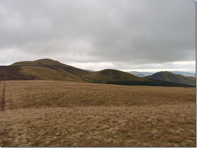
From Burnbank Fell summit you get this great view of Blake Fell, Sharp Knott & Knock Murton. |
 |
| |
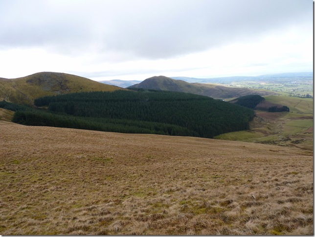
My route down back to Cogra Moss. I’m heading for the gap in between the forest on the left & the small wooded area on the right, its a gentle descent to start with but as I head over the crest the descent gets a whole lot steeper. |
 |
| |
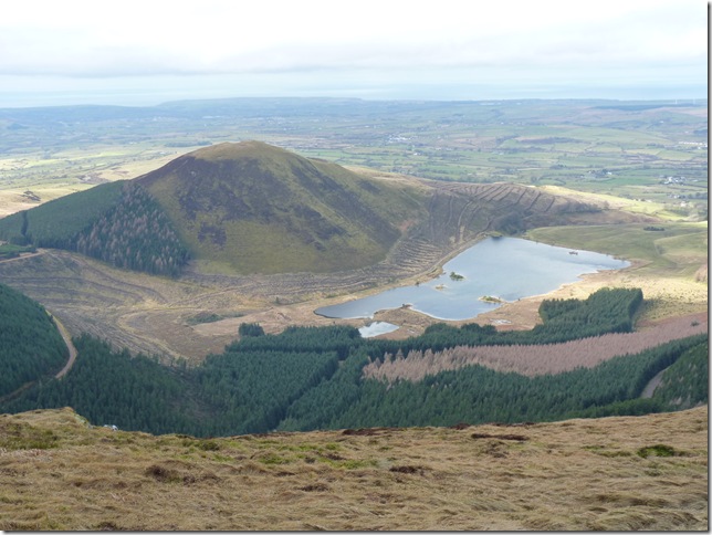
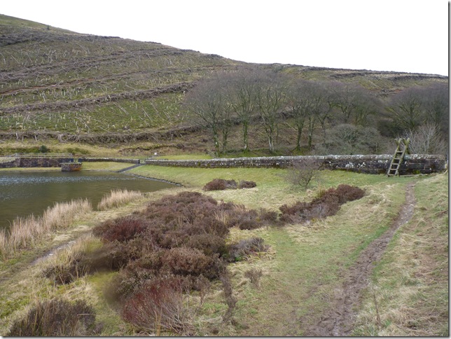
Cogra Moss Dam, the dam was in actual fact a reservoir constructed around 1880, but come the twentieth century in 1975 this Dam was built.
In years gone by this place probably didn’t look as sorry as it does today, the reservoir surrounded by pine trees must have looked beautiful. |
 |
| |
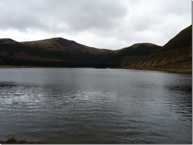
Blake Fell from Cogra Moss Dam.
It was just a short walk back into Lamplugh from here, in all just less than a mile, considering how my chest is right now I figured I’d made good time in just over four hours the whole trip.
Wainwright described these fells as belonging to Lamplugh & not Lakeland. I can see what he meant, they do seem a world away from the towns of Keswick or Bowness, the much trampled tops of Cat Bells or even Scafell Pike, I felt the loneliness as I traversed Great Borne’s ridge weeks ago & I felt it today. These fells for me are the Far edge of Lakelands solar system, you will taste salt being blown in from the coast not 7 miles away.
These fells are the frontier of Lakeland. |
|
| |
| Back to top |
 |
|