|
The NW Fells from Lanthwaite Green |
 |
 |
20th January 2011 |
 |
|
I was well overdue a good walk peak bagging, something I could get my boots into, somewhere I haven’t been for a while & this precise walk was just that, the fells around Grasmoor are pretty virgin to me on account of the last time I & Tim was here we couldn’t see the fingers in front of our faces due to low visibility & only ended up summating Grasmoor & finishing off in the pub, I half expected a little more snow on the ground on the drive up even though I know Lakeland had had its fare share of rain this week I couldn’t help wondering had it melted the hard stuff, so as a precaution measure I packed the crampons just in case…well they stopped in the boot when I saw the glorious blue skies, crisp thin air & not a breath of wind, there’s winter walking I like when I’m battling against horizontal hail & white outs & then there’s other winter walking I like.. |
|
Wainwright Guidebook |
 |
| The North Western Fells |
There is no mountain not worth climbing, and any summit above the magic figure of 2,500 feet might be expected to attract fell walkers and peak baggers in large numbers. To some extent Wandope does this. |
 |
|
| |
|
Overview |
|
|
| Ascent: |
1,814 Meters, 5,951 Feet |
| Wainwrights: |
5, White Side, Hopegill Head, Wandope, Whiteless Pike & Rannerdale Knotts |
| Weather: |
Warm & Sunny Throughout The Whole Day, No Wind, Highs Of 3 ° Lows Of -4 ° |
| Parking: |
Car Park, Lanthwaite Green |
| Area: |
North Western |
| Miles: |
8.9 |
| Walking With: |
On my own |
| Ordnance Survey: |
OL4 |
| Time Taken: |
|
| Route: |
|
|
| |
|
Map and Photo Gallery |
|
|
 |
| |
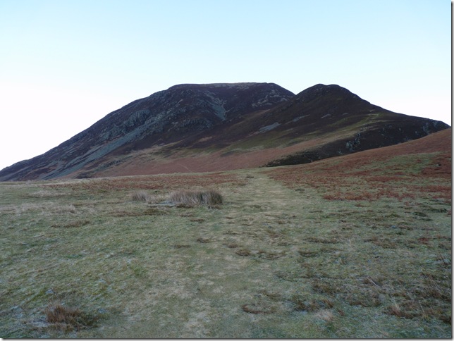
Whin Ben & Whiteside from Lanthwaite Green. |
 |
| |
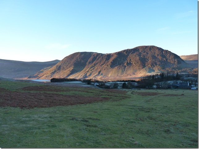
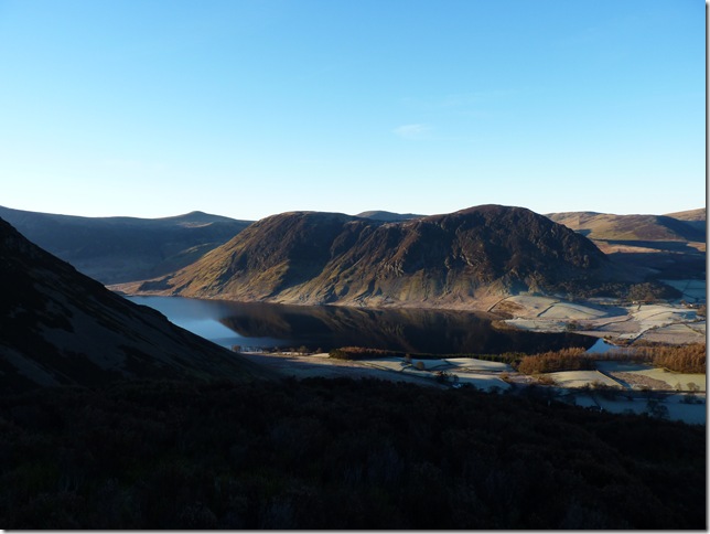
Early morning sun on Mellbreak. |
 |
| |
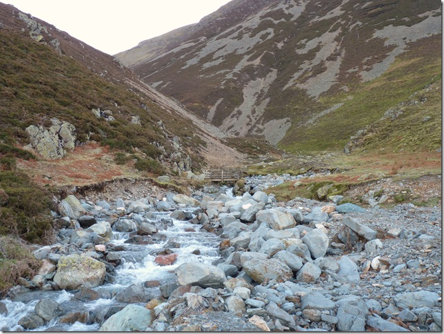
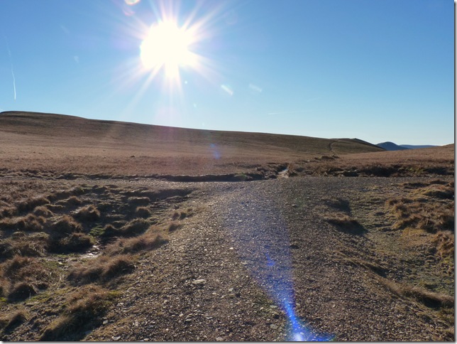
Using the wooded bridge to cross Liza beck, right about now I’m getting a cold gust of air coming down between the two valleys. |
 |
| |
Its so difficult not to keep turning round, Mellbreak again. |
 |
| |
After reaching the summit of Whin Ben you get this wonderful view of the ridge ahead, here we have to the left, Gasgale Crags with Hopegill Head & Sandhill taking centre, to lower right is Gasgail Gill leading to the head of the valley & Coledale Hause. |
 |
| |
Whiteside summit cairn with my ridge route ahead, the prominent peak centre is my next destination Hopegill Head, to the left of Hopegill Head is Grisedale Pike & to the right Sandhill leading down to Coledale Hause, its time to put the hard graft behind me for a while & enjoy the ridge walk. |
 |
| |
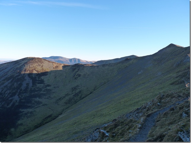
From the ridge I get to see my third peak of the day, Ladyside Pike (L) ahead is Hopegill Head & what looks like a pretty steepish descent down to Ladyside Pike, but first I have to traverse this mini… |
 |
| |
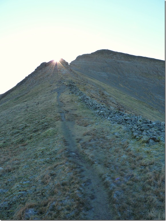
Striding Edge or Sharp Edge take your pick, its not as bad as it looks, the path flanks this 300Mtr arête of rock safely around the bottom of the crags mirroring Striding Edge in actual fact! |
 |
| |
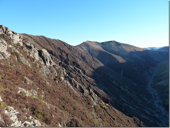
Looking back along the ridge towards Whiteside. |
 |
| |
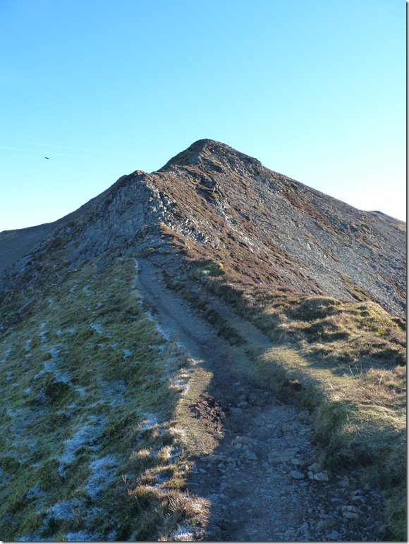
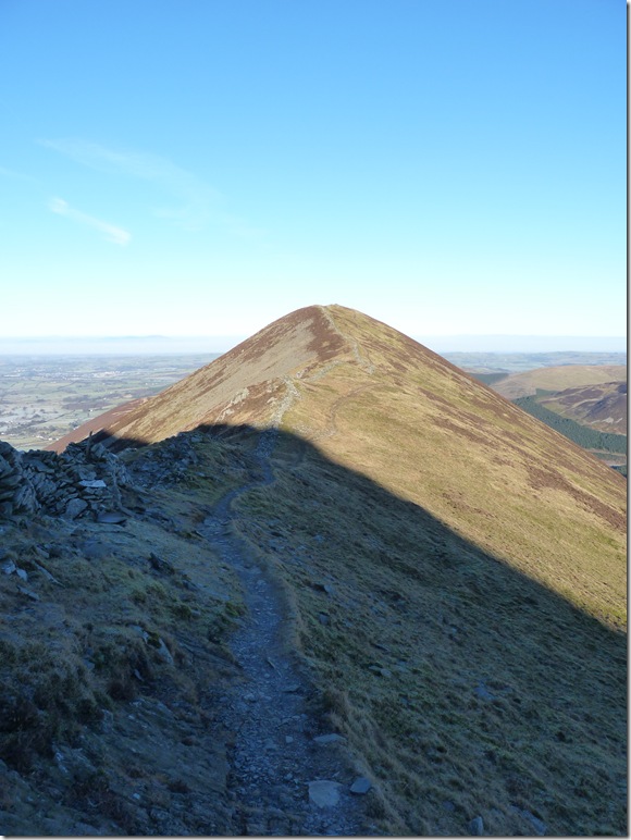
A closer view of Ladyside Pike before I crest the summit of Hopegill Head. |
 |
| |
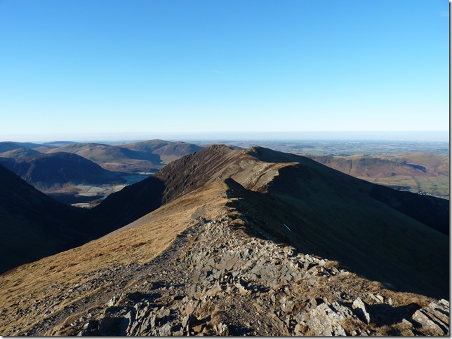
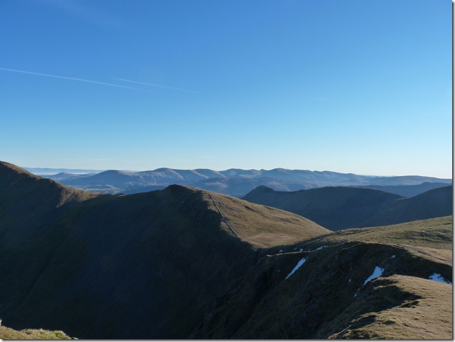
Hobcarton Crag, Causey Pike, The Dodds & the Helvellyn Range from Hopegill Head summit, next its a steep descent down to Ladyside Pike. |
 |
| |
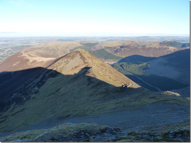
On the approach to Ladyside Pike, this is a fell I missed back last summer when I was last up here due to the fact I started the walk at two in the afternoon,. after that descent from Hopegill Head I don’t think I missed much! |
 |
| |
Ladypike summit cairn,. is anybody missing the numbers 64 from your front door ha! |
 |
| |
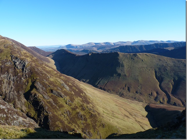
Looking down onto Lords Seat, Broom Fell & Whinlatter. |
 |
| |
Making my way back up towards Hopegill Head & an ascent on the short but steep path, I can just make out a figure back on the summit, the same person watched me climb all the way back up & within feet of being back on the summit he walked away, not sure if he was just watching or making sure I got up ok but I thought a conversation might be in hand as he was the first person I’d seen all day. |
 |
| |
Coledale Hause drenched in sunshine. |
 |
| |
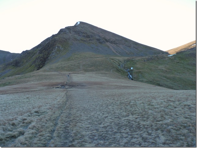
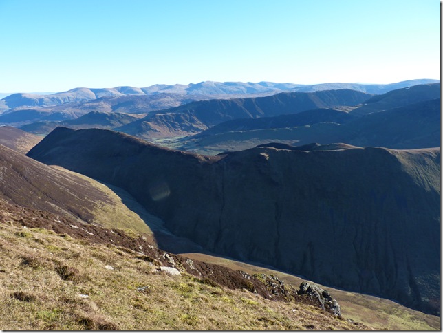
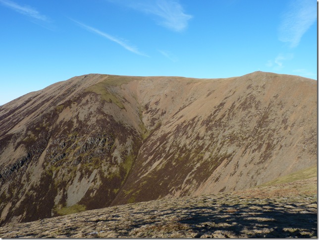
Crag Hill from Coledale Hause, my route takes me (R) in between (Eal Crag) Crag Hill & Grasmoor, its nice to be in the shade for a while.. |
 |
| |
Scar Crags & Causey Pike from Coledale Hause. |
 |
| |
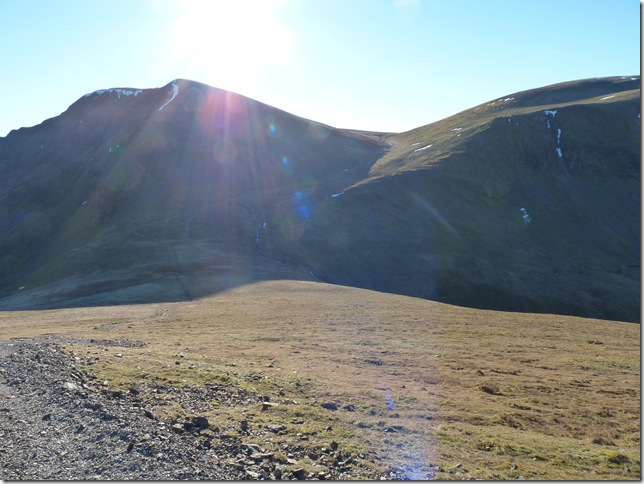
The crossroads found at the very top of the Hause, right here is just a short but steep walk to Grasmoor’s summit, ahead will lead you on to Third Gill Head Man & Whiteless Pike & a short detour up to Wandope which is my route, left is the main route up towards Crag Hill. |
 |
| |
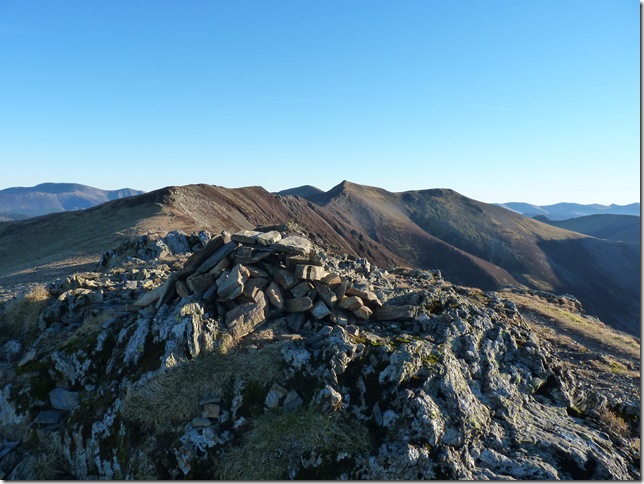
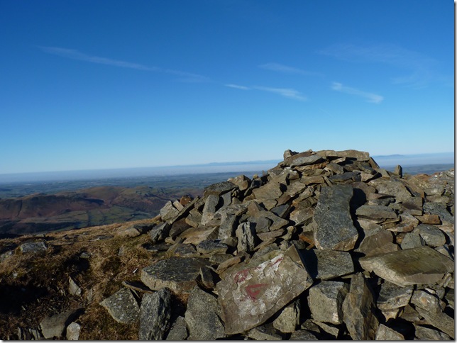
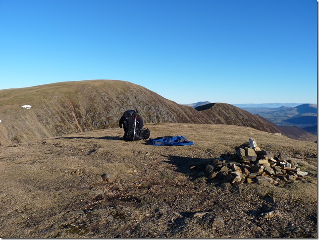
| Wandope summit cairn with Crag Hill & Scar Crags in the background, also its time to layer down, here I take my fleece & jacket off & do the rest of the walk in just my mid layer, it really does feel like a summers day |
 |
| |
Ard Crags & a whole host of Eastern Fells. |
 |
| |
Blazing my way towards Third Gill Head Man. |
 |
| |
Grasmoor from Third Gill Head Man. |
 |
| |
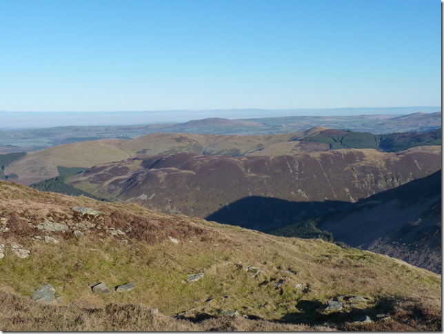
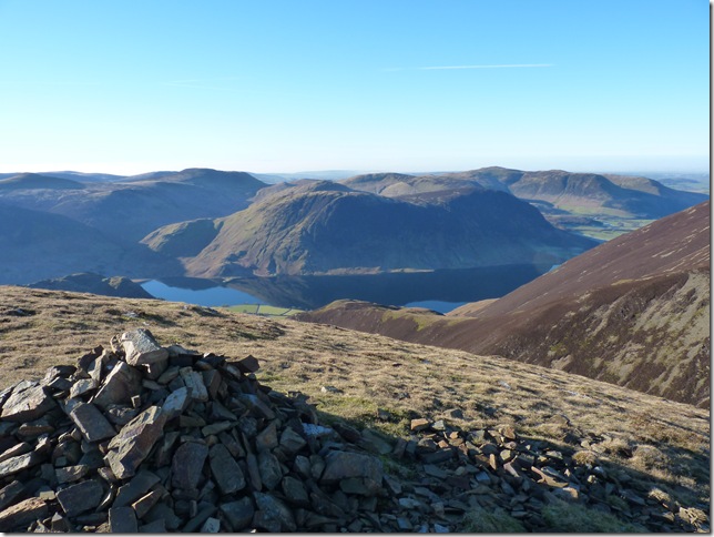
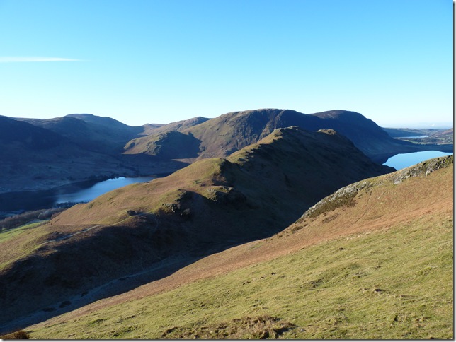
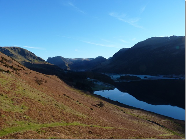
Crummock Water & Mellbreak from Third Gill Head Man. |
 |
| |
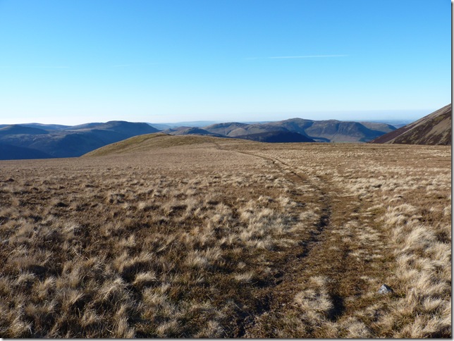
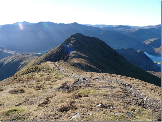
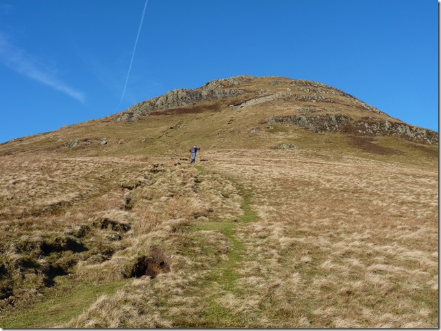
Whiteless Pike from Whiteless Edge. |
 |
| |
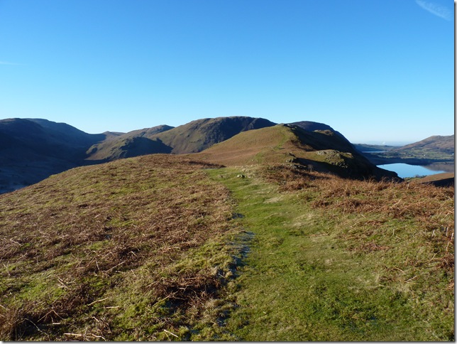
Knott Rigg & Ard Crags. |
 |
| |
Not the best start to a conversation “what’s this one called?” “is that the summit?” “where have you come from?” “where are you parked? I’m parked at Crummock Water (him pointing at Buttermere) I just answered yeah & carried on,. idiot. |
 |
| |
Rannerdale Knotts & my last fell of the day, I still can’t believe we are in January! |
 |
| |
Summit bound. |
 |
| |
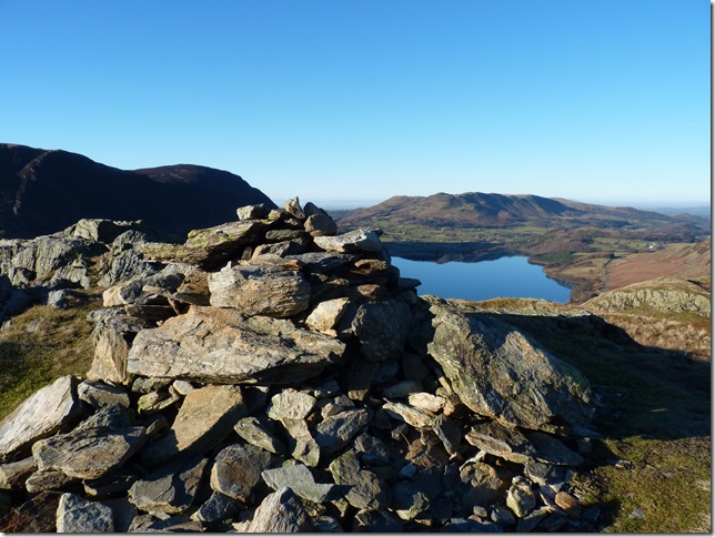
Rannerdale Knotts summit cairn with Crummock Water & Lorton Vale. |
 |
| |
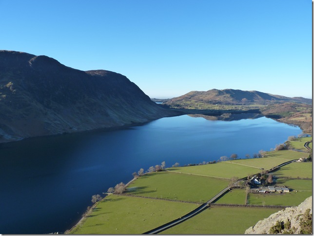
Mellbreak & Crummock Water. |
 |
| |
Looking towards Buttermere, the High Stile Ridge, Haystacks & Fleetwith Pike. |
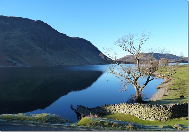 |
| |
Reflections on Crummock Water.
It’s just over a mile & a half walk back to the car & I don’t think its enough time to wipe the smile of my face, this kind of weather in January is not common at all especially in Lakeland so even more so this walk will take alot of beating |
|
| |
| Back to top |
 |
|