|
The Bannerdale Round |
 |
 |
31st October 2010 |
 |
|
It’s been three whole weeks since I was last in Lakeland & in between that I’ve walked in Yorkshire & been on holiday to Portugal all the while missing my beloved Lakes, With the holiday munches thankfully in the past but hanging on for dear life to my newly formed spare tyre given the fact I ate three square meals a day while I was abroad something that me & my body isn’t used to, (I normally never eat before lunchtime) so here I am packing some extra baggage or so it feels anyway.
Sat on the sun lounger during the day here’s me thinking of routes (because I’m sad like that!) I can do on my return & initially my first thoughts was ‘lets get you sweating Sharkey’ burn some excess calories gained & do something hard & steep, something still virgin to me & my first thoughts where lets finally finish of the Helvellyn ridge (I’m still yet to conquer Dollywagon Pike) & close some Eastern Fells off, then my radically changing mind spotted this route ‘The Bannerdale Round’ taking in as much as three Wainwrights & starting off in the beautiful tucked away hamlet on Mungrisdale just North of the Blencathra Fells, viewing this walk got the ‘that’s the one’ inside me going & once that feeling comes well,.its all up hill from there. |
|
Wainwright Guidebook |
 |
| The Northern Fells |
"Bannerdale Crags, to be appreciated fully, should be aproached from the pleasant village of Mungrisdale, for only in this direction, eastwards, is revealed the mile long rim of cliffs that gives the fell a name and is it’s great scenic attraction." |
 |
|
| |
|
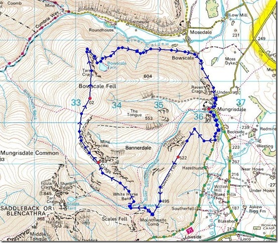
Overview |
|
|
| Ascent: |
2,560Ft, 780 Mtrs |
| Wainwrights: |
3 Souther Fell, Bannerdale Crags & Bowscale Fell |
| Weather: |
Partly Cloudy & Some Clear Skies, No Wind, Lows Of 7° Highs Of 11° |
| Parking: |
By The Mill Inn, Mungrisdale Village |
| Area: |
Northern |
| Miles: |
8.7 |
| Walking With: |
On my own |
| Ordnance Survey: |
OL5 |
| Time Taken: |
|
| Route: |
|
|
| |
|
Map and Photo Gallery |
|
|
 |
| |
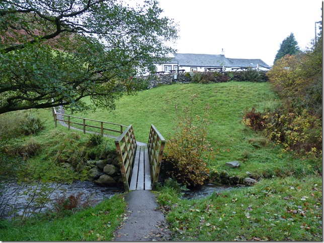
Parking was easy this morning, me being the second car at the off road parking just as you enter Mungrisdale Village, all was asked was a £2 donation towards parking fees, here I crossed the River Glenderamakin before making a left at the white building (The Mill Inn) were I was surprised to be met by the chef on a break from his breakfast duties I gathered, he spoke to me like he’d known me all his life which was a pleasant start to the walk if there ever was one. |
 |
| |
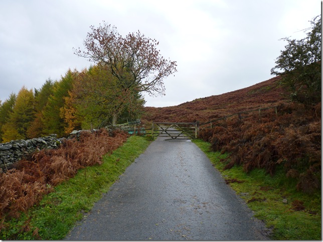
It’s basically a case of following the tarmac road until you reach this gate where I hooked a right onto the grassy slopes of Souther Fell, the obvious choice of route would have been to pick a path up behind The Mill Inn but access is denied by a No Right Of Way sign so you kind of get the feeling your coming back round on yourself on this route. |
 |
| |
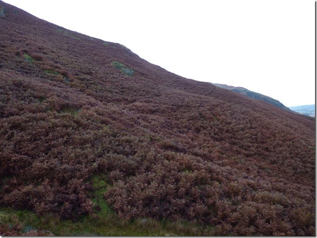
You can just pick the path up through the dying bracken in all its autumn colours, still gets you wet though & at this point my GPS was taking all the brunt. |
 |
| |
The steep grassy slopes just before I crest the ridge. |
 |
| |
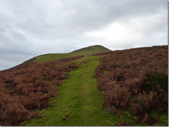
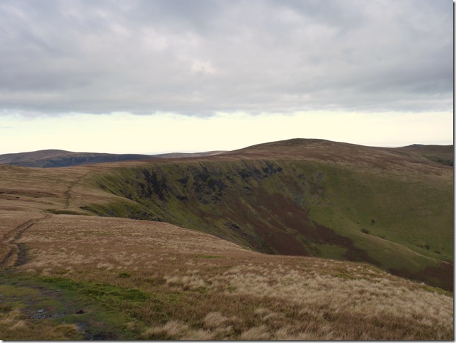
What appears to be the highest point on Souther Fell is this duly natural small rock formation causing me to wonder where the Summit Cairn is? it’s half a mile further along the ridge you divert! It doesn’t take much to confuse me but it made me wonder until I spotted the Hugh cairn along the second ridge. This location is used by the Hang Gliders commonly seen throughout the Northern Fells & you can see why, anyone for a game of footie? |
 |
| |
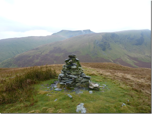
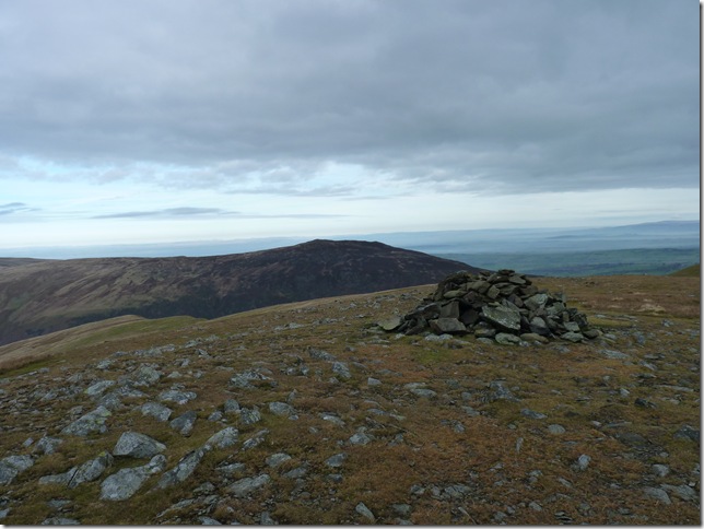
On approach to Souther Fell Summit Cairn. |
 |
| |
Souther Fell Summit Cairn with White Horse Bent directly behind, Scales Fell to the left of the picture then leading on to Blencathra’s Summit. |
 |
| |
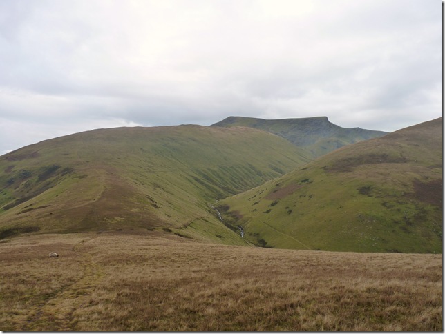
Leaving Souther Fell behind & heading down the col seen centre, ahead would take me up towards Scales Fell & Blencathra bound, but my Fell is over the River Glenderamackin to the right, ‘White Horse Bent’ which indeed will take me towards my next summit of the day Bannerdale Crags, but that’s a while off yet. |
 |
| |
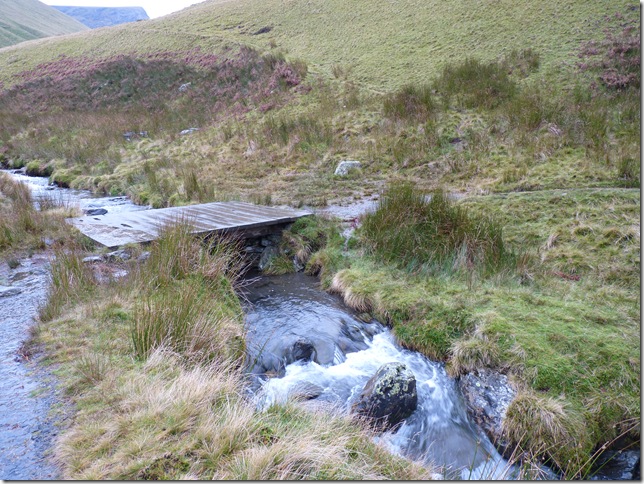
Using the wooden foot bridge to cross the River Glenderamackin I take the path to the right & start another steep grassy ascent. |
 |
| |
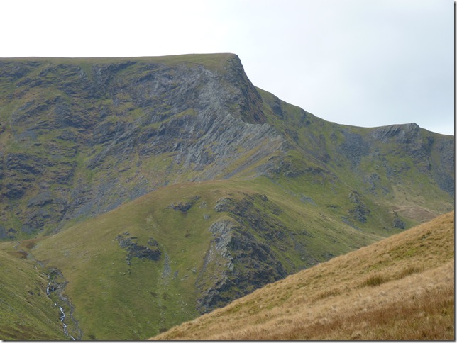
| Not before taking one of many shots of one of Lakelands most famous ridges, Sharp Edge, tempting..very very tempting |
 |
| |
Blencathra & Sharp Edge, Scales Tarn hides deep hidden in its large natural bowl formed in the last Ice Age. |
 |
| |
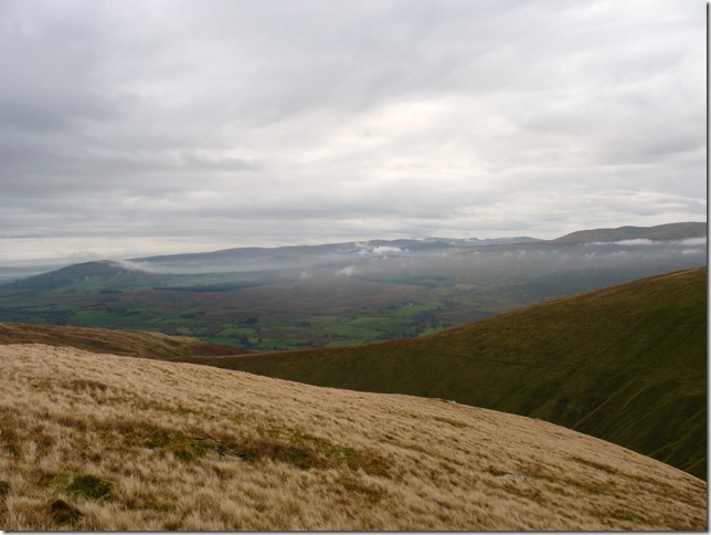
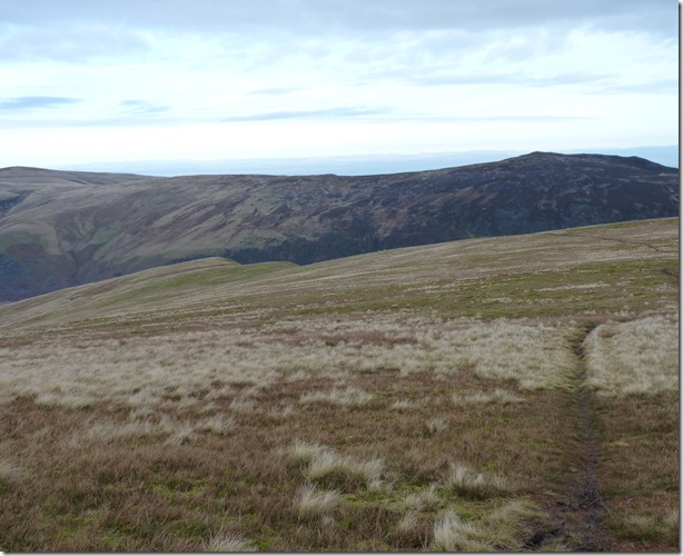
Looking back on the Northern & Central Fells with the mist still looming from my ascent up White Horse Bent. |
 |
| |
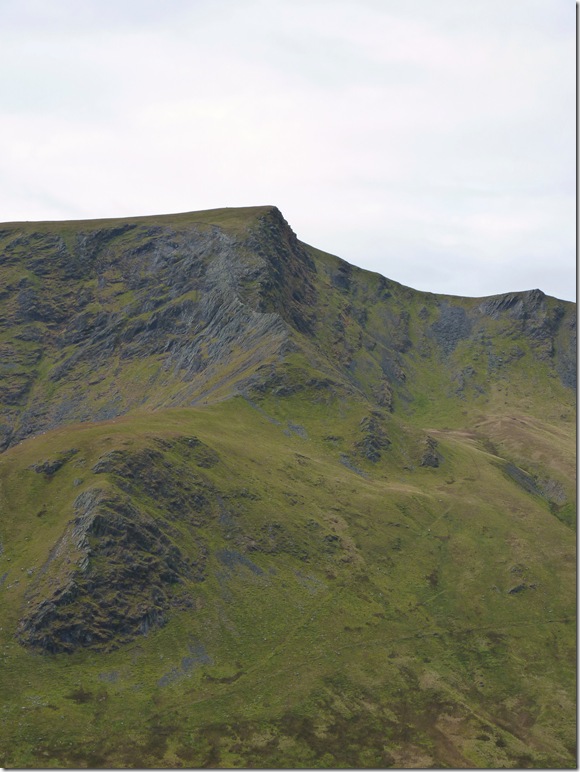
Sharp Edge & Atkinson Pike. |
 |
| |
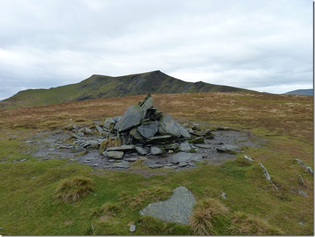
Bannerdale Crags summit Cairn with Blencathra in the background. |
 |
| |
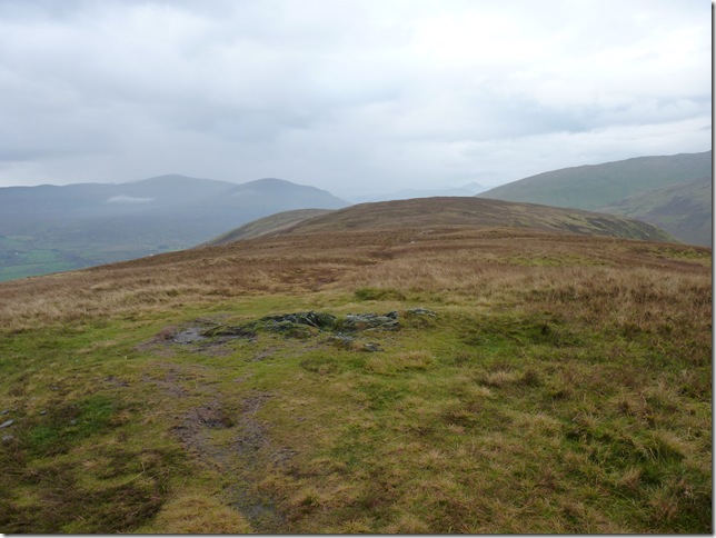
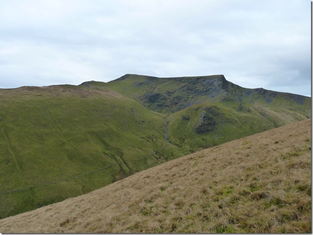
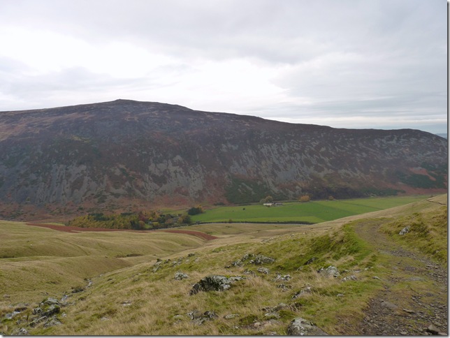
Bannerdale Crags with my third & final Fell of the day the prominent peak centre Bowscale Fell. |
 |
| |
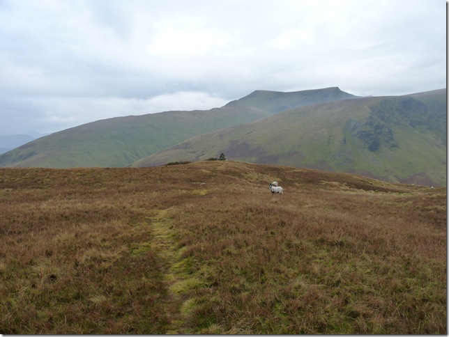
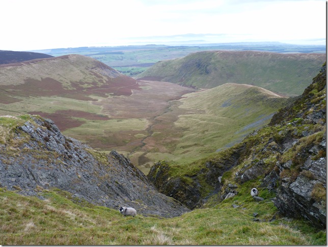
Looking down into Bannerdale with The aptly named ‘The Tongue’ on the left & my first ascent of the day Souther Fell to the right. |
 |
| |
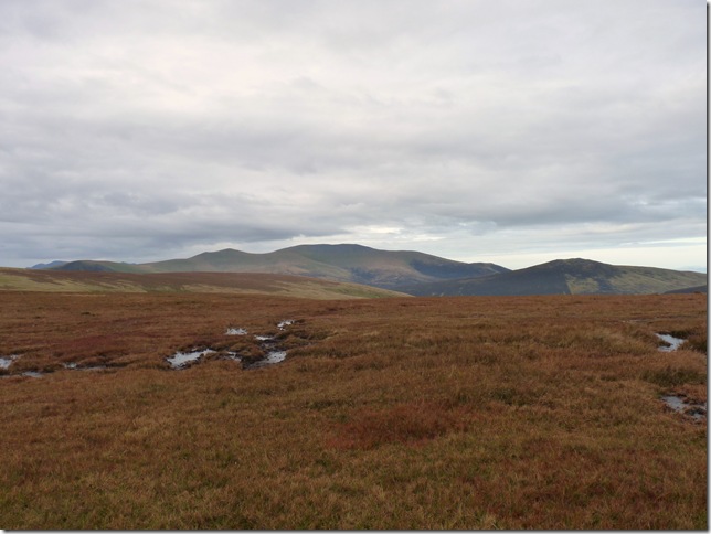
Looking west across Mungrisdale Common towards Skiddaw & Great Calva. |
 |
| |
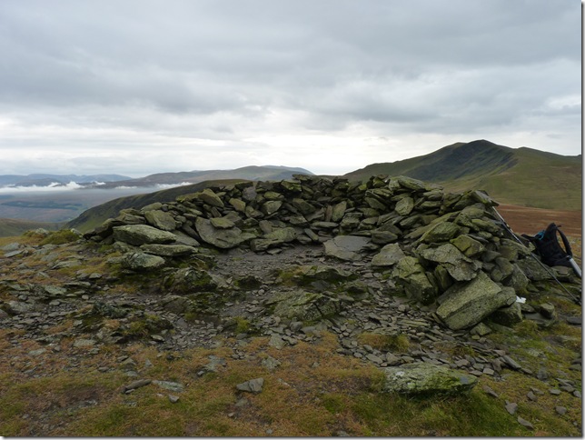
Bowscale Fell Summit shelter, I’ve cut the walkers out of the picture but they are the only people besides the chef this morning I’ve met during the walk, sometimes I like to chat with fellow walkers & others I wouldn’t mind If I didn’t see a single soul all day. |
 |
| |
And the main Summit Cairn with Carrock Fell in the background,.my next destination is off to the left of the picture where you can make out two prominent humps ‘Tarn Crags’ & make my way down the steep path towards Bowscale Tarn & grab a much needed coffee & sandwich. |
 |
| |
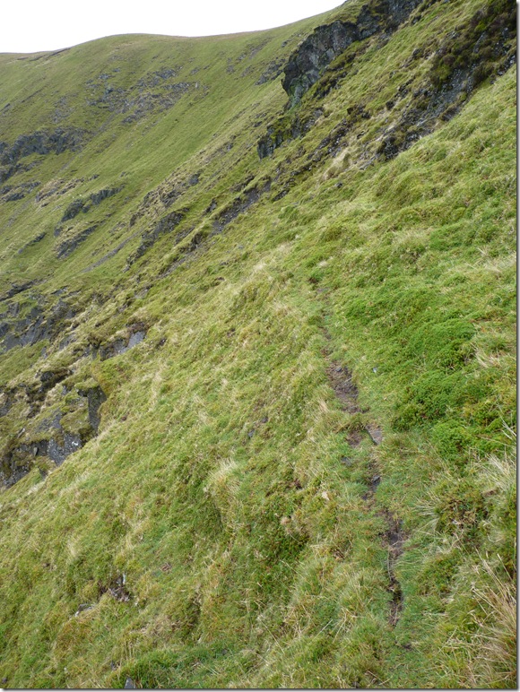
I couldn’t quite remember if the path leading down towards the Tarn was right at the end of the Fell or in between the two crest, so what I did was take the suicide path as I approached the first crest, note to self as I now know, the main zig zag path which will lead you down safely towards Bowscale Tarn is after the second crest! |
 |
| |
All thoughts of coffee & sandwiches have suddenly taken a back seat, keep your weight to your right Paul. |
 |
| |
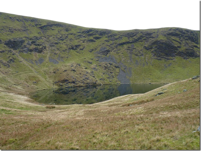
Lunch time at Bowscale Tarn, you can make out a path to the left of the Tarn & not so prominent is my path above the Crags, the safer path is out of shot begrudgingly I refused to take a picture out of pure stubbornness that I’d kind of messed up!
Enough of that, I really need my coffee now |
 |
| |
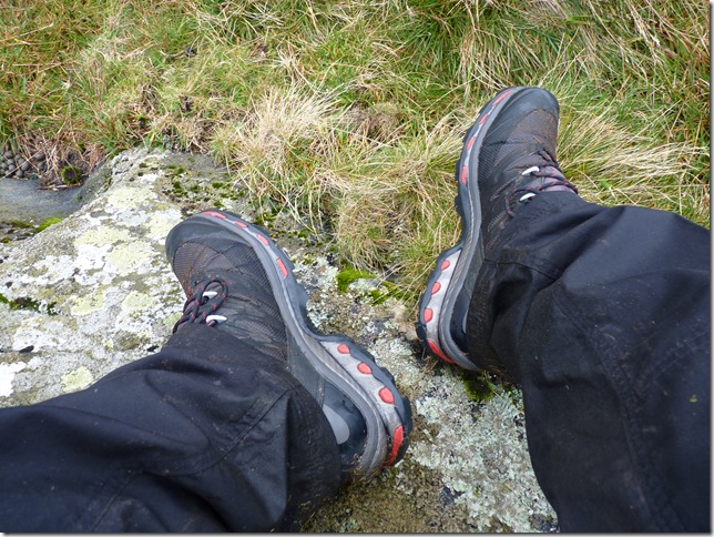
The new Salomon Quest looking not so new. |
 |
| |
With lunch over & another internal telling off it was time to head back through the valley of Mosedale, the Fell seen here is Carrock Fell overshadowing Roundhouse, the picturesque Farm encircled by the small wood. |
 |
| |
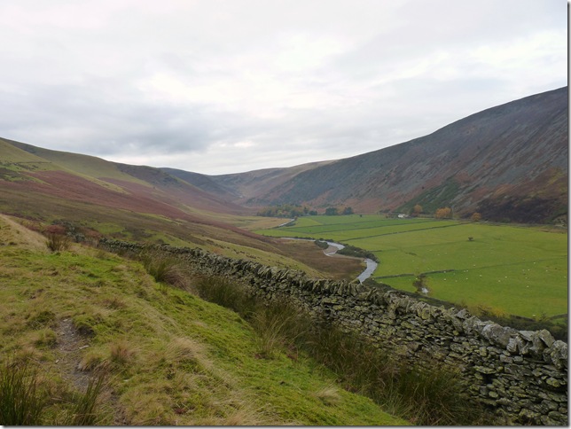
Looking back into Mosedale & the River Caldew. |
 |
| |
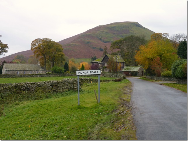
The path through the valley was great underfoot but what I hadn’t realised while parking at the other end of the village was just how beautiful Mungrisdale really is, seen here with my first Fell of the day Souther Fell.
It seemed I’d bargained with what ever weather was going to be thrown at me but today in my corner of Northern Lakeland I had mostly clear weather & quite good views while all the while looking into Central & Eastern Lakeland seemed to have all the low cloud, if I’d of chosen my intended route for this Weekend along the Helvellyn Ridge I wouldn’t have been blessed with half the views I had today so for once I got something right! And that’s kind of made me smile |
|
| |
| Back to top |
 |
|