|
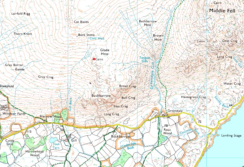
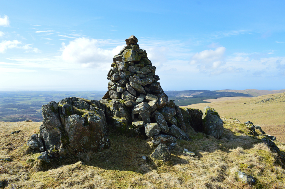
Glade How |
 |
 |
Overview |
 |
|
| Height: |
1,420 Feet - 433 Metres |
| Grid Ref: |
NY 133 064 |
| Area: |
Western |
| Group: |
W/PIL |
| Ordnance Survey: |
OL6 |
|
| |
|
Map and Photo Gallery |
|
|
|
| |
|
Walks including Glade How are:- |
|
|
Greendale Round |
|
|
 |
|
2nd August 2025 |
| ASCENT: |
2,400 Feet - 731 Metres |
| MILES: |
6 |
| WAINWRIGHTS: |
3, Middle Fell - Seatallan - Buckbarrow |
| ROUTE: |
Greendale - Greendale Gill - Middle Fell - Seatallan - Cat Bields - Glade How - Buckbarrow - Joss Naylor Cairn - Tongue Gills - Greendale Gill - Greendale |
|
| |
|
Seatallan & Buckbarrow from Greendale |
|
|
|
|
9th March 2024 |
| ASCENT: |
2,089 Feet - 637 Metres |
| MILES: |
6 |
| WAINWRIGHTS: |
2, Seatallan - Buckbarrow |
| ROUTE: |
Greendale - Greendale Gill - Greendale Tarn - Seatallan - Cat Bields - Glade How - Buckbarrow - Gill Beck - Harrow Head - Nether Wasdale - Greendale |
|
| |
|
A Nether Wasdale Circuit - David's 2000th Walk |
|
|
|
|
1st December 2019 |
| ASCENT: |
2,526 Feet - 770 Metres |
| MILES: |
6.2 |
| WAINWRIGHTS: |
3, Buckbarrow - Seatallan - Middle Fell |
| ROUTE: |
Greendale - Nether Wasdale - Harrow Head - Gill Beck - Buckbarrow - Glade How - Cat Bields - Seatallan - Middle Fell - Greendale - Nether Wasdale - Harrow Head |
|
| |
|
Walking the Birketts - A Circuit of Nether Wasdale Common |
|
|
|
|
11th March 2018 |
| ASCENT: |
2,526 Feet - 770 Metres |
| MILES: |
6.2 |
| BIRKETTS: |
4, Middle Fell - Seatallan - Glade How - Buckbarrow |
| ROUTE: |
Greendale - Nether Wasdale - Harrow Head - Gill Beck - Buckbarrow - Glade How - Cat Bields - Seatallan - Middle Fell - Greendale - Nether Wasdale - Harrow Head |
|
| |
|
Walking the Wainwrights in 30 Walks - Walk 30 Nine fells west of Wast Water |
|
|
|
|
10th September 2016 |
| ASCENT: |
5,126 Feet - 1,563 Meters |
| MILES: |
13.3 |
| WAINWRIGHTS: |
9, Buckbarrow - Seatallan - Middle Fell - Haycock - Scoat Fell - Steeple - Pillar - Red Pike - Yewbarrow |
| ROUTE: |
Harrow Head - Gill Beck - Buckbarrow - Glade How - Seatallan - Middle Fell - Winscale Hows - Pots of Ashness - Haycock - Scoat Fell - Steeple - Black Crag - Windy Gap - Pillar - Windy Gap - Black Crag - Red Pike - Dore Head - Stirrup Crag - Yewbarrow - Bell Rib - Overbeck Bridge |
|
| |
| Back to top |
 |
|