|
Helm Crag |
 |
 |
Map and Photo Gallery |
 |
|
 |
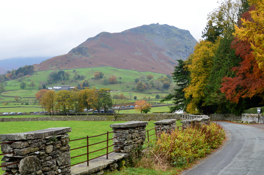
| Helm Crag taken just outside Grasmere. |
 |
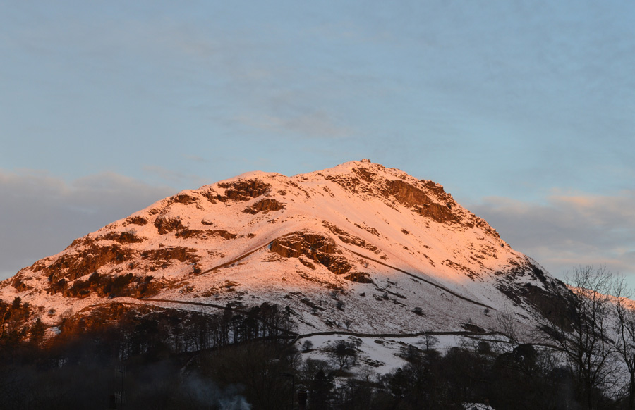
| Helm Crag from Grasmere. |
 |
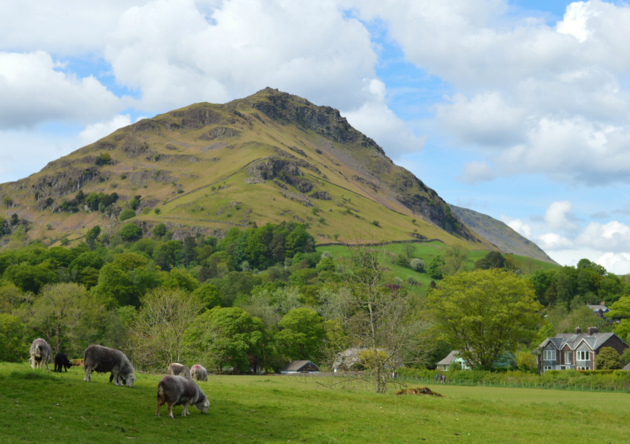
| Helm Crag from Michael's Nook. |
 |
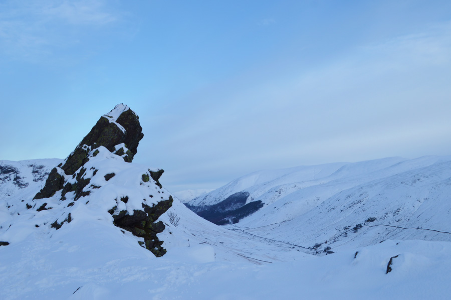
| The Lion and the Lamb, Helm Crag. |
 |
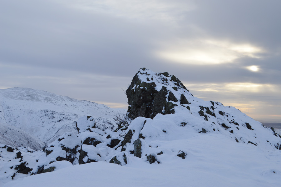
| The Howitzer, the true summit of Helm Crag. |
|
| |
|
There are 7 walks to choose from including Helm Crag |
|
|
The Greenburn Horseshoe |
|
|
 |
|
7th November 2023 |
| ASCENT: |
2,277 Feet - 694 Metres |
| MILES: |
8.1 |
| WAINWRIGHTS: |
4, Helm Crag - Gibson Knott - Calf Crag - Steel Fell (Dead Pike) |
| ROUTE: |
A591 - Grasmere - Easdale Road - Lancrigg - White Crag - Helm Crag - Bracken Hause - Gibson Knott - Pike of Carrs - Calf Crag - Steel Fell Tarn - Steel Fell - Cotra Breast - Ghyll Foot - Underhelm - A591 |
|
| |
|
Easedale Tarn, Easedale & Helm Crag |
|
|
|
|
23rd October 2021 |
| ASCENT: |
1,648 Feet - 502 Metres |
| MILES: |
6 |
| WAINWRIGHTS: |
Helm Crag |
| ROUTE: |
A591 - Grasmere - Easedale Road - Goody Bridge - Easedale Beck - Sourmilk Gill - Easedale Tarn - Easedale - Stythwaite Steps - Bracken Hause - Helm Crag - Helmside - A591 |
|
| |
|
Walking the Birketts, Helm Crag to Steel Fell Horseshoe |
|
|
|
|
24th June 2018 |
| ASCENT: |
2,277 Feet - 694 Metres |
| MILES: |
8.1 |
| BIRKETTS: |
4, Helm Crag - Gibson Knott - Calf Crag - Dead Pike (Steel Fell) |
| ROUTE: |
A591 - Butharlyp Howe - Easdale Road - Lancrigg - Helm Crag - Bracken Hause - Gibson Knott - Pike of Carrs - Calf Crag - Steel Fell Tarn - Steel Fell - Cotra Breast - Ghyll Foot - Underhelm - Easedale Road - Butharlyp Howe - A591 |
|
| |
|
Walking the Wainwrights in 30 Walks - Walk 1 A Greenburn Skyline |
|
|
|
|
16th January 2015 |
| ASCENT: |
3,150 Feet - 961 Meters |
| MILES: |
11.2 |
| WAINWRIGHTS: |
5, Helm Crag - Gibson Knott - Calf Crag - Sergeant Man - Steel Fell |
| ROUTE: |
A591 - Butharlyp Howe - Easedale Road - Helm Crag - Gibson Knott - Calf Crag - Brownrigg Moss - Broadstone Head - Sergeant Man - Broadstone Head - Brownrigg Moss - Steel Fell Tarn - Steel Fell - Cotra Breast - Helm Side - Low Mill Bridge - Goody Bridge - Grasmere - A591 |
|
| |
|
High Raise from Grasmere via Helm Crag |
|
|
|
|
7th January 2012 |
| ASCENT: |
2,800 Feet, 854 Meters |
| MILES: |
9.6 |
| WAINWRIGHTS: |
5, Helm Crag, Gibson Knott, Calf Crag, High Raise, Sergeant Man |
| ROUTE: |
Grasmere – Easedale Road – Helm Crag – Gibson Knott – Calf Crag – Brownrigg Moss – Mere Beck – High Raise – Sergeant Man – Easedale Tarn – Easedale – Grasmere |
|
| |
|
The Greenburn Horseshoe |
|
|
|
|
25th August 2010 |
| ASCENT: |
2,456 Ft, 758 Mtrs |
| MILES: |
8.5 |
| WAINWRIGHTS: |
4, Helm Crag, Gibson Knott, Calf Crag, Steel Fell |
| ROUTE: |
|
|
| |
|
Helm Crag |
|
|
|
|
27th November 2007 |
| ASCENT: |
428Mtrs 1328Ft |
| MILES: |
xxx |
| WAINWRIGHTS: |
1 Helm Crag |
| ROUTE: |
xxxx |
|
| |
| Back to top |
 |
|